Sunday 12 July 2026
Landschlacht, Canton Thurgau, Switzerland
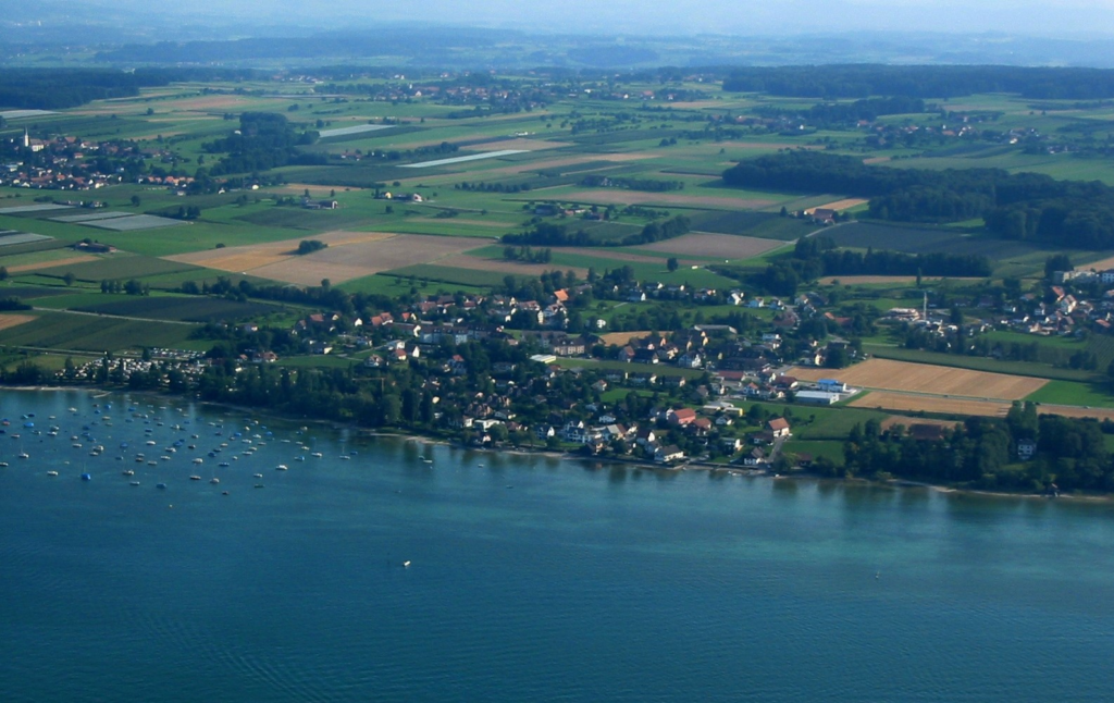
Above: Landschlacht, Canton Thurgau, Switzerland
I sit at my laptop and I write.
About places I have known, conversations I have heard and people I have observed in the hope that my own experiences are rich enough material.

It is only 0900 but I have been up and about since 0430.
The bladder commands.
The body rouses.
Feet hit the floor and remain there.
Singapore Starbucks cup of instant coffee.

Electric fan already needed with warmer temperatures sure to follow.

I hope that I have accumulated enough photographs, notes and memories to create vivid descriptions.
One impresses.
Many create a world.
Each observation strengthens the next.
I try to write with my eyes open, noticing the texture of experience, to linger over a moment, to let the sights and sounds and small interactions with Life breathe.
The world is already interesting.
The first duty is to notice.

Monday 11 May 2026
(0545) Room 404, Grand 464 Otel, Rize, Rize Province, Türkiye
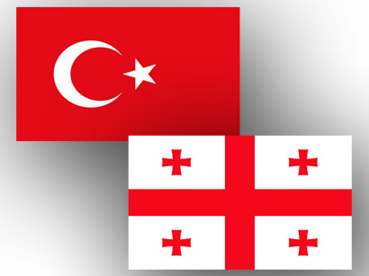
75 minutes before departure for the border and Batumi.
Long enough to get myself organized.
Short enough that my mind can start racing.
The practical move now is simple:
Passport, phone, charger, wallet, anything I would hate to lose – put and keep them on my body, tactile present.
That removes most of the friction before the bus, before a new chapter.
But the new chapter feels less like a cinematic breakthrough and more like stepping forward before I feel fully ready.
A leap of faith.
What matters is that I am moving.
Right now, the win is simple.
Leave Rize calm, with everything I need and arrive in Batumi with my head clear.
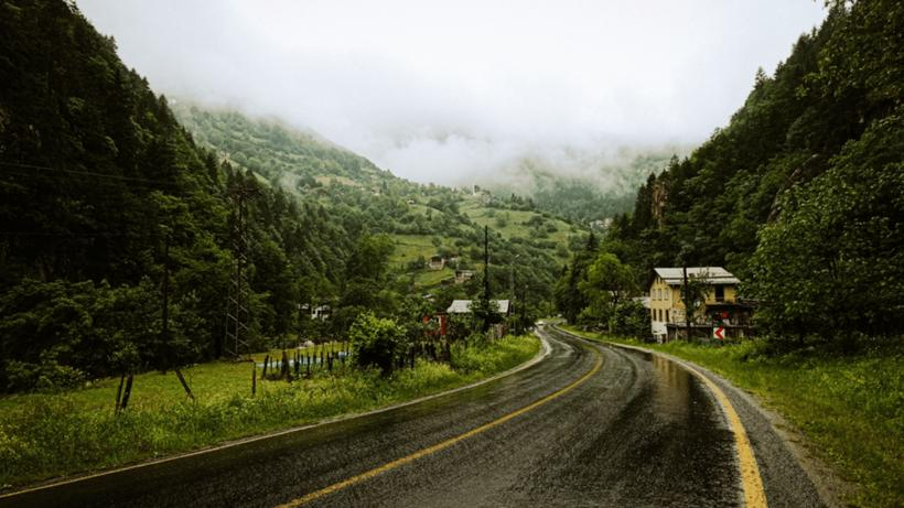
A city is a character.
If Rize were a person, I imagine someone like this.
A man in his late fifties or early sixties.
Strong hands, weathered face, a quiet voice.
He rises before dawn because the rain and the tea bushes won’t wait.
He has no need to tell you how hard he works.
You can see it in his posture.
He isn’t talkative at first.
In fact, you might mistake his reserve for aloofness.
But stay long enough, accept a second glass of tea, and he begins telling stories — not dramatically, but as though they simply belong to the landscape.
He values competence over charm.
If you boast, he smiles politely and changes the subject.
If you help carry something heavy without being asked, you’ve earned his respect.
He loves the mountains, though he rarely speaks romantically about them.
They are not scenery to him.
They are family.
The rain doesn’t bother him.
Sunshine is welcome, but rain is simply part of life.
He’s deeply attached to home.
He may travel, but he always returns.
Not because he believes nowhere else is beautiful, but because nowhere else smells like wet earth and fresh tea after a summer shower.
He can be stubborn.
Once he’s made up his mind, persuasion is difficult.
Traditions matter to him.
He may be cautious about new ideas until he sees that they work in practice.
Yet beneath that conservatism is generosity.
If a stranger arrives cold and soaked, the kettle is already on.
Hospitality comes before conversation.
He has a dry sense of humor.
He won’t tell many jokes, but every now and then he’ll make a quiet remark that has everyone at the table laughing.
There are tensions within his character, too.
Rize is industrious, but not hurried.
Proud, but not ostentatious.
Religious, yet shaped as much by geography as by theology.
Independent, though aware that life in the mountains has always required cooperation.
He looked as though he’d spent his whole life arguing with rain and had come to an understanding with it.
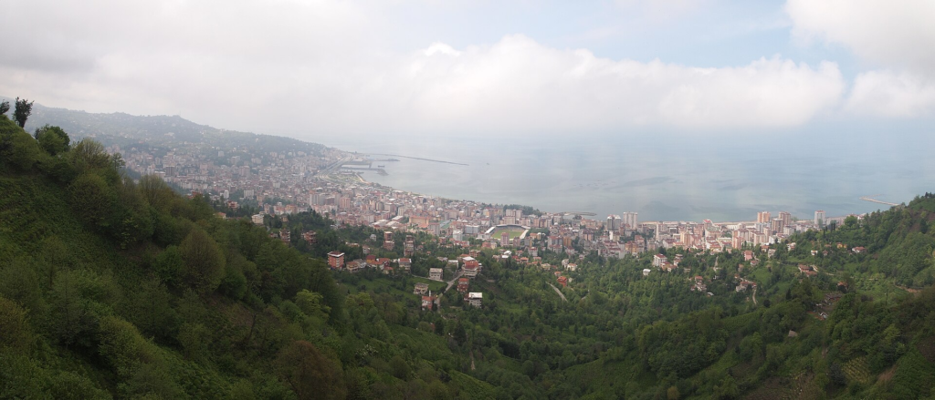
Above: Rize, Rize Province, Türkiye
And how will I remember Rize?
The historical Orta Cami (Middle Mosque), a distinct mint-green and cream building with twin rounded arch windows, a central cultural landmark.
Beside the mosque, the bustling open-air market stalls, adjacent to the local fish-selling area where fresh Black Sea catches are regularly sold.
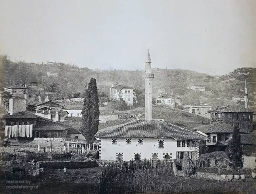
Above: Orta Camii, Rize
The 15 Temmuz Şehitler Anıtı (15 July Martyrs Monument) located at the Yeniköy Mahallesi junction, a busy intersection connecting coastal roads to higher neighbourhoods, a mix of modern residential buildings that appear insignificant but are homes to ordinary life.
People eat, walk, wait, argue, smoke, read their phones.
Yet these moments reveal loneliness, ambition, fear and hope.
Ordinary lives that need not depend on extraordinary events, but have real concerns about incomplete landscaping and lighting.
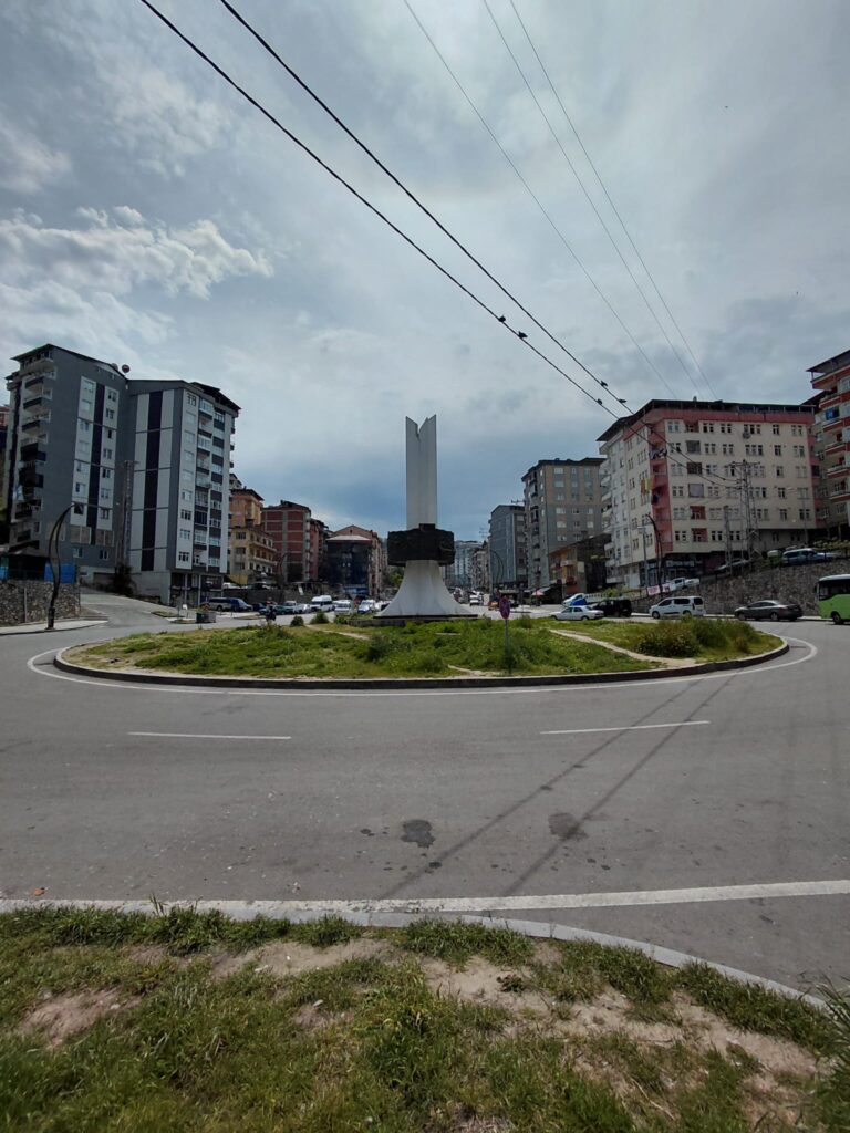
Above: 15 Temmuz Şehitler Anıtı (15 July Martyrs Monument) located at the Yeniköy Mahallesi junction
A vibrant street market, that could be anywhere, Liverpool or Rotterdam or Istanbul or other cities across the planet.
Vendors showcasing a wide variety of goods for sale:
Fresh produce, textiles, household items.
An atmosphere suggesting a bustling, authentic local shopping experience.
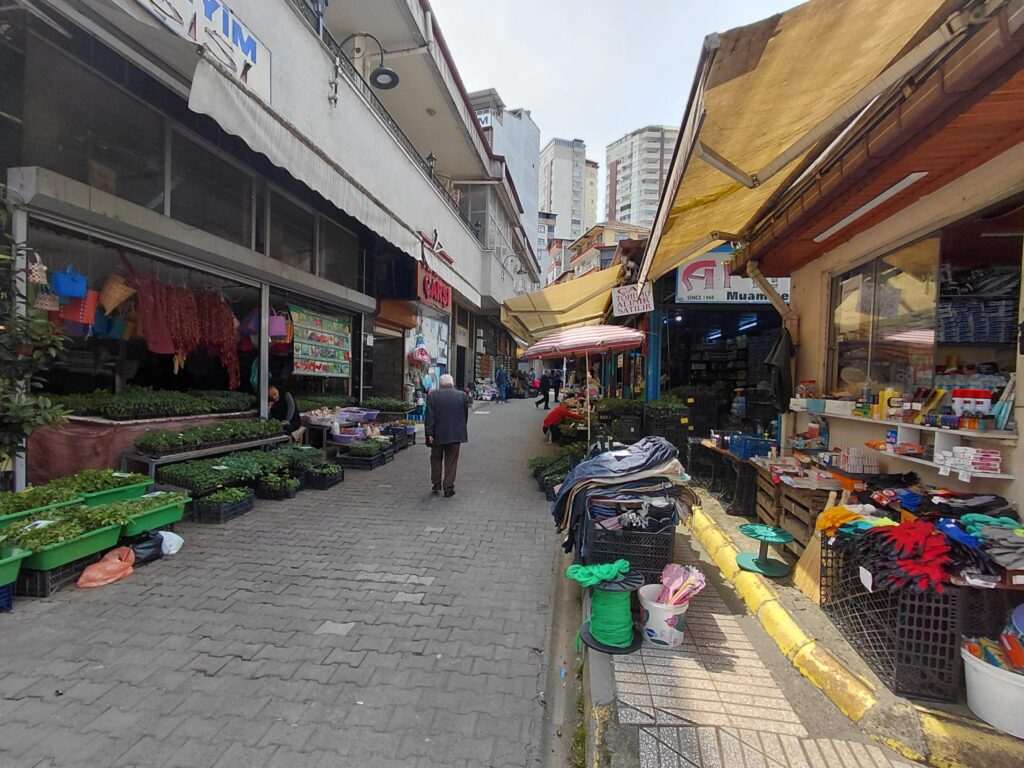
Inside Rize Memşağa Parkı, right in the city centre.
A distinctive wooden kiosk, a local ice cream and refreshment stand, featuring a large painted mural depicting a traditional Black Sea stone arch bridge and the Kaçkar Mountains.
Because Rize is the capital of Turkish tea production, prominent local branding like Çaykur can be seen on the kiosk.
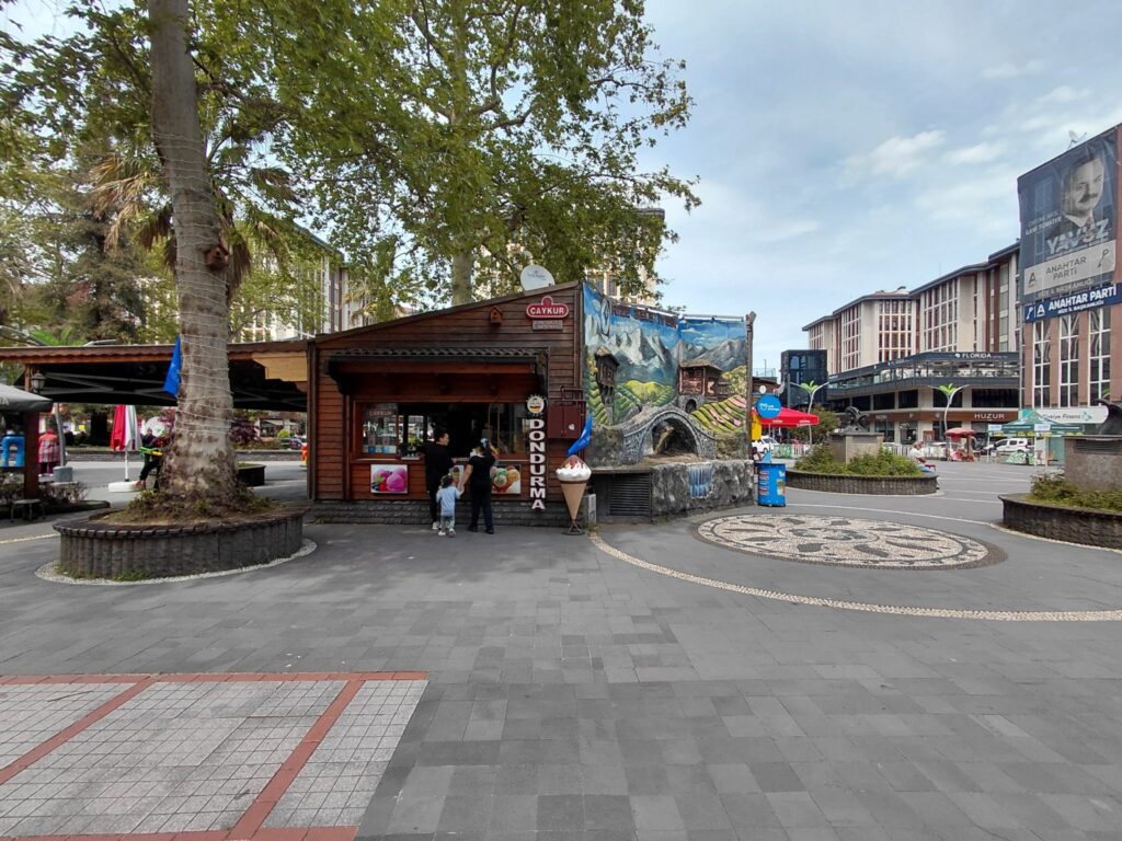
Above: Memşağa Parkı, Rize
The Laz People Monument depicts figures harvesting tea leaves.
It was erected to honour the cultural heritage of the indigence Laz people and their critical historical role in the region’s agrıcultural economy.
The bronze figures at the base of the stylized tree symbolize the local families whose collective hard work and labour established Rize’s booming tea industry.
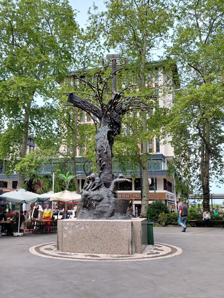
Above: Laz People Monument, Rize
The Laz are a Kartvelian (spoken primarily in Georgia – there are approximately five million Georgian language speakers worldwide) ethnic group native to the South Caucasus, who mainly live in Black Sea coastal regions of Türkiye and Georgia.
They traditionally speak the Laz language but have been subjected to a process of deliberate Turkification under Turkish rule.
(Turkification is a shift whereby populations or places receive or adopt Turkic attributes such as culture, language, history or ethnicity, due to the Turkish nationalistic policies of the Republic of Türkiye toward ethnic minorities.)
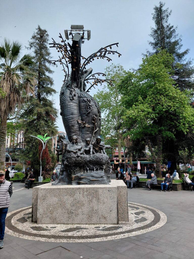
Above: Laz People Monument, Rize
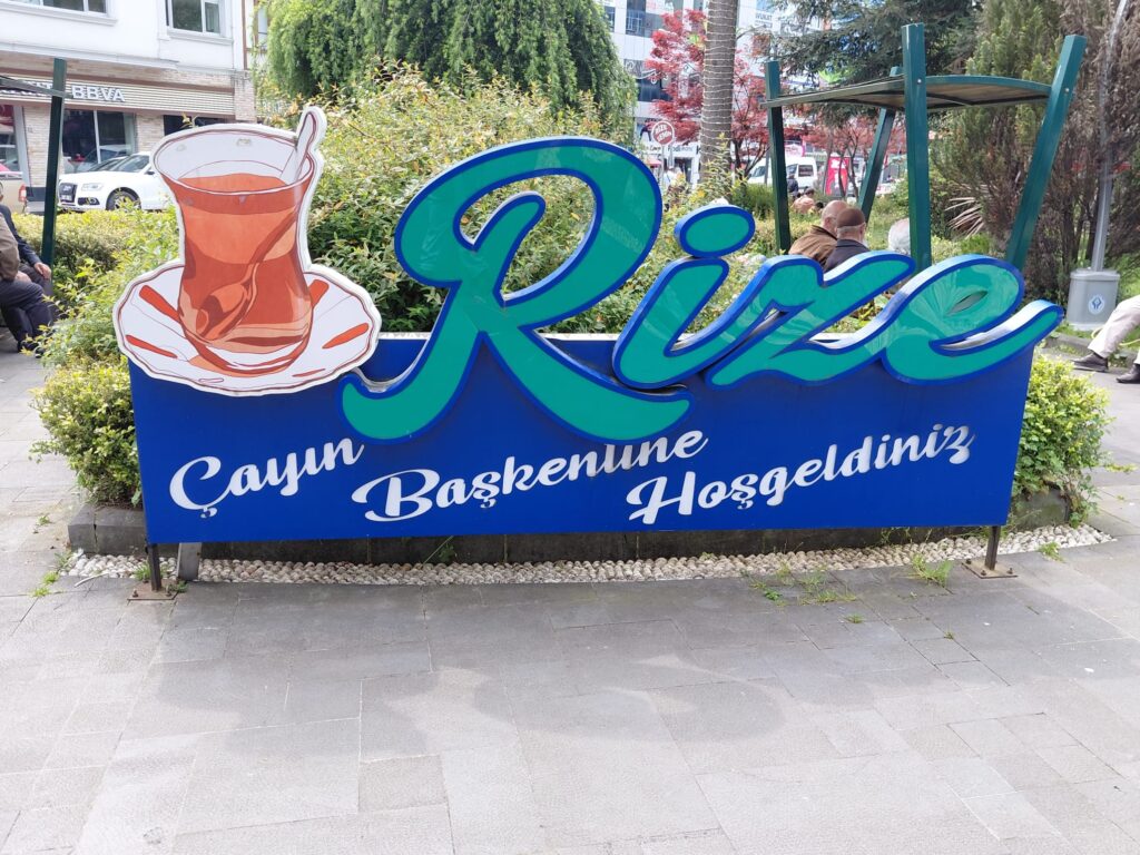
The decorative sign welcoming visitors to Rize, the capital of tea, with a prominently featured tea glass, a symbol of Turkish hospitality.
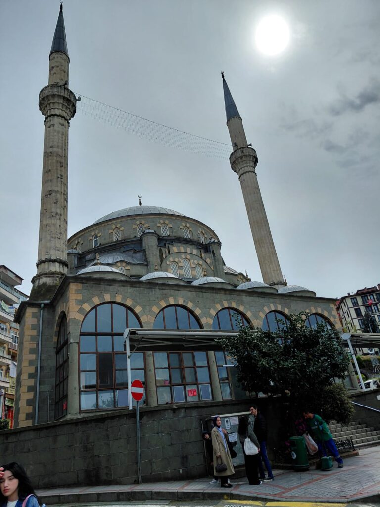
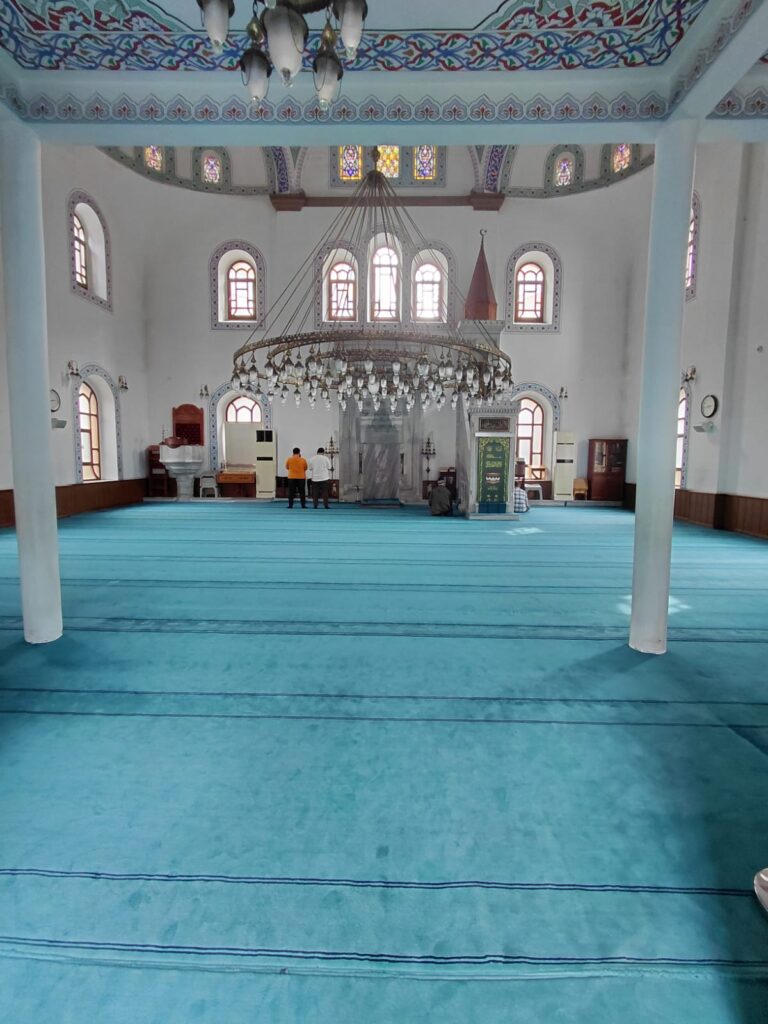
The Şeyh Camii (Sheikh Mosque) with its distinctive stone masonry and two tall minarets, its history spanning over three centuries across distinct eras.
According to its marble inscription plaque, the original mosque was built in 1711 by a local benefactor named El Hac Muhammed Efendi.
Historical accounts and older photographs indicate that the initial building was much smaller and featured a traditional local wooden hip roof rather than a stone dome.
By the mid-20th century, the original structure had degraded past the point of repair.
It was completely dismantled to make way for a grander structure.
The building seen today was completed in 1965.
The mosque was redesigned into a classic Ottoman-style central plan, shifting from its historical local aesthetic to an expansive square layout crafted fully from cut stone.
In 2014, the mosque underwent major restoration to reinforce its structural integrity and update its glass-enclosed outer portico and detail its ornate interior marble.
Above: Şeyh Camii, Rize
Above: Şeyh Camii, Rize
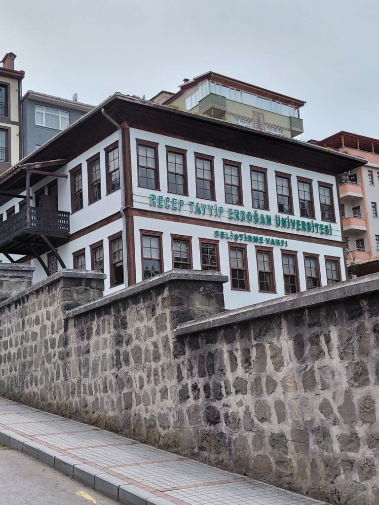
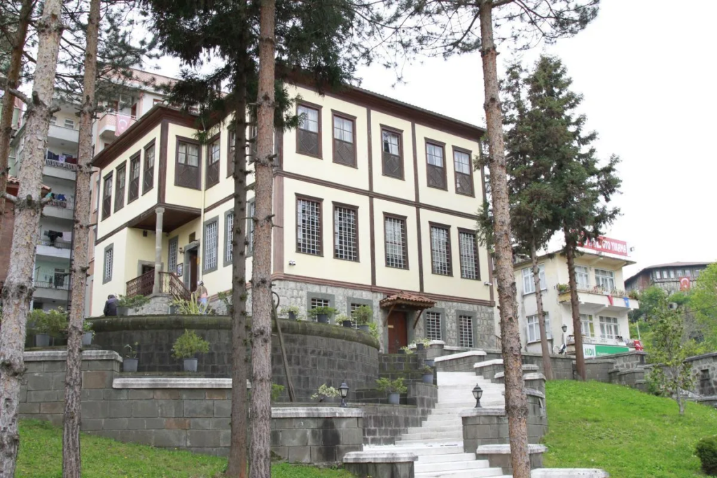
The historic 19th century Sarı Ev (Yellow House), which currently serves the Recep Tayyip Erdoğan University Development Foundation.
Originally a residential home, it now houses the University Foundation’s Rize Museum and holds over 1,700 archaeological and ethnographic displays about daily life.
Beneath it, a central wooden structure raised on stilts – a traditional Black Sea storehouse known as a serender or nayla.
Above: Recep Tayyip Erdoğan University Development Foundation, Rize
Above: Sarı Ev, Rize
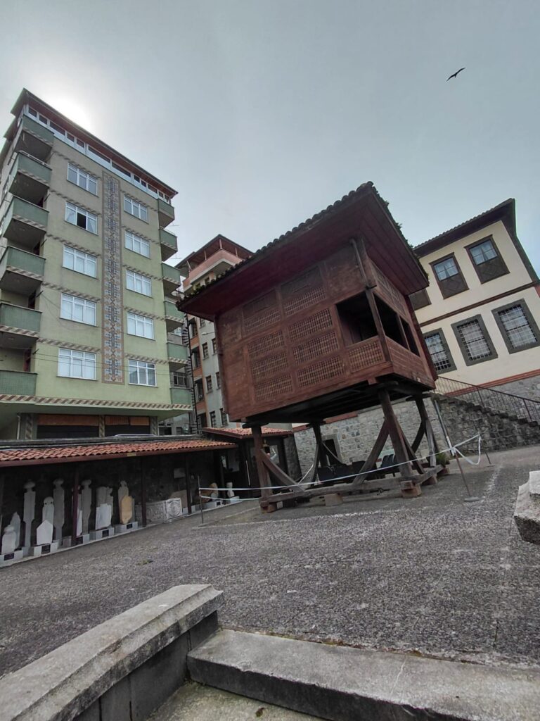
Above: Beneath Sarı Ev, Rize
The 15 Temmuz Demokrasi ve Cumhuriyet Meydanı (15 July Democracy and Republic Square) with its prominent clock tower.
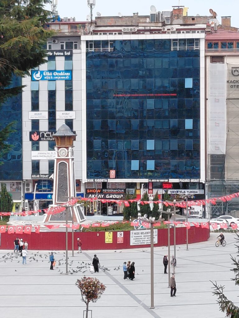
Above: 15 Temmuz Demokrasi ve Cumhuriyet Meydanı, Rize
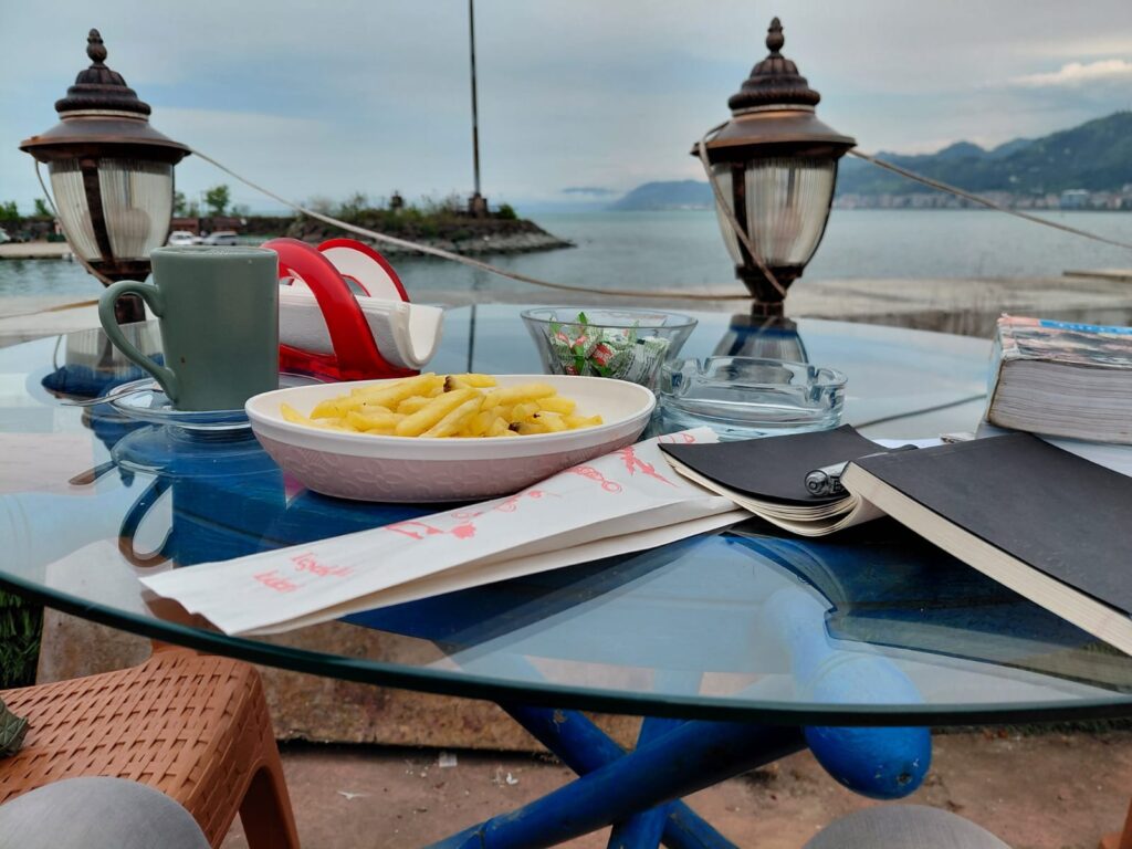
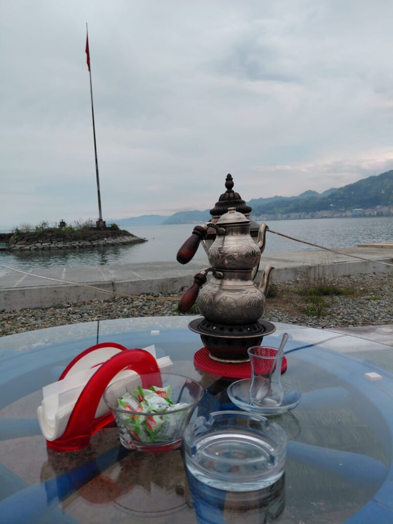
The seaside Marina Café with views of the Black Sea where I sat at a glass table set for a snack of French fries, beside an unnecessary ashtray, open books and notebook, and a traditional teapot set – a Çaydanlık made of copper with wooden handles and an engraved design, consisting of two stacked kettles, with the bottom for boiling water and the top for brewing strong tea – and ince belli bardaklar (small tulip-shaped glasses for serving.
The Çay Çarşısı (Tea Bazaar) with its main structure a massive building designed in the shape of a traditional Turkish tea glass, a tea museum, exhibition halls and cafés within the complex.
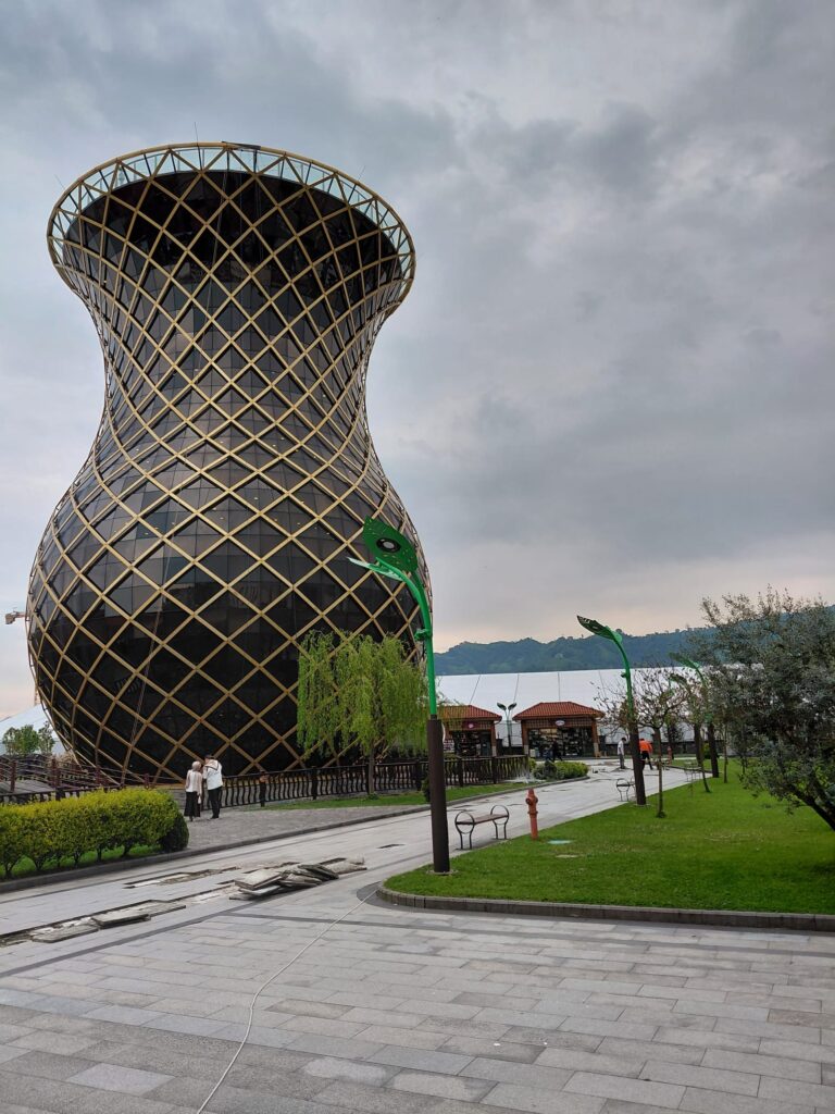
Above: Çay Çarşısı, Rize
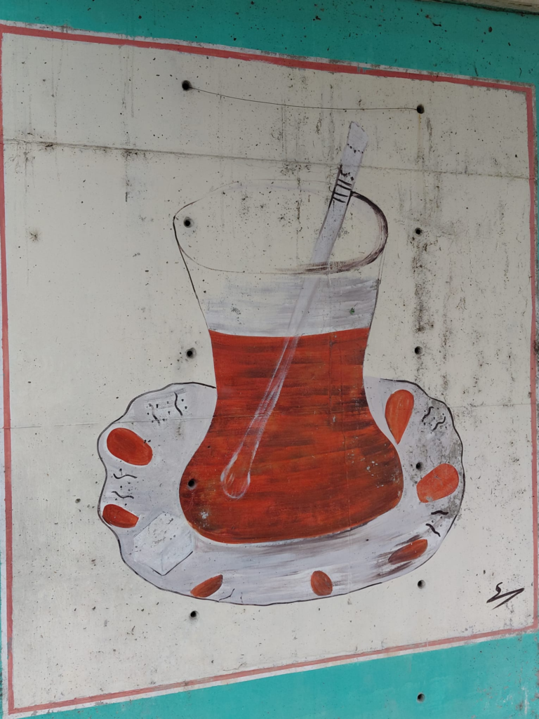
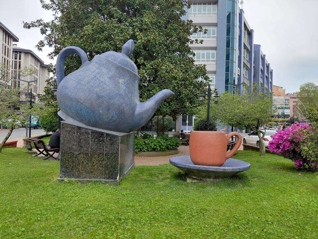
Murals painted on the pillars of the underpass of the coastal highway depicting – what else? – the tea industry, across from a giant teapot and cup.
Photographs and memories.
But now it is time to face my fears and make new memories….

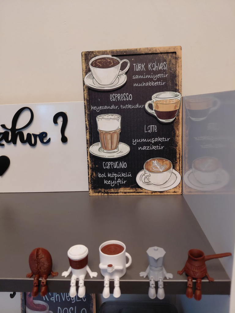
As I exit the Otel, I snap photographs of a picture of four coffees offered at the Otel’s café:
- Turk Kahvesi (Turkish coffee)
- Espresso (heyecandır, tutkudur)
- Latté (yumuşaktır naziktir)
- Cappucino (bol köpüklü keyiftir)
Another sign tells me that “Coffee: My Daily Grind“.

(0645) Bus station (Otogar), Rize
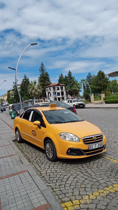
Taxi to bus station.
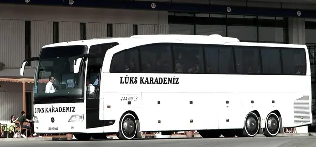
There, Daniel of Bienne, whom I met yesterday evening at a kebab restaurant, is waiting for his 0630 Metro bus to Batumi, while my Luks Karadeniz bus leaves, in theory, at 0700.
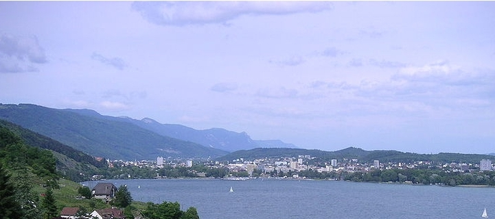
Above: Biel/Bienne, Canton Bern, Switzerland

I wish him farewell on his continuing adventures (Batumi – Tbilisi – Azerbaijan – Caspian Sea – Kazakhstan – China – Japan) while I then wander through the half-open-air bus station.
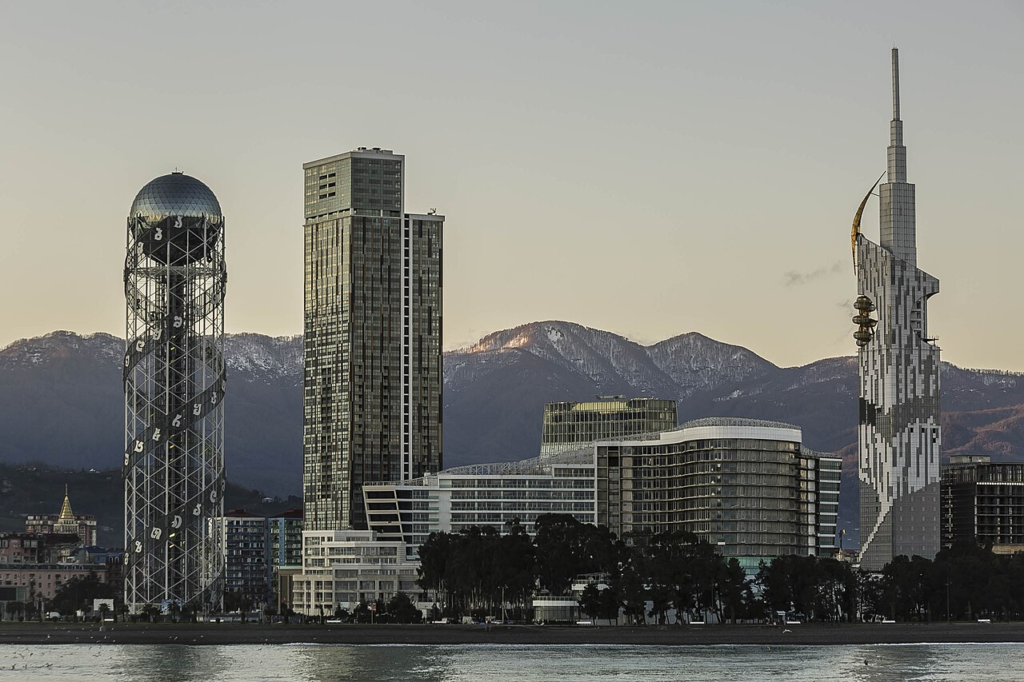
Above: Batumi, Adjara, Georgia
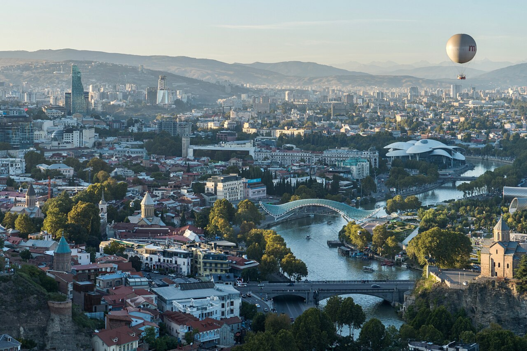
Above: Tbilisi, Georgia
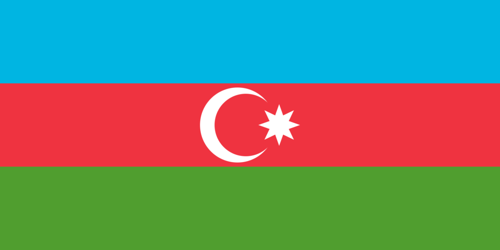
Above: Flag of Azerbaijan
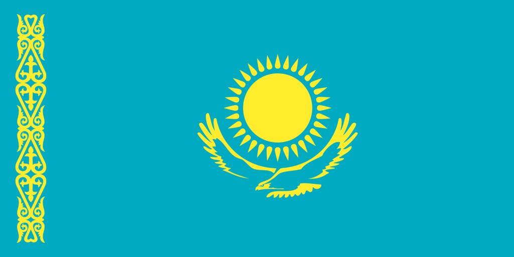
Above: Flag of Kazakhstan

Above: Flag of China

Above: Flag of Japan
Dan struck a nerve because there is a familiar figure there:
Travelling alone, moving eastward, carrying a plan that may or may not survive first contact with reality.
That does not mean that our stories are the same, but Dan has made me look at my own road a little differently.
I doubt I will see him in Batumi.
I doubt we will ever meet again.
Bus travellers that pass in the morning.
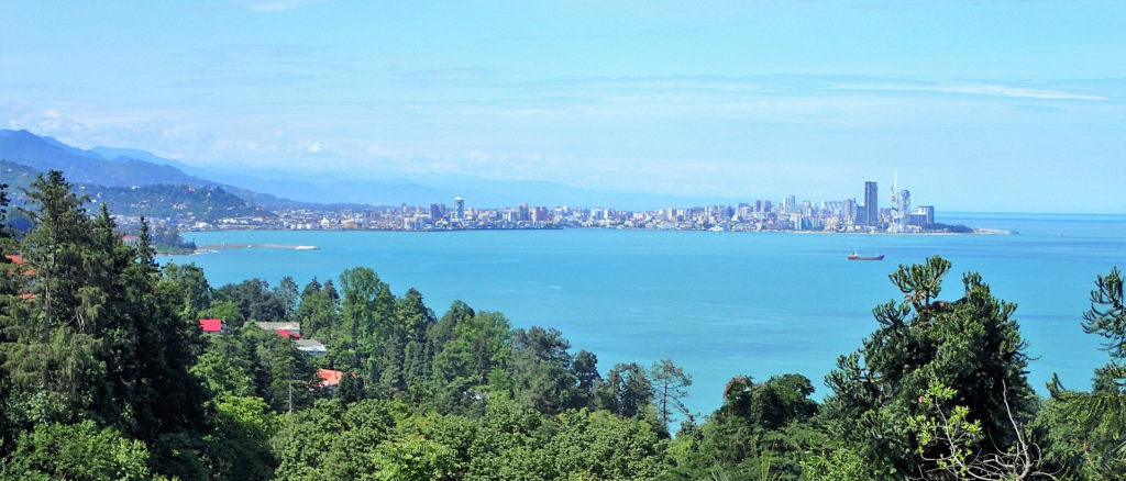
Above: Batumi, Georgia
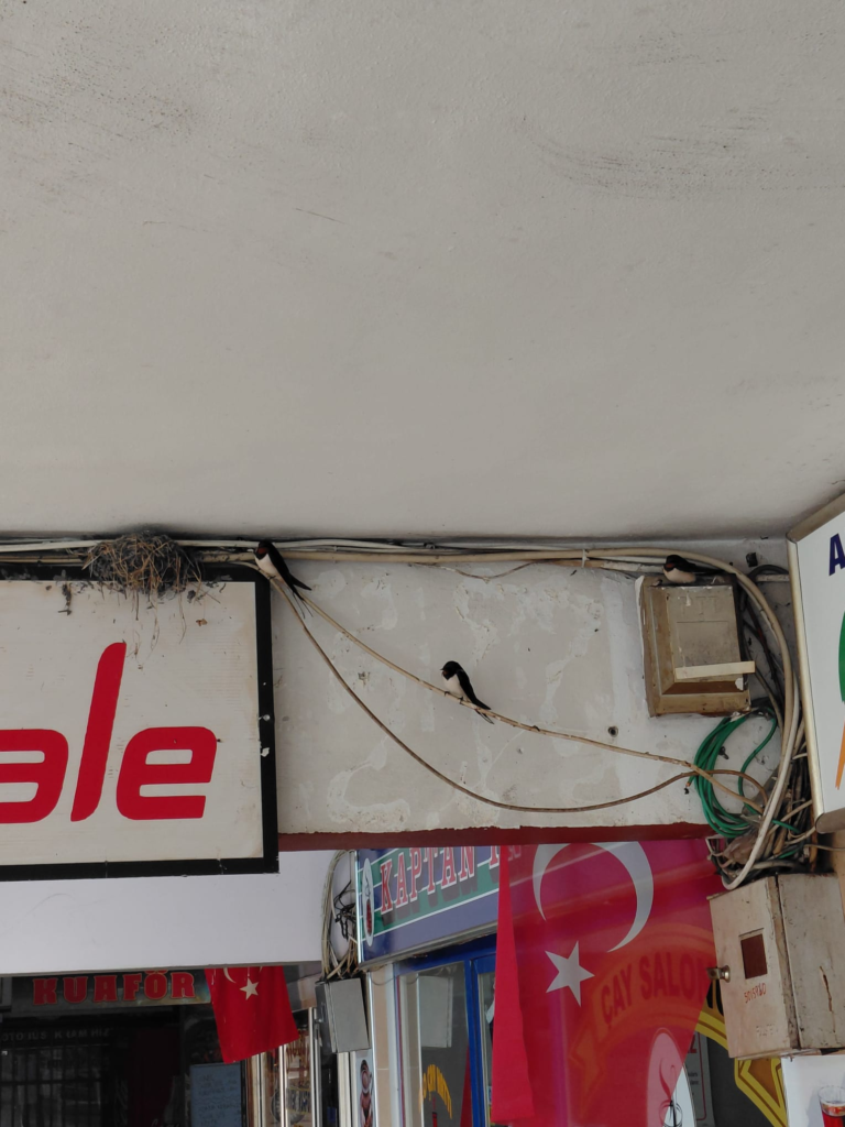
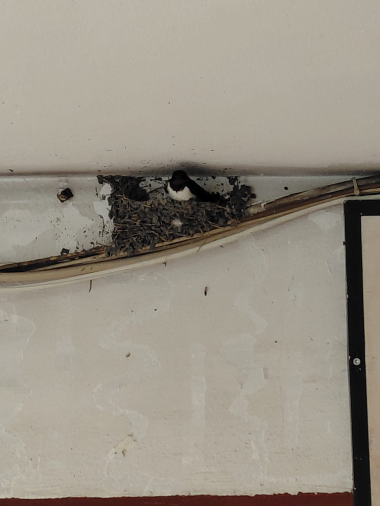
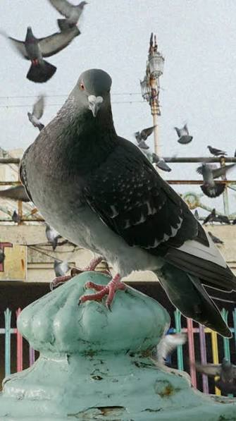
I hear birdsong from starlings from nests they have built in the rafters.
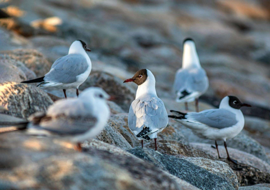
Seagulls scream.
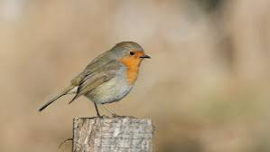
Robins warble.
Pigeons coo.
An older gentleman in a suit directs hapless, helpless travellers to their buses.
Diesel fumes from purring bus engines mingle seamlessly as conversations ebb and flow around me.
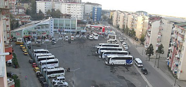
Above: Rize Otogar
I am tired this morning.
It is one of those travel mornings that stays with you – half fatigue, half anticipation – everything sharpened by the sense of change coming.
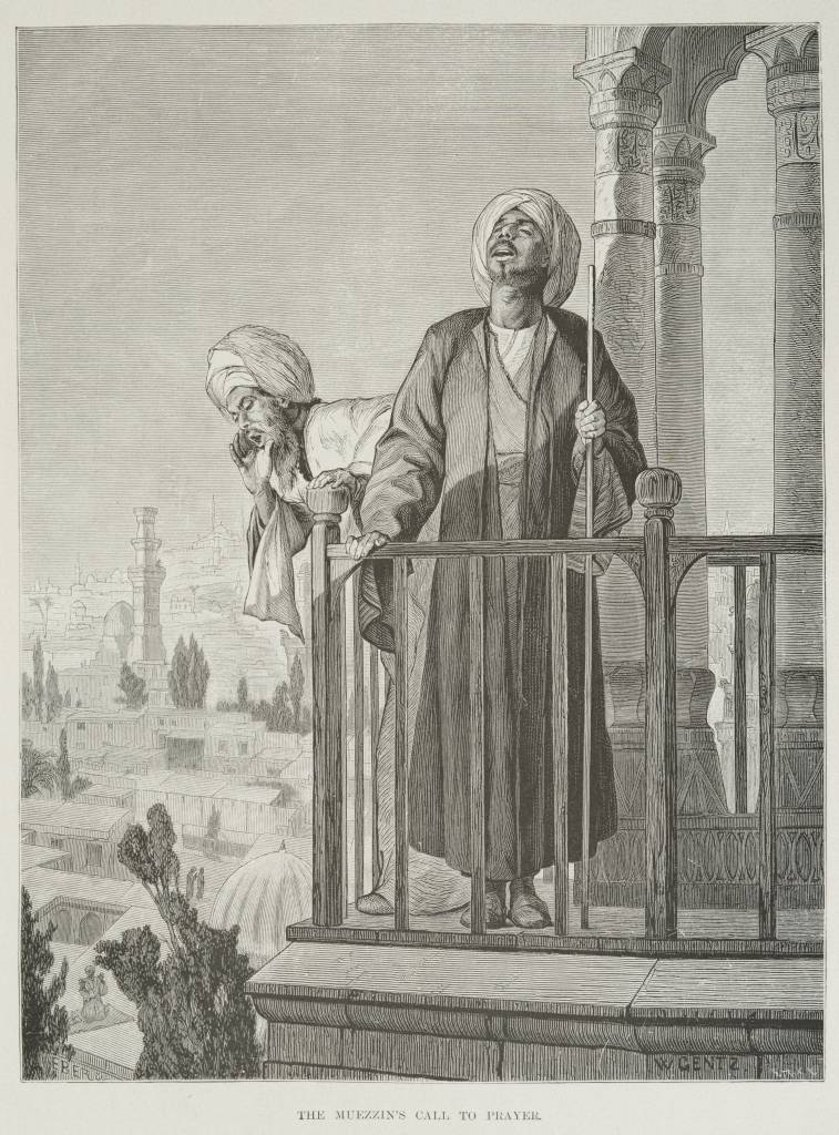
I will NOT miss 0400 calls to prayer outside my sleeping chambers.
The sun is warm.
The sky is pastel blue with wisps of cloud.
I hope that crossing the border checkpoints will be effortless.
I hope I can find work in Georgia.
I hope.

Above: From The Shawshank Redemption (1994)
From Rize, the bus heads east along the Black Sea coast.
Gündoğdu is a town located in the central district of Rize.
Covering an area of seven square kilometers and with a population of 6,200, it encompasses five neighborhoods and fifteen villages.
With its existing geographical and administrative structure, Gündoğdu is larger than seven districts.
It attained town status in 1965 and ceased to exist as a town after the 2014 local elections.
The existing neighborhoods and villages, retaining their original names, were transferred to the Rize Municipality.
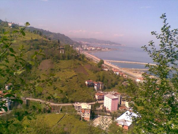
Above: Gündoğdu, Rize Province, Türkiye
The history of Gündoğdu is considered together with the history of the Central District.
Historical information begins with the expeditions of seafarers from Miletus to the region in the 7th century BC .
The people of the trading colonies they established, called emporion (marketplaces), later merged with the tribes of Central Anatolia fleeing from the Cimmerians (Gimirrai) who migrated to Eastern Anatolia, forming the first settlement centers of the region.
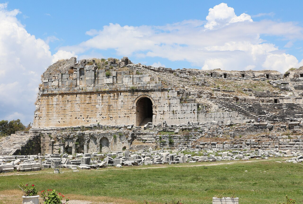
Above: Ancient Greek theatre, Miletus, Türkiye
The region, which did not witness significant military and political developments until 370, constantly changed hands between the Sasanian Empire (224 – 651) and the Roman Empire – (27 BC – AD 395 (unified) / 395 – 476/480 (Western) / 395–1453 (Eastern) – from that date onwards, due to its location on the Black Sea – Iran trade route.
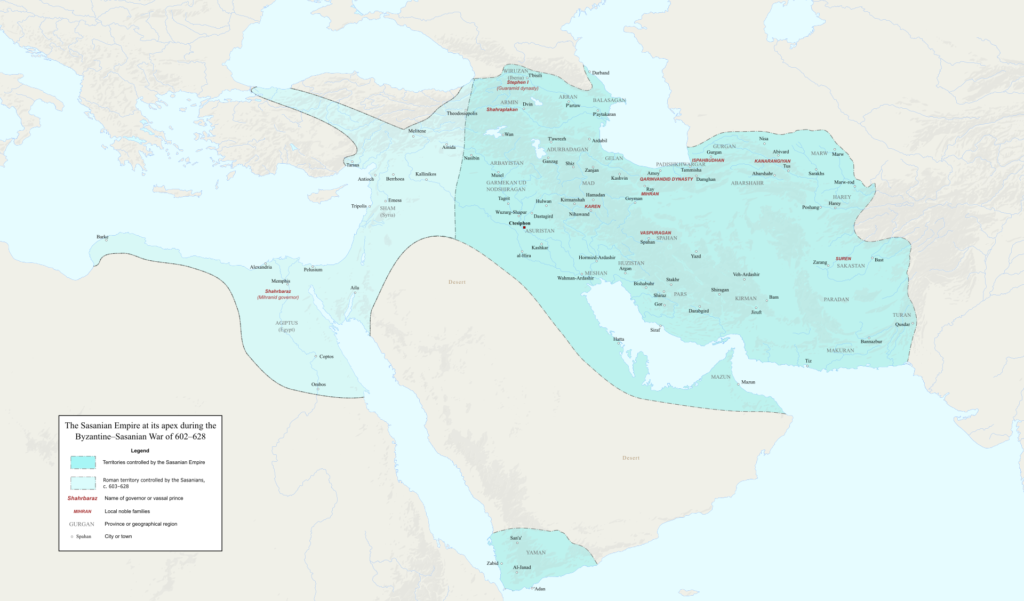
Above: Sasanian Empire
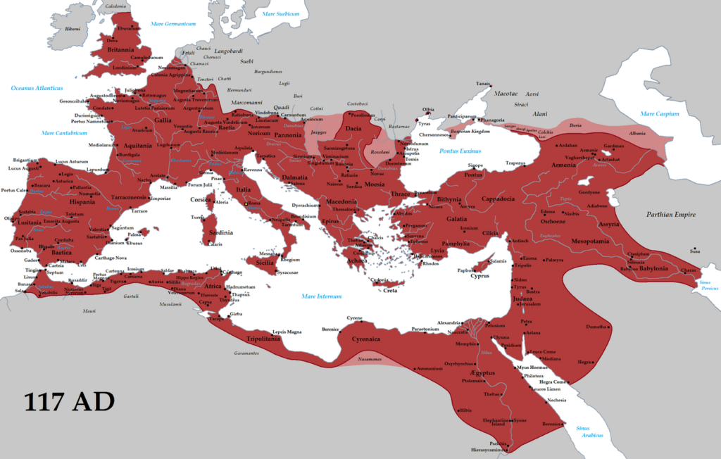
Above: The Roman Empire at its greatest extent
After the Battle of Malazgirt (Manzikert)(Malazgert, Muş Province, Türkiye) in 1071, the Turks rapidly spread throughout Anatolia, conquering Rize and its surrounding region.
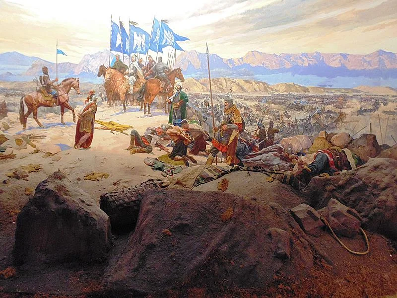
Above: The capture of Emperor Romanos (1030 – 1072) at the Battle of Malazgirt (26 August 1071)(Istanbul Military Museum)
The decisive defeat of the Byzantine army and the capture of the emperor Romanos IV Diogenes played an important role in undermining Byzantine authority in Anatolia and Armenia, and allowed for the gradual Turkification of Anatolia.
Many Turks, travelling westward during the 11th century, saw the victory at Manzikert as an entrance to Asia Minor.
However, the shift of the battlefield to Western Anatolia following the establishment of the Anatolian Seljuk State (1037 – 1194) resulted in the region returning to Byzantine rule in 1075.
After this date, Rize changed hands between the Byzantine, Danishmend and Anatolian Seljuk states, remaining under Byzantine influence until 1184 .
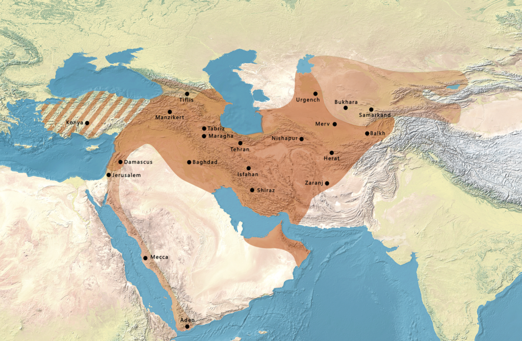
Above: The Seljuk (Selçuk) Empire (1090)
When Constantinople (Istanbul) (12 – 15 April 1204) was occupied during the Fourth Crusade (1202 – 1204), the Byzantines retreated to the Black Sea and established the Pontic Greek Empire of Trebizond, which included Rize.
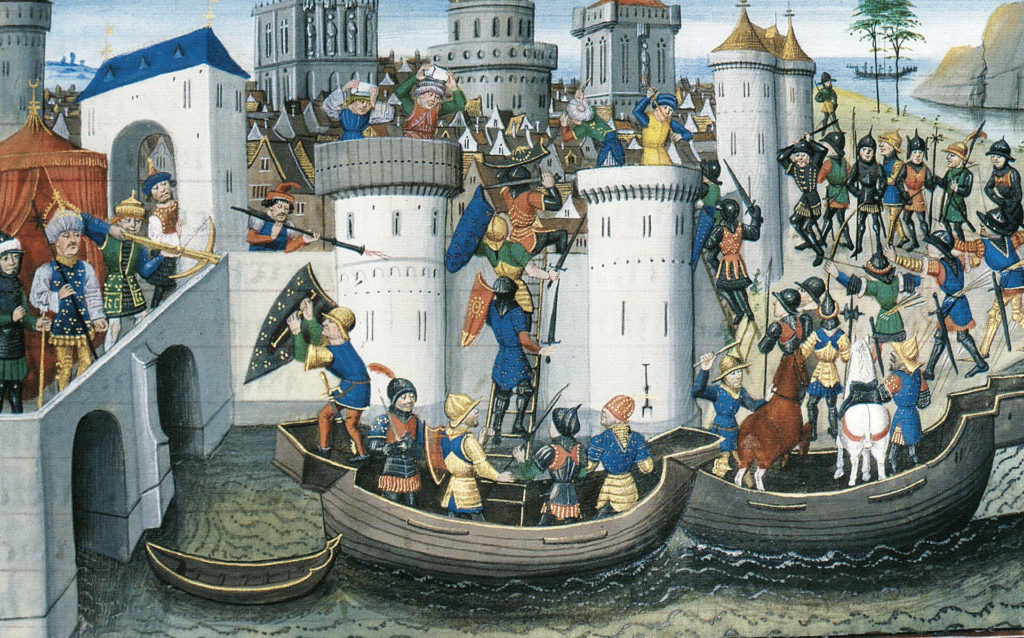
Above: A 15th-century miniature depicting the conquest of Constantinople by the Crusaders in 1204
This Empire ruled the Rize region for centuries before being abolished by Sultan Mehmed the Conqueror in 1461.
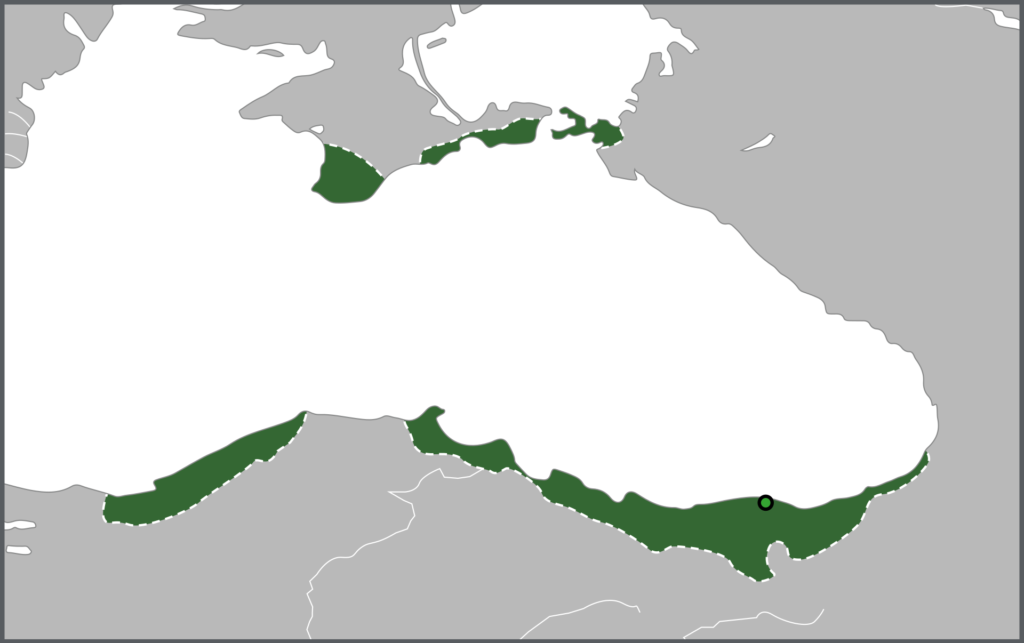
Above: Map of the Empire of Trebizond shortly after the foundation of the Latin Empire in 1204
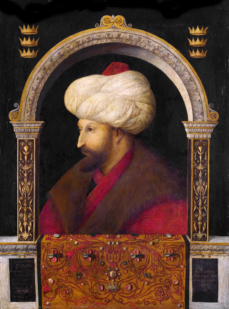
Above: Ottoman Sultan Mehmed II (1432 – 1481)
Sultan Selim I incorporated the entire Rize region into the Ottoman Empire in 1509.
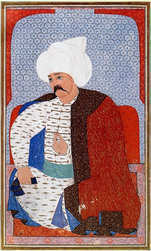
Above: Ottoman Sultan Selim I (1470 – 1520)
Despite its close interaction with the outside world, Gündoğdu, with its closed social structure, has seen its way of life change with the rise of tea production.
As people from rural areas migrated to the city, they brought their own values with them, influencing life in Gündoğdu.
Despite changes in living conditions and rising living standards, beliefs, customary values, and traditional practices in birth, marriage, and nutrition have been preserved.
In Gündoğdu, which consists of five neighborhoods, no social differences are observed between the neighborhoods.
In the town with a population of 6,200, residents protested the closure of the town municipality before the 2014 elections by collecting 3,560 signatures.
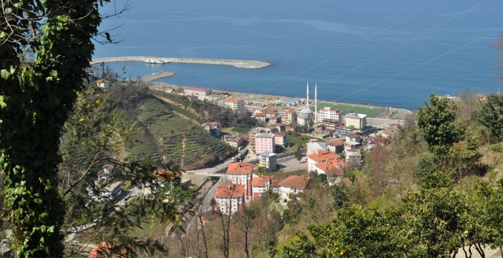
Above: Gündoğdu
Gündoğdu’s topography consists of a narrow coastal strip followed by mountains rising parallel to the sea.
The Kaçkar Mountains reach over 3,900 meters in the southeast, while Dilek Mountain in the south is 3,711 meters high and Kırklar Mountain is 3,352 meters high.
These are the highest mountains in the region.
The Kaçkars form a spectacular snaggle-toothed mountain range that few outside Türkiye seem to have heard of.
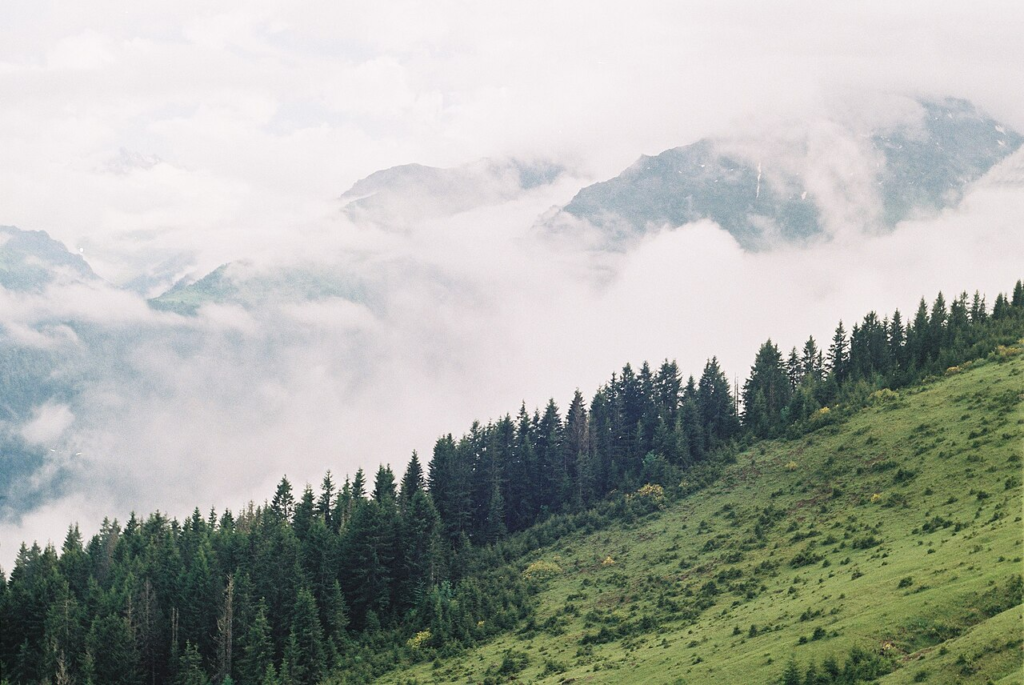
Above: Kaçkar Mountains
To the north and west, misty foothill valleys are slathered with forest and gravity-defying tea fields, then topped with grassy yayla (shepherd meadows).
The land is frequently dissected by a network of streams.
Due to the steep slopes, the fast-flowing streams do not have economic value.
The forests covering the valley slopes form a belt parallel to the sea.
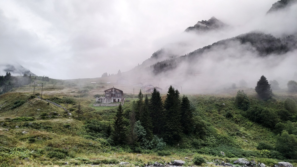
Above: Elevit Yaylası, Rize Province
Gündoğdu, which borders Rize Central District to the east, is situated on a narrow strip of plain and scattered hills.
It is located in a 4th degree earthquake zone.
It generally has a flat structure along its narrow and long coastline, immediately followed by very steep slopes.
Although limited, the streams within the municipal boundaries and zoning plan areas create flat or nearly flat areas inland.
The majority of the city’s population resides in these limited flat areas.
The dominant vegetation in Gündoğdu is tea gardens.
On the elevations that begin immediately after the narrow coastal strip, there are shrublands, short forest trees, hornbeam, alder and elm trees along with tea gardens.
Recently, kiwi production has also increased.
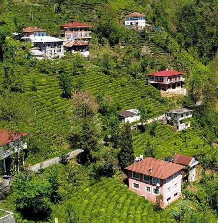
Above: Gündoğdu
The old name of Çayeli is Mapavra or Mapavri.
Indeed, it appears as “Mapavra” on the 1854 Kiepert map.
According to Özhan Öztürk, “Mapavri” is a Laz word (მაფავრი) meaning “Lords, priests“.
The author claims that it was named this way because it was the ethnic eastern border of the Greeks, Lazs and other Caucasian peoples during the Byzantine period, and Christianity spread to the Caucasus via Trabzon.
However, in Laz, “pavri” (ფავრი) means leaf, and Mapavri means “leafy place“.
This place name may be related to the vegetation of the region.
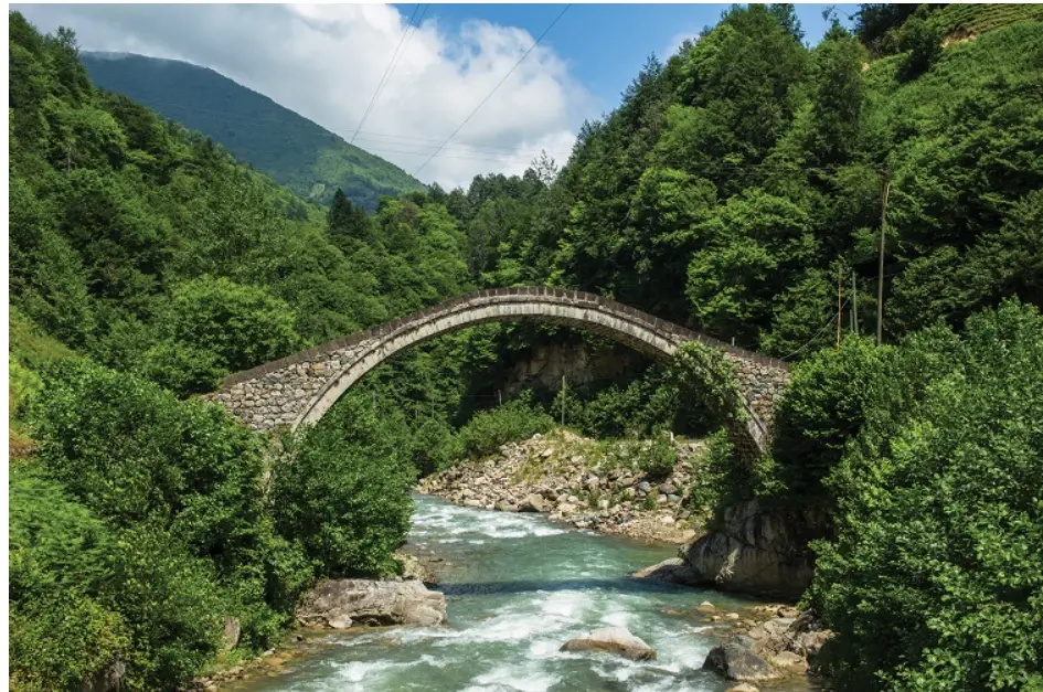
Above: Çayeli District, Rize Province
Mapaura, located in the Colchis cultural area and the settlement region of the ancient Laz people in ancient times, came under the rule of the Roman Empire in the 1st century AD.
As a result of the Lazic War in the 6th century, it became the last settlement point of the Roman/Byzantine Empire on the Black Sea coast.
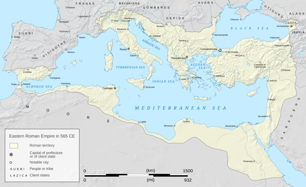
Above: Byzantine/Eastern Roman Empire at its greatest extent (565)
The Lazic War, also known as the Colchidian War or in Georgian historiography as the Great War of Egrisi, was fought between the Byzantine Empire and the Sasanian Empire for control of the ancient Georgian region of Lazica.
The Lazic War lasted for twenty years, from 541 to 562, and ended with the Fifty-Year Peace Treaty, which obligated the Byzantine Empire to pay tribute to Persia each year for the recognition of Lazica as a Byzantine vassal state by the Persians.
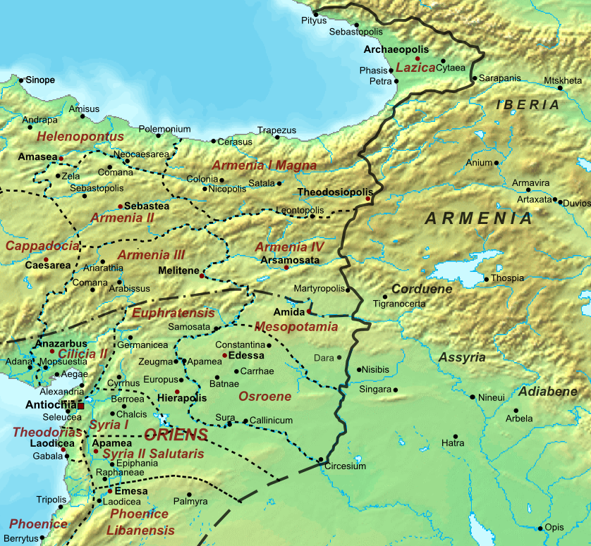
Above: Roman – Persian frontier (565)
The Lazic War is narrated in detail in the works of Procopius of Caesarea (500 – 565) and Agathias Scholasticus (530 – 594).
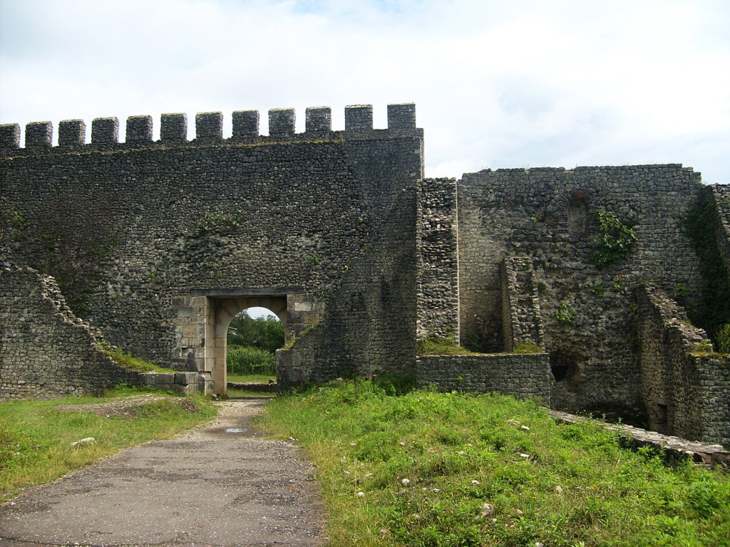
Above: The remains of the Roman fortifications of Archaeopolis (Nokalakevi / ნოქალაქევი), Senaki municipality, Samegrelo-Zemo Svaneti region, Georgia
During the period of the Empire of Trebizond, which was established after the temporary collapse of the Byzantine Empire in 1204, Mapaura/Mapavri remained the last eastern stronghold of Greek rule.
The Empire of Trebizond or the Trapezuntine Empire was one of the three Byzantine rump states of the Byzantine Empire that existed during the 13th through to the 15th century.
The empire consisted of the Pontus, or far northeastern corner of Anatolia, and portions of southern Crimea.
It was formed with the help of Georgia’s interventions in Trebizond.
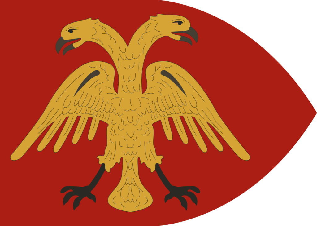
Above: Banner of the Empire of Trebizond
After the Fourth Crusade overthrew Alexios V Doukas and established the Latin Empire (1204 – 1261), the Empire of Trebizond became one of three Byzantine successor states to claim the imperial throne alongside the Empire of Nicaea under the House of Laskaris and the Despotate of Epirus under a branch of the House of Angelos.
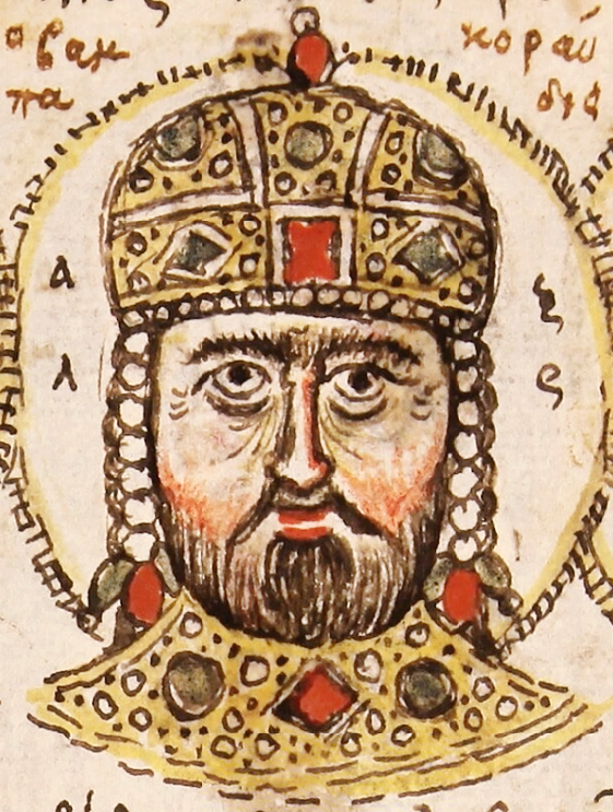
Above: Byzantine Emperor Alexios V Doukas (d. 1204)
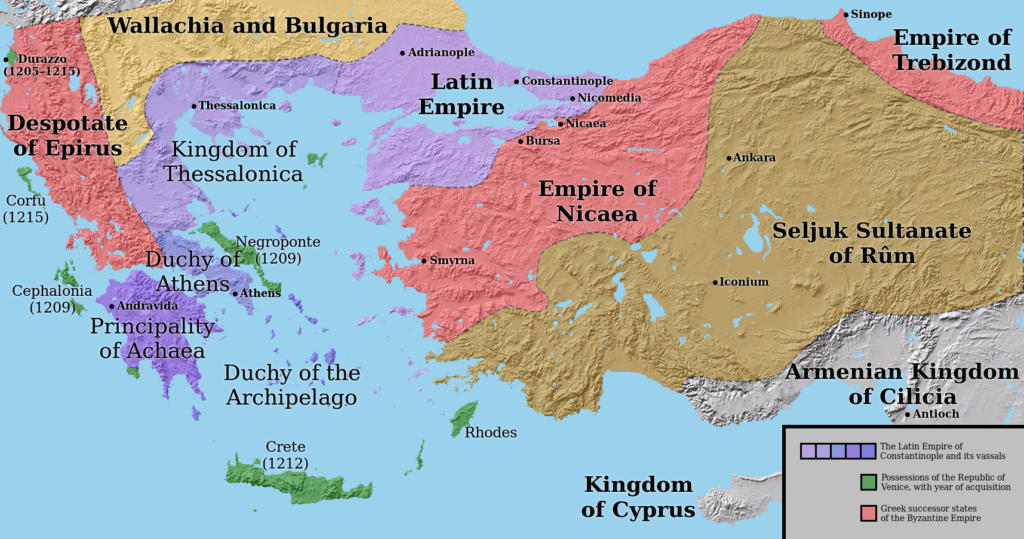
Above: The Latin Empire (in purple) with its vassals in 1204
The Trapezuntine Empire was formed in 1204 with the help of Queen Tamar of Georgia after the Georgian expedition in Chaldia and Paphlagonia, which was commanded by Alexios Komnenos (1182 – 1222) a few weeks before the Sack of Constantinople.
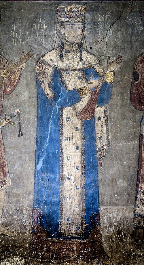
Above: Queen Tamar of Georgia (1160 – 1213)
Alexios later declared himself Emperor and established himself in Trebizond (now Trabzon in Turkey).
Alexios and David Komnenos (r. 1204 – 1212), grandsons and last male descendants of the deposed Emperor Andronikos I Komnenos (1118 – 1185), pressed their claims as Roman emperors against Alexios V Doukas.
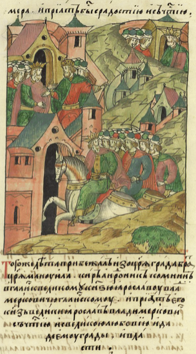
Above: Andronikos’ arrival at the court of Yaroslav Osmomysl
The ensuing wars saw the Empire of Thessalonica (1224 – 1246), the imperial government that sprang from Epirus, collapse following conflicts with Nicaea and the Second Bulgarian Empire (1185 – 1222) and the final recapture of Constantinople by the Nicaeans in 1261.
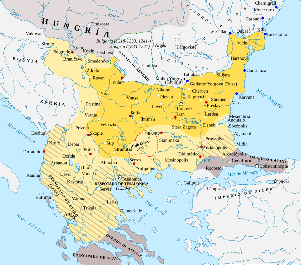
Above: The Second Bulgarian Empire
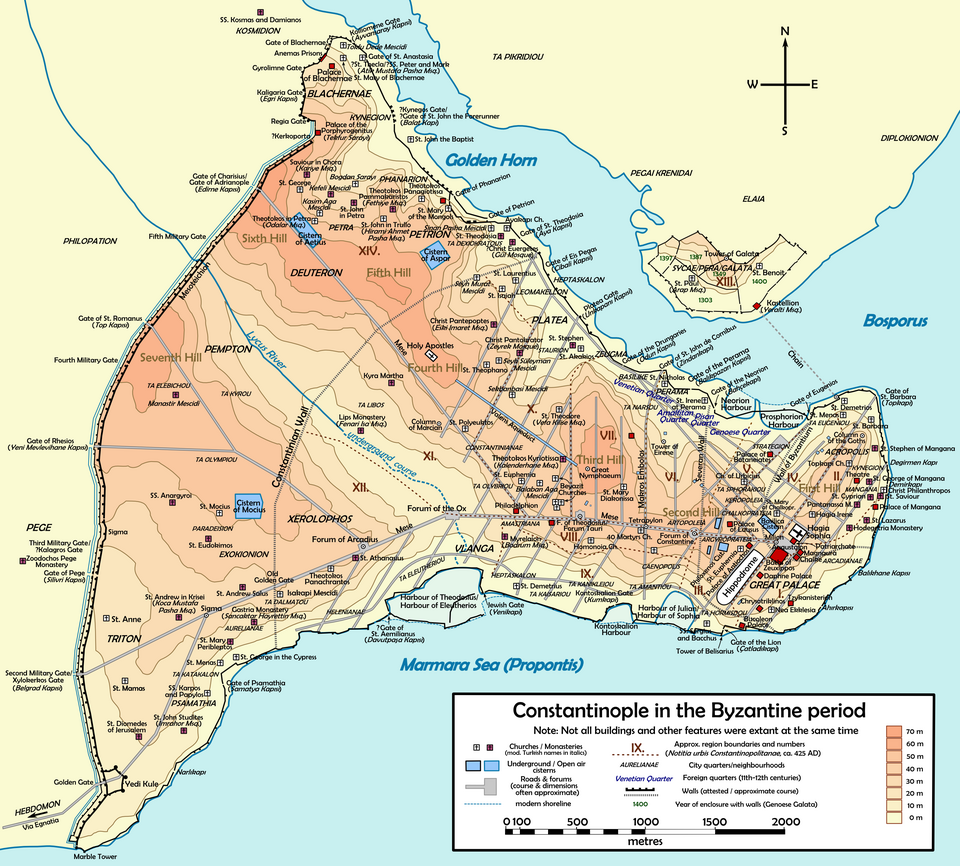
Despite the Nicaean reconquest, the Emperors of Trebizond continued to style themselves as Roman emperor for two decades and to press their claim on the imperial throne.
Emperor John II of Trebizond officially gave up the Trapezuntine claim to the Roman imperial title and Constantinople itself 21 years after the Nicaeans recaptured the city, altering his imperial title from “Emperor and Autocrat of the Romans” to “Emperor and Autocrat of all the East, Iberia and Perateia“.
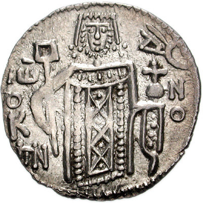
Above: Coin depicting John II of Trebizond (1262 – 1297)
The restored empire ended in 1453 with the conquest of Constantinople by the Ottomans.
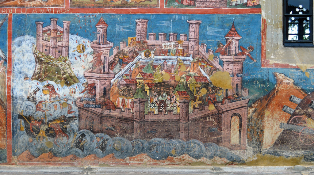
Above: Siege of Constantinople, 6 April – 29 May 1453
Trebizond lasted until 1461, when the Ottoman sultan Mehmed II conquered it after a month-long siege and took its ruler and his family into captivity.
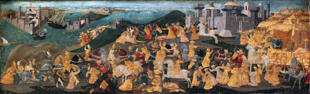
Above: Conquest of Trebizond, 14 September 1460 – 15 August 1461
The Crimean Principality of Theodoro, an offshoot of Trebizond, lasted another 14 years, falling to the Ottomans in 1475.
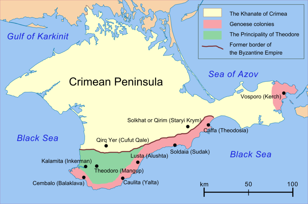
The Trapezuntine monarchy survived the longest among the Byzantine successor states.
The Despotate of Epirus had ceased to contest the Byzantine throne even before the Nicaean reconquest and was briefly occupied by the restored Byzantine Empire c. 1340, thereafter becoming a Serbian Imperial dependency later inherited by Italians, ultimately falling to the Ottoman Empire in 1479.
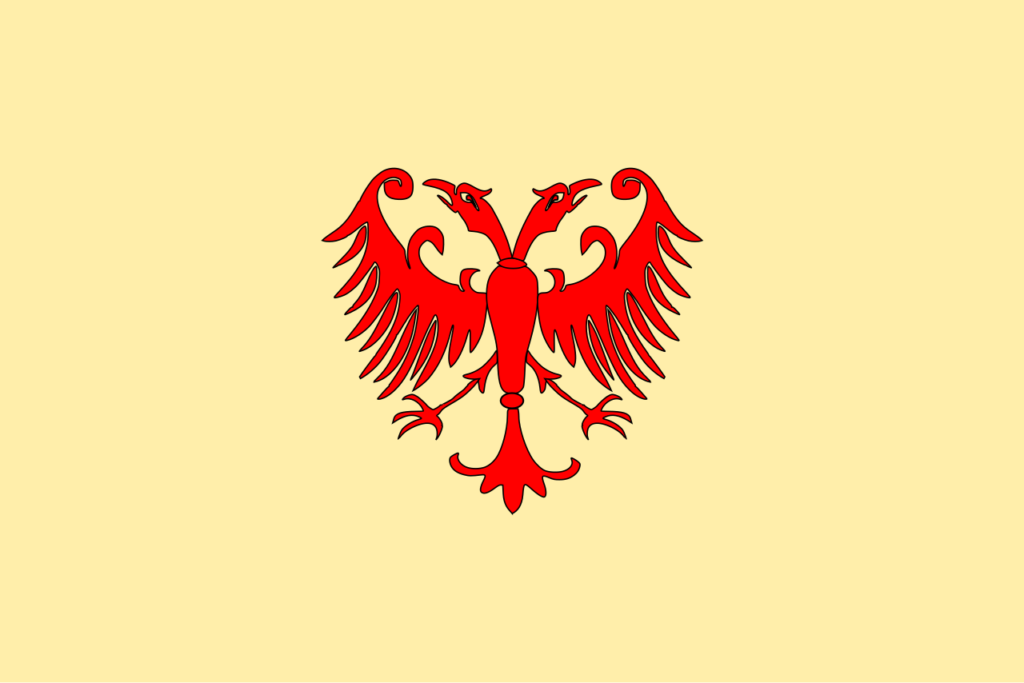
Above: Flag of the Serbian Empire (1346 – 1371)
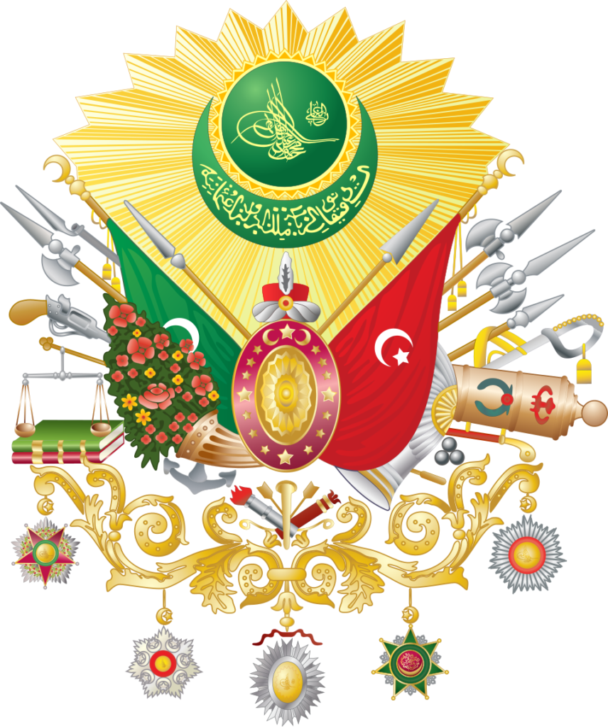
Above: Coat of arms of the Ottoman Empire (1299 – 1922)
While the rulers of Trebizond bore the title of Emperor until the end of their state in 1461, their rivals, the Laskarids in Nicaea and the Palaiologoi in Constantinople contested their claim to the imperial title until the later 14th century.
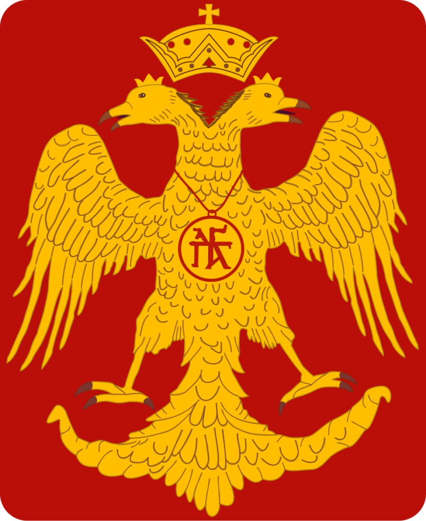
Above: The Byzantine double-headed eagle with the sympilema (the family cypher) of the Palaiologos dynasty
In the 13th century, George Pachymeres would call them the princes of the Laz, while Byzantine Chancellor Demetrios Kydones (1324 – 1398) in the mid 14th century would claim that the emperors at Constantinople had given the rulers of Trebizond their state.
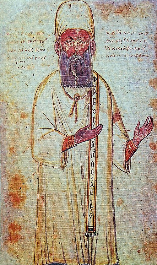
Above: Byzantine historian Georgius Pachymeres (1242 – 1310)
For the rulers in Constantinople, Trebizond was often viewed as a rebellious former vassal or barbarian who had broken loose and proclaimed themselves as emperors, but the emperors in Trebizond never renounced their imperial claim.

Above: The path of the Fourth Crusade and the political situation of what once was the Byzantine Empire in 1204
In 1461, it came under Turkish rule when Mehmed II (the Conqueror) incorporated the Trebizond state into Ottoman territory.
For approximately 50 years after that, Mapavri was a border point of the Ottoman Empire on the Black Sea coast.
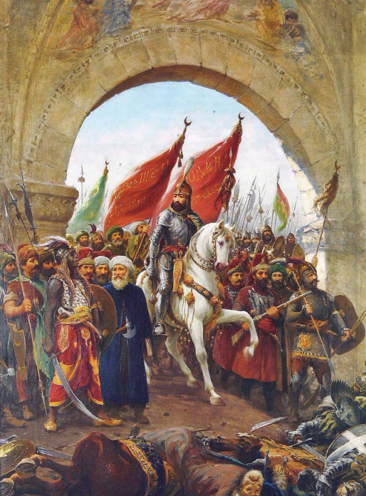
Above: Entry of Mehmet II into Constantinople
In 1622, Mapavri was attacked and plundered by Abaza pirates.

Above: Proposed flag of Abkhazia
Şemsettin Sami, in his work Kamasü’l-Alam, refers to Mapavri as “a sub-district of the Rize district, within the Lazistan province of Trabzon“.
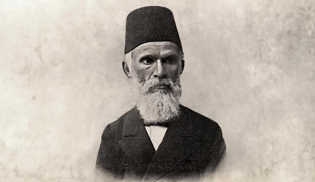
Above: Şemsettin Sami (1850 – 1904)
The region, which was under Russian occupation for two years during World War I, came back under Turkish administration on 9 March 1918.
The coastal road connecting the district to Rize was built during the Russian occupation period.

Above: Flag of Russia
The vast majority of village names are Greek.
However, there are also a small number of Laz and Hemshin place names.
No Turkish place names were recorded before the beginning of the 20th century.
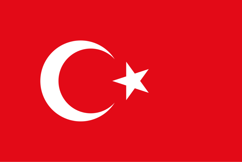
Above: Flag of Türkiye
Çayeli is located 18 km east of Rize.
It is a typical Eastern Black Sea coastal district with a narrow coastline and mountain ranges rising immediately behind it, running parallel to the sea.
A large part of it is covered by the Rize Mountains, which form the highest section of the Eastern Black Sea Mountains.
The elevation exceeds 2,000 meters at its southern end.
In some of the mountainous villages of the district, the Hemshin people, the indigenous people of the region, live.
The Laz language is also spoken in the districts to the east of Çayeli (Pazar, Ardeşen and Fındıklı).
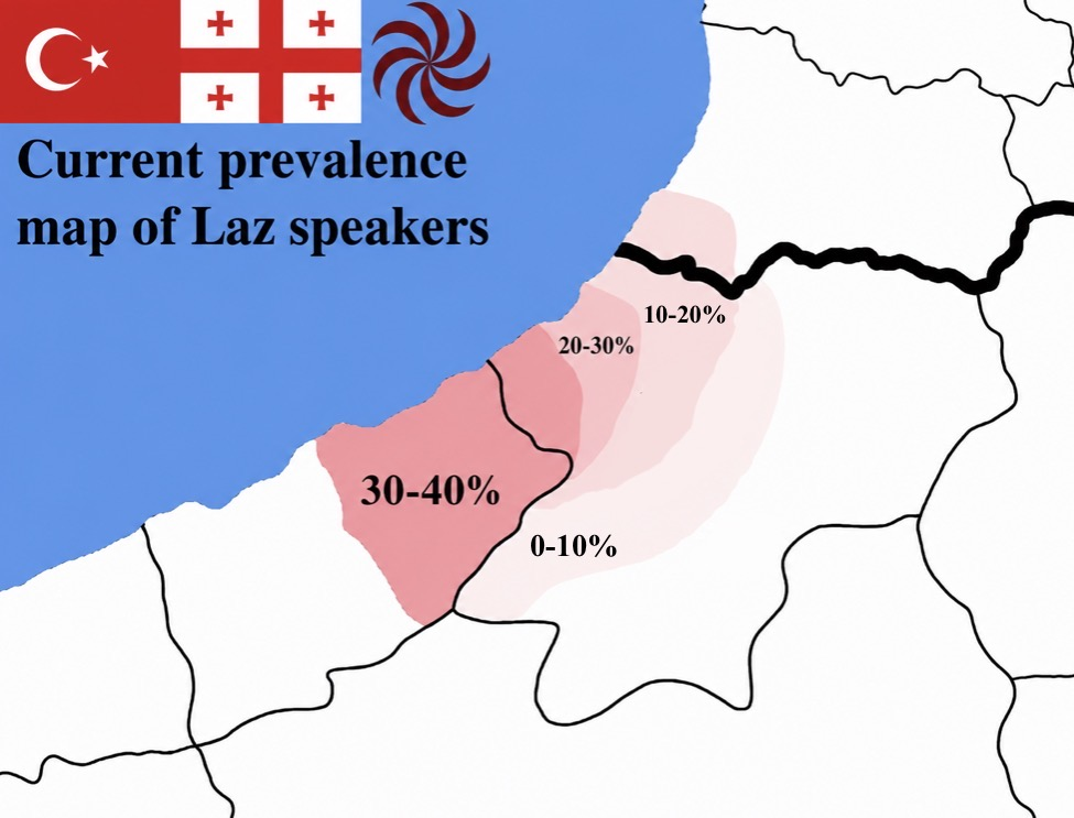
The district’s economy is based on tea production.
Before tea production began in the region, the main crop was corn.
In Çayeli, the only area suitable for both settlement and agricultural production is the narrow coastal strip.
A large portion of the population is concentrated here.
Tea cultivation is also heavily concentrated in this area.
Two-thirds of Turkey’s tea cultivation areas are in Rize province.
18% of that is within the borders of Çayeli district.
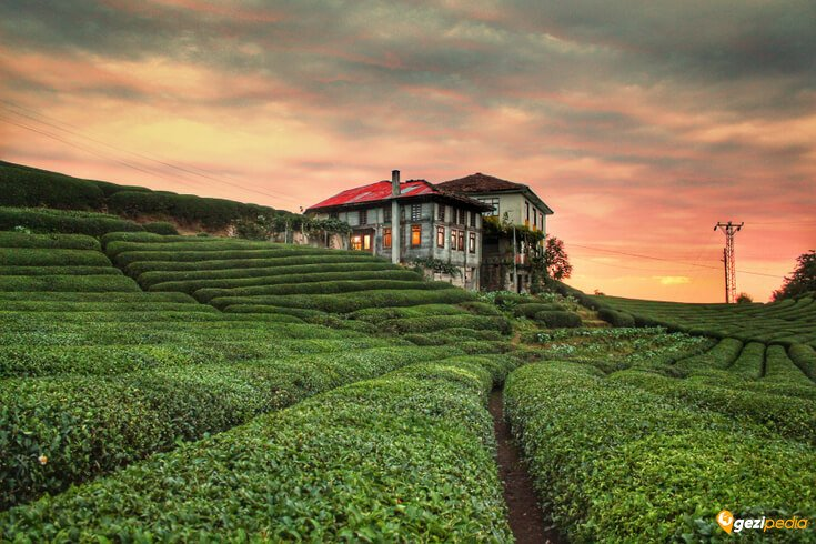
Above: Çayali, Rize Province
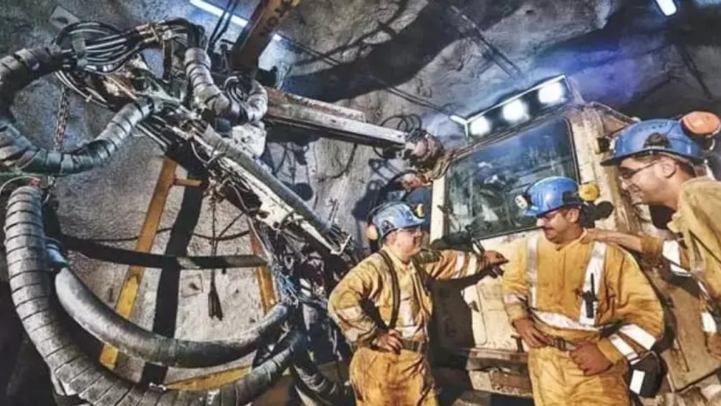
Copper mining has been taking place in the town of Madenli since 1984 (by Çayeli Bakır İşletmeleri A.Ş./First Quantum Minerals Ltd.).
The company is of great importance to the local people through its contributions to the regional economy and its social responsibility initiatives.
I drift in and out of sleep as we pass through this region without stopping.
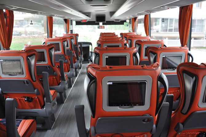
The journey unfolds almost like a travelling ethnography — a moving chronicle of the eastern Black Sea littoral as seen through a half-sleeping bus window.
What strikes me most is how the landscape and the history seem inseparable there.
Every valley, every tea slope, every place-name carries traces of the distant past:
Greeks, Laz, Hemshin, Ottomans, Russians, Georgians, Byzantines, Pontic emperors, migrants, traders, shepherds, tobacco farmers.
The region feels less like a borderland than a palimpsest.
And the names themselves are extraordinary:
Mapavri, Atina, Noğa, Lazistan.
One senses how recent many modern national narratives really are when confronted with these older linguistic layers still clinging stubbornly to rivers and hillsides.
The Black Sea coast has always resisted simplicity.
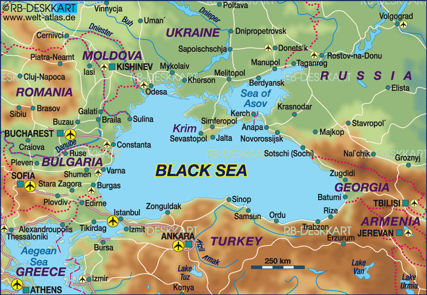
I am especially taken by this recurring theme:
— mountains rising immediately behind the coast
— narrow strips of habitable land
— people compressed between sea and stone
— migration as necessity
— survival through adaptation
Tea changes everything in the story.
Again and again, the chronicle returns to it almost as a civilizational force.
Tea reshapes agriculture, destroys old industries, alters migration patterns, transforms diets, labour systems, even social structure.
Tobacco fades.
Orchards shrink.
Linen weaving declines.
Animals disappear from the lowlands.
Tea becomes destiny.
The bus which left Rize 30 minutes late, stops in Pasar, for 15 minutes.
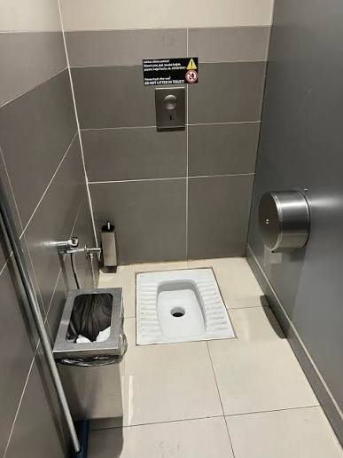
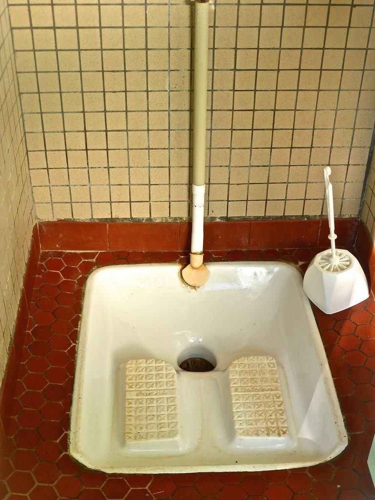
I seek out the man’s “thunder box“.
A man of indeterminate sadness sits on a bench outside the open door of the unpleasant scent of the WC, collecting TL 15 from each visitor as he is exposed to the cacophony and stink of men performing their toilet.
The scene saddens me.
What circumstances led to this man’s life?
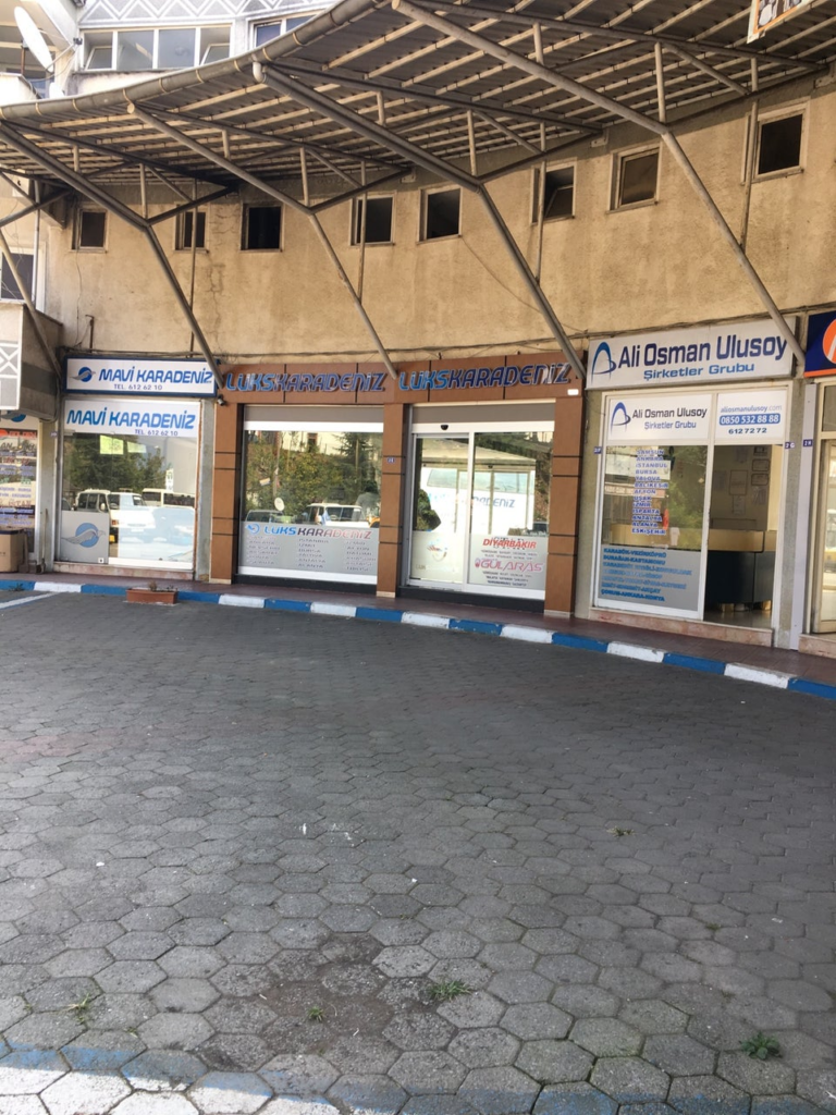
Above: Otogar, Pazar, Rize Province, Türkiye
Pazar (Atina) is a district of Rize province in the Black Sea region and the administrative center of the district.
As a settlement, Athens was founded in 64 BC by Pompeius under the name Athenae.
This place name, a Greek word, means intellect, beauty and wisdom.
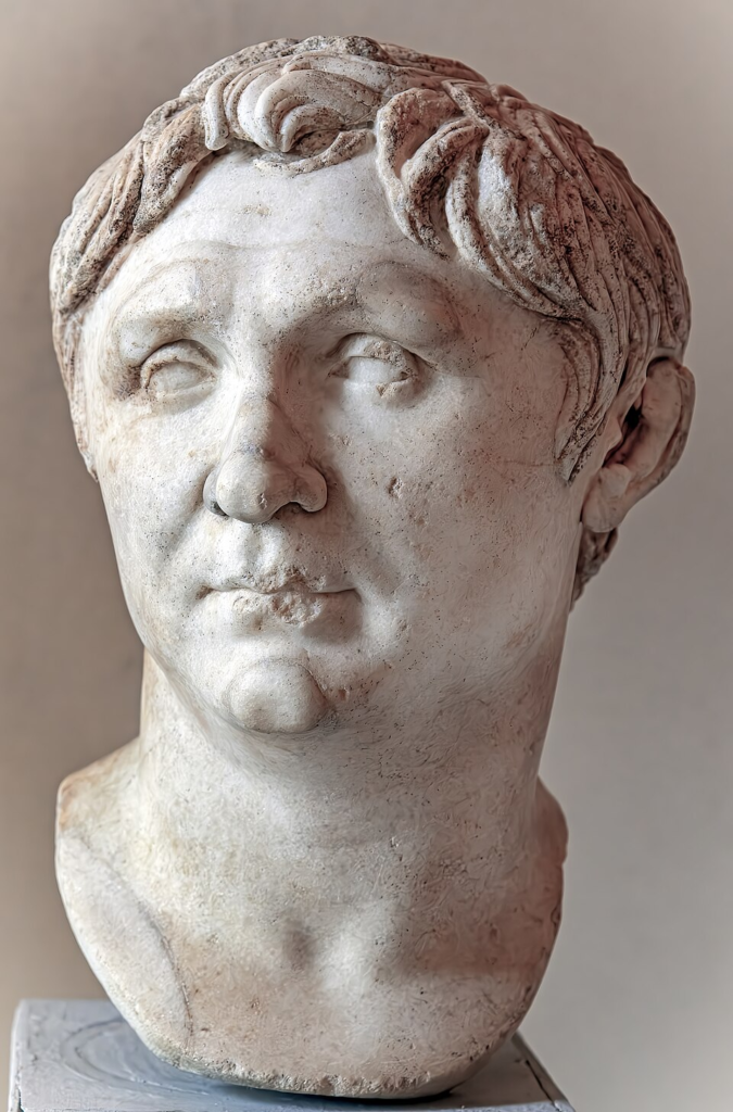
Above: Bust of Pompey the Great (Gnaeus Pompeius Magnus)(106 – 48 BC)(Museo Archeologico Nazionale, Venezia/Venice)
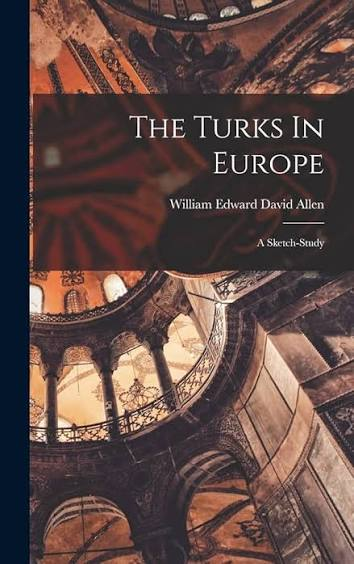
According to British scholar William Edward David Allen (1901 – 1973), the word Athenae is an adaptation of a Laz and Georgian word meaning “shady“.
The city of Athenae was also the port of Pontus and had a Greek temple there.
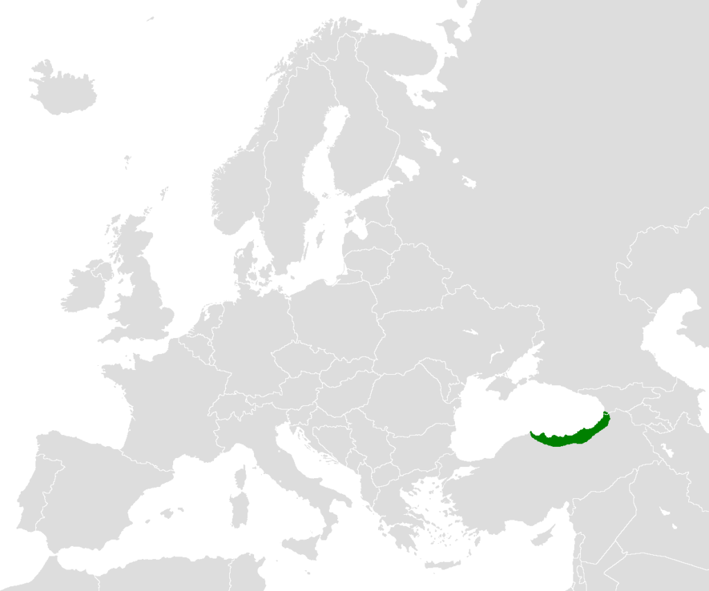
Above: Region of Pontus
Pontus is a region within Anatolia on the southern coast of the Black Sea, located in the modern-day eastern Black Sea region of Turkey, in West Asia.
The name was applied to the coastal region and its mountainous hinterland (rising to the Pontic Alps in the east) by the Greeks who colonized the area in the Archaic period and derived from the Greek name of the Black Sea: Εύξεινος Πόντος (Eúxinos Póntos), ‘Hospitable Sea‘, or simply Pontos (ὁ Πόντος) as early as the Aeschylean Persians (472 BC) and Herodotus’ Histories (440 BC).
Lazistan was within the borders of the Kingdom of Colchis in antiquity.
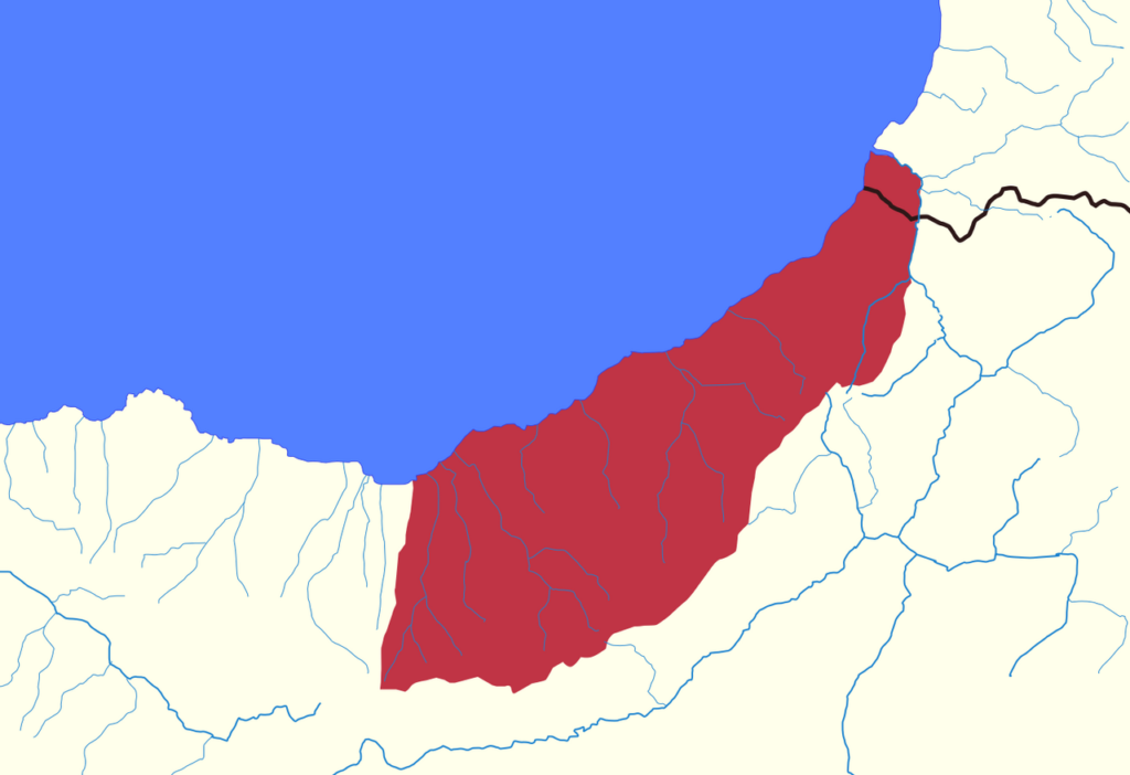
Above: Historical Lazistan
Lazistan or Lazeti (Laz: ლაზონა) is a historical and cultural region of the Caucasus and Anatolia.
The term was primarily used during Ottoman rule in the region.
Traditionally inhabited by the Laz people and located mostly in Türkiye, with small parts in Georgia, its area is about 7,000 km2 (2,703 sq mi) with a modern-day population of around 500,000 (including groups outside of the Laz peoples).
Geographically, Lazistan consists of a series of narrow, rugged valleys extending northward from the crest of the Pontic Alps, which separate it from the Çoruh Valley, and stretches east–west along the southern shore of the Black Sea. The term “Lazistan” has no longer been in use in Turkey or Georgia since the collapse of the Ottoman Empire.
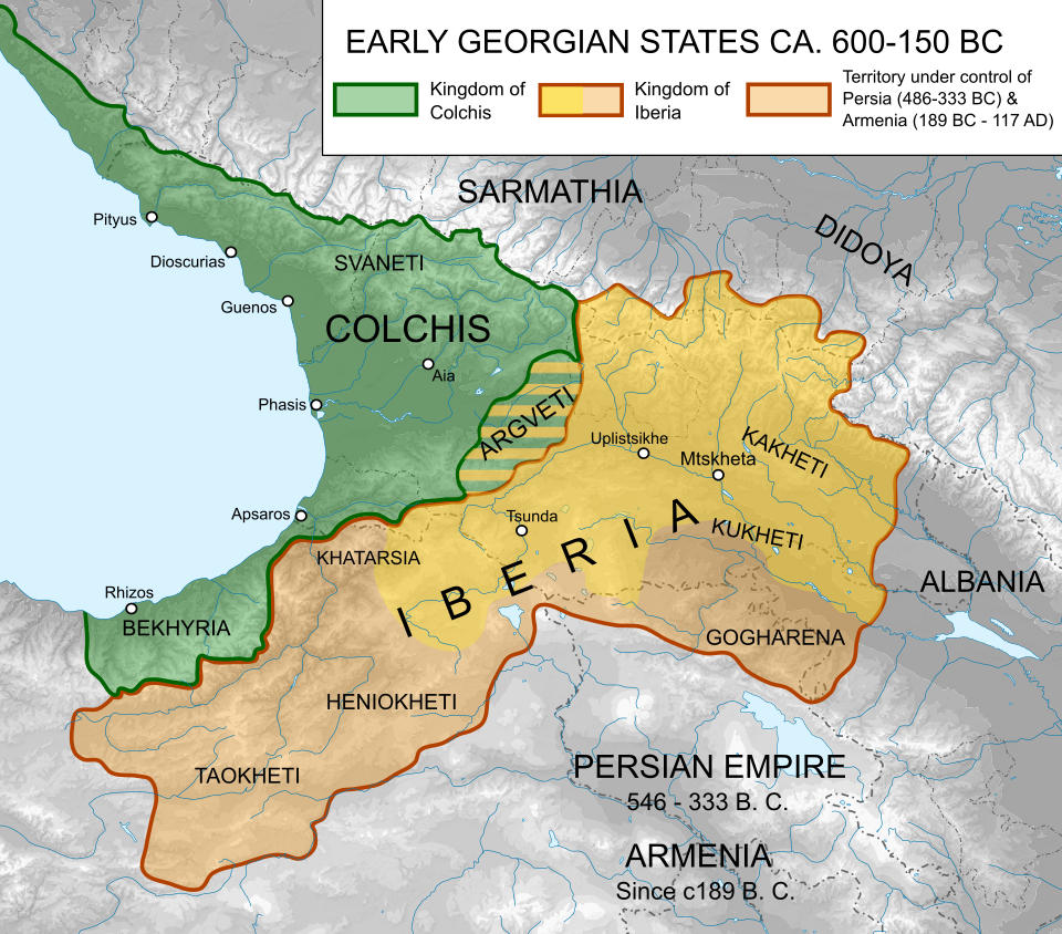
Above: In classical antiquity and Greco-Roman geography, Colchis was an exonym (a foreign-established, non-native name for a group of people, an individual person of that group, a geographical place, a language, or a dialect, meaning that it is used primarily outside the particular place inhabited by the group or linguistic community) for the Georgian polity of Egrisi (Georgian: ეგრისი) located on the eastern coast of the Black Sea, centered in present-day western Georgia also including the region of Abkhazia.
After the Ottomans destroyed the Empire of Trebizond in 1461, they completely conquered this region in 1547, except for the present-day city of Batumi and its surroundings.
According to the 1876 Trabzon Province Yearbook, Atina was the name of the district as an administrative unit.
The administrative center of the Atina district was called Nefs-i Bazar (نفس بازار).
The Laz name of Nefs-i Bazar, which was recorded as a neighborhood or, in today’s sense, “market center,” is Noğa (ნოღა), meaning “the place where the market is established“.
At this time, the Nefs-i Bazar neighborhood was the administrative center of the Atina district of the Lazistan Sanjak of Trabzon Province.
Its population consisted of 73 people living in 22 households.
At this time, only the male population were recorded.
As taxable livestock, eight goats, 30 cows, six oxen, ten buffaloes and two horses were recorded in the neighborhood.
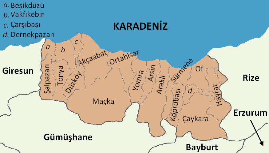
Above: Map of Trabzon Province
According to the 1888 Trabzon Province Yearbook, the people of the Atina district worshipped the pagan god Antas.
The town’s name derives from this pagan god.
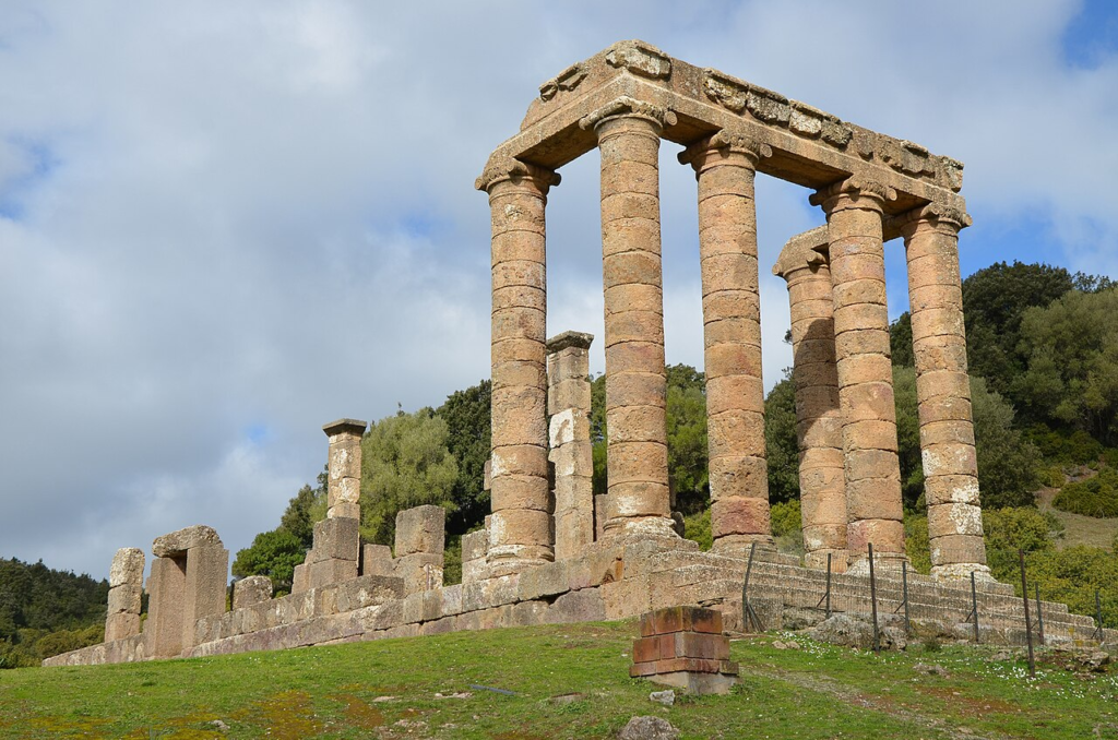
Above: Temple of Antas, Fluminimaggiore, Sardinia, Italia
At that time, Atina, which was part of the Trabzon Sanjak of Trabzon Province, had a population of 2,313 households and 37,279 people.
The district’s economy was based on agriculture and animal husbandry.
Wheat, barley, corn, rice, beans, hazelnuts and flax were cultivated.
Besides farmers, there were also traders and craftsmen.
Dolphin hunting was practiced in the sea – the oil of the captured dolphins was extracted and sold abroad.
Animal husbandry was based on cattle, sheep and goat breeding.
A market was held in Atina on Fridays.
Atina was also famous for its linen and woolen shawls.
Caviar was extracted from the trout caught in the rivers.
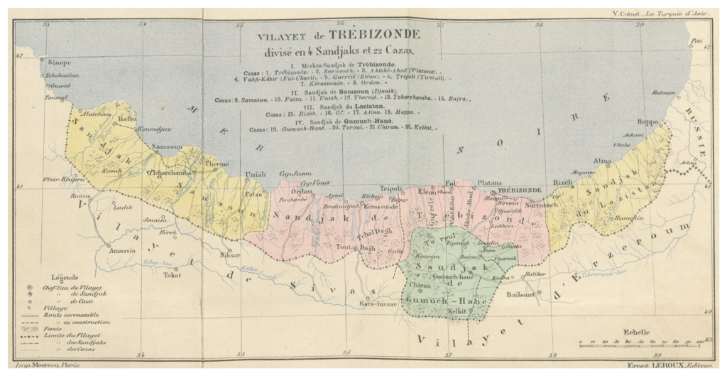
Above: Trébizonde Vilayet
Linguist Nikolay Marr, in his notes from a research trip to Lazistan in 1910, wrote the name of the settlement as Bazar or Atina.
According to Marr, at that time there were 69 villages or hamlets in the Atina district, and the Laz language was spoken in 64 of these villages.
It is understood from this record that the name Bazar was used to mean the city of Athenae.
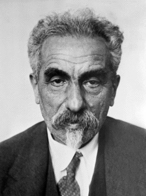
Above: Georgian historian/linguist Nikolai Marr (1865 – 1934)
Bazar or Atina fell into the hands of the Russians during the First World War.
During the Russian administration, in 1917, Georgian linguist Ioseb Kipshidze, who made a research trip to the Lazistan region, noted the name of the settlement as Bazar (ბაზარ) in Georgian and Atina (Атина) in Russian, and stated that 113 people lived in 25 households in the neighborhood.
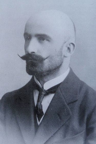
Above: Ioseb Kipshidze (1882 – 1919)
The town of Pazar is located 37 km east of Rize.
Pazar District is a Black Sea coastal strip that runs parallel to the coast, bordered by high inland mountains.
This coast has a mild climate with hot summers (22°C in August) and cool winters (7°C in January, snow is rare on the coast), but it is very wet and humid, with heavy rainfall throughout the year except for the beginning of summer (April – May – June).
On average, there are 50 sunny days a year.
The Black Sea wind is cold in autumn and wet and humid in summer.
More water comes to the region from numerous streams formed by rainwater and snowmelt from the Black Sea mountains, including the Pazar Stream.
Pazar has grazing land (highlands), including summer grazing in the higher pasture areas.
Planting trees is more difficult at higher altitudes.
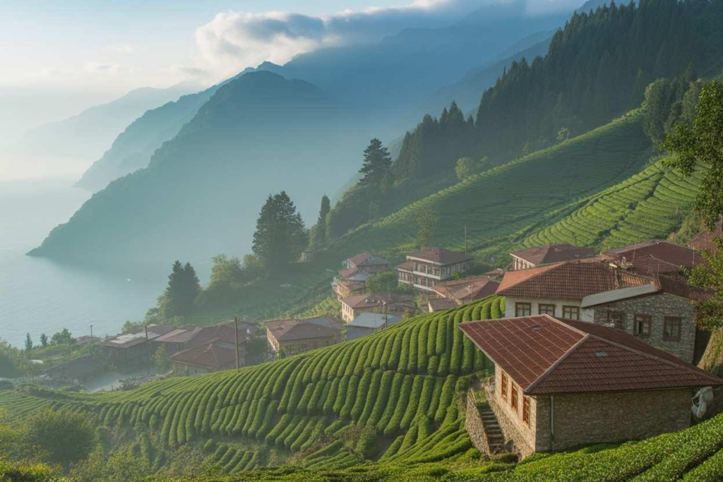
Transhumance is a type of pastoralism or nomadism, a seasonal movement of livestock between fixed summer and winter pastures.
In montane regions (vertical transhumance), it implies movement between higher pastures in summer and lower valleys in winter.
Herders have a permanent home, typically in valleys.
Generally only the herds travel, with a certain number of people necessary to tend them, while the main population stays at the base.
In contrast, movement in plains or plateaus (horizontal transhumance) is more susceptible to disruption by climatic, economic, or political change.
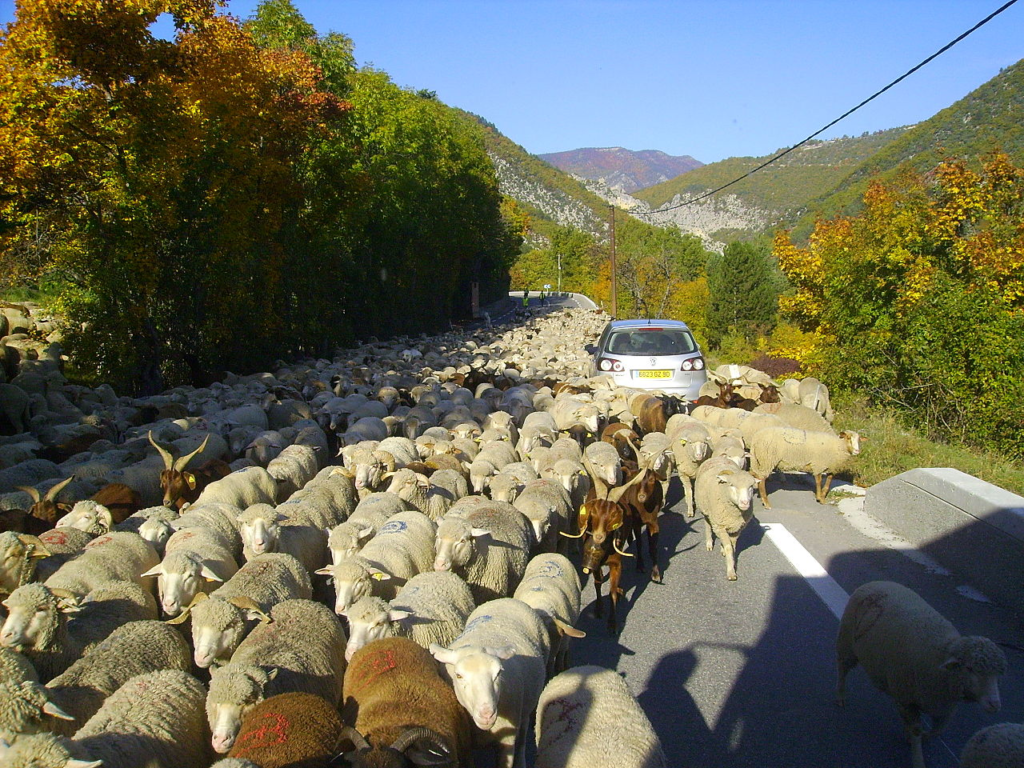
Above: Transhumance in Alpes-de-Haute-Provence, France
Traditional or fixed transhumance has occurred throughout the inhabited world, particularly Europe and western Asia.
It is often important to pastoralist societies, as the dairy products of transhumance flocks and herds (milk, butter, yogurt and cheese) may form much of the diet of such populations.
In many languages there are words for the higher summer pastures, and frequently these words have been used as place names: e.g. hafod in Wales, shieling in Scotland, or alp in Germany, Austria and German-speaking regions of Switzerland.
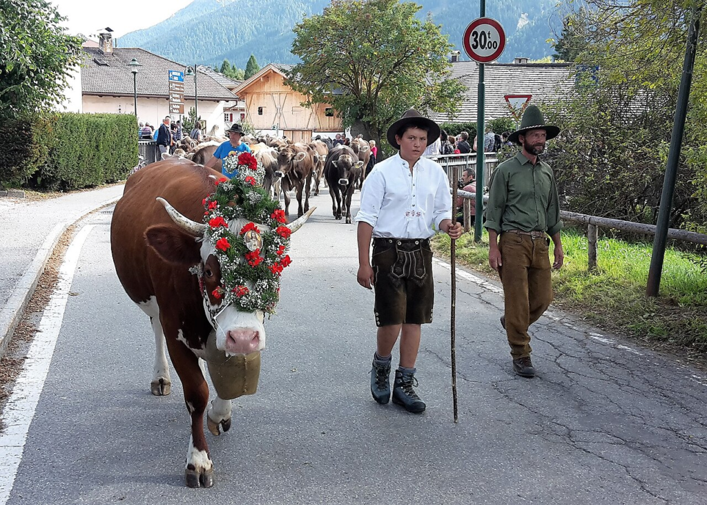
Above: Transhumance in Toblach, South Tyrol, Italy
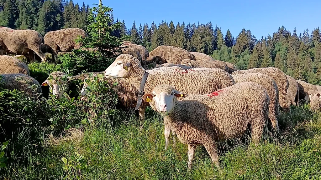
Transhumance is an economic activity that has been practiced in the Pazar district for centuries as a result of natural conditions.
Especially the residents of some villages located in the central and coastal areas go to the plateaus located in the upper reaches of the Fırtına River during the summer months to graze their animals and store their produce.
The first thing one notices about Pazar is that there is almost nowhere for the land to rest.
The Pontic Mountains rise almost directly from the Black Sea, leaving only a narrow coastal strip between water and rock.
There are no broad river valleys, no spacious plains, and few natural harbours.
Every stream rushes impatiently down steep slopes before emptying into the sea.
Fed by constant rain and melting mountain snow, they rarely run dry.
The same mountains that frustrate transport also determine what people can grow.
Nearly 90% of the district is steep or hilly.
Farming on such terrain has never been easy.
Tea changed everything.
When the first tea bushes were planted in 1944, few could have imagined how completely they would reshape the landscape.
Today almost 2/3 of Pazar’s cultivable land is devoted to tea, and three factories process the harvest.
The district’s acidic, low-lime soil — unsuitable for many crops —proved almost perfect for Camellia sinensis.
Tea did not simply become another crop.
It displaced an older agricultural world.
Citrus groves, apple orchards and even a canning factory built to process local fruit gradually faded into history.
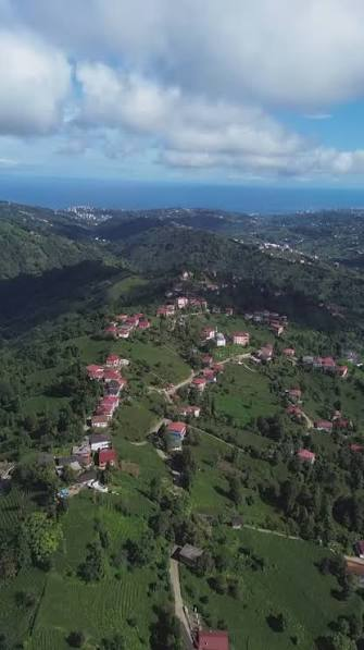
Above: Pazar District
Before tea, Pazar possessed another agricultural curiosity.
Beginning in the 1950s, Cuban cigar tobacco was introduced into 26 villages whose soils proved suitable for its cultivation.
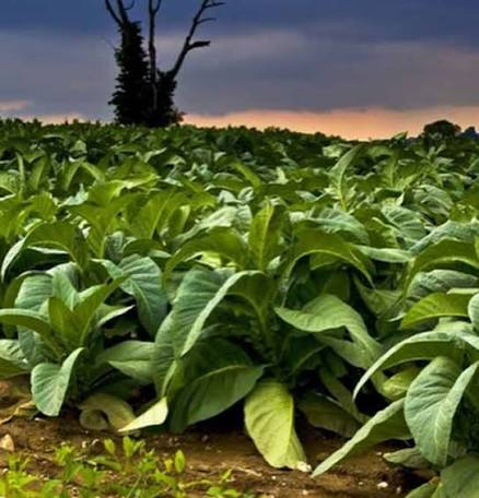
Above: Tobacco field, Pazar District
Its leaves could grow to nearly a metre in length and were used as filler and wrappers for cigars marketed under the name “Pazar“.
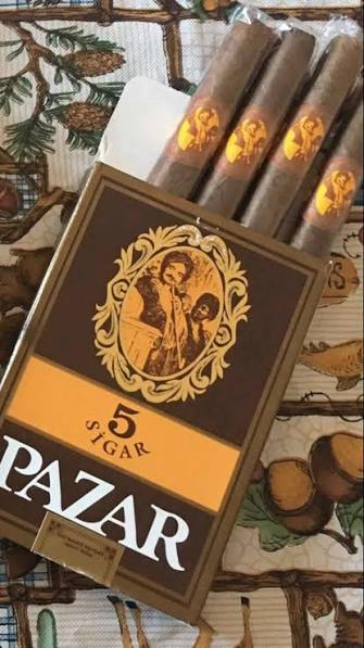
By the early 1990s, almost 140 growers still cultivated the crop.
Within a decade, only three remained.
Tea had won.
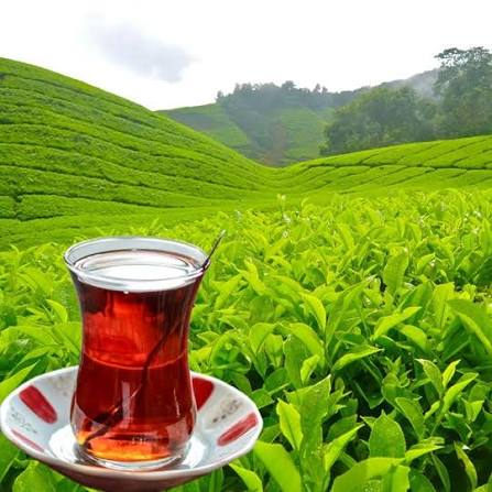
Corn survived as the district’s second crop, while beans, potatoes and vegetables retreated to family gardens, grown largely for the household rather than the marketplace.
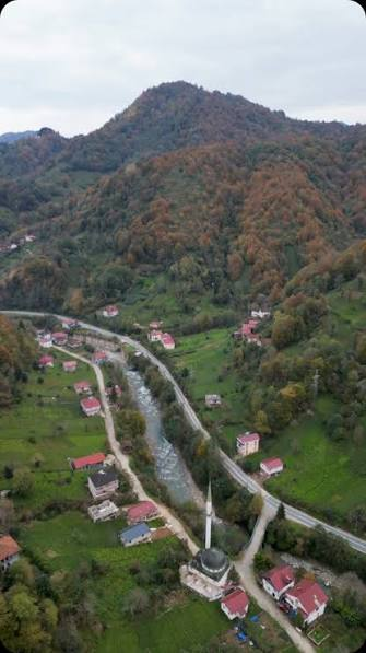
Above: Pazar Distirct, Rize Province, Türkiye
Even livestock must adapt to the terrain.
Along the coast, there is little room for grazing, so cattle are often kept in barns and fed with hay brought from eastern Anatolia.
Sheep and goats are rarely seen among the tea plantations, although small flocks still graze on the high mountain pastures.
Poultry and kitchen gardens supplement family diets rather than provide commercial income.
The forests tell a similar story.
Steep slopes, relentless rain and unstable ground make both logging and reforestation difficult.
Yet these hills remain covered with spruce, fir, beech and alder, while vast stands of rhododendron — known locally as komar — paint the mountainsides each spring.
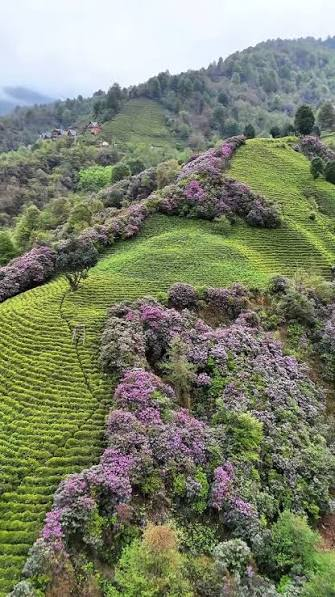
Above: Komar, Pazar District
The District’s name, “Pazar” (market), also comes from its status as a focal point of trade.
All kinds of groceries, textiles, haberdashery, footwear, glassware, and woven goods, as well as fruits, vegetables, and herbs, are brought from outside the district.
Small industrial products such as tea shears, cable cars and churns, which meet the most important needs of the local people, are manufactured and used in the district and also sent to surrounding districts.
Furniture manufacturing is also well-developed.
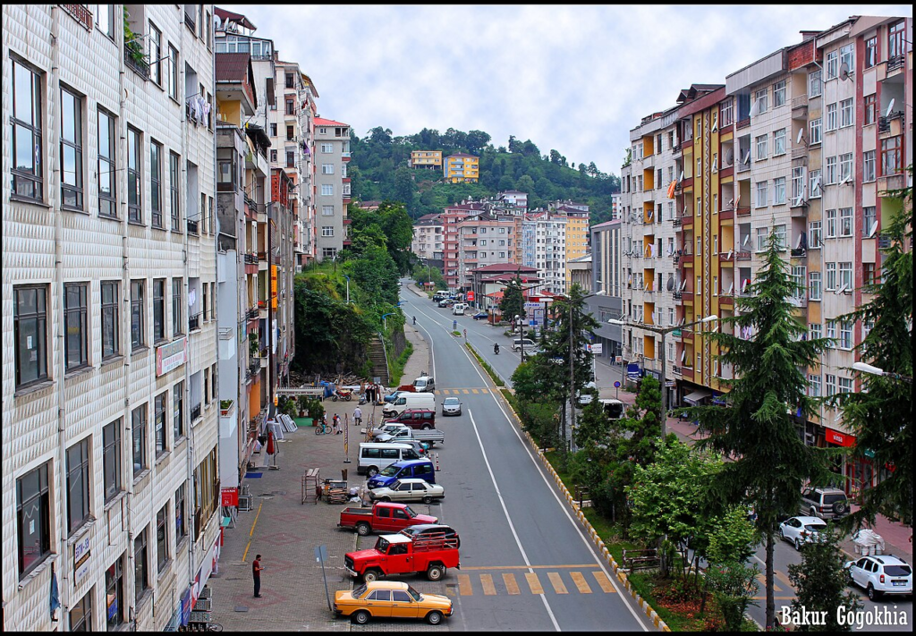
Above: Pazar, Rize Province, Türkiye
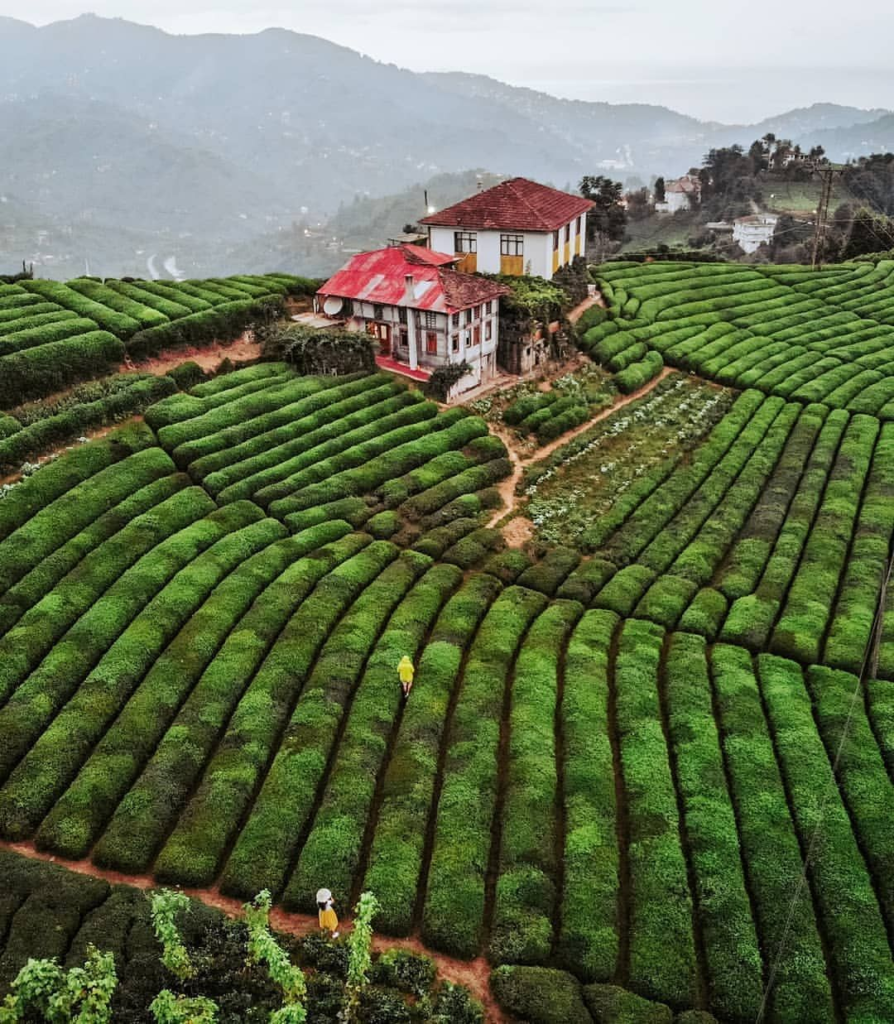
On the road through Pazar, I realized that almost every green hillside I could see was tea.
It was difficult to imagine that only 80 years earlier these slopes had been orchards and tobacco fields.
The mountains had not changed.
The rain had not changed.
Only the plant had.
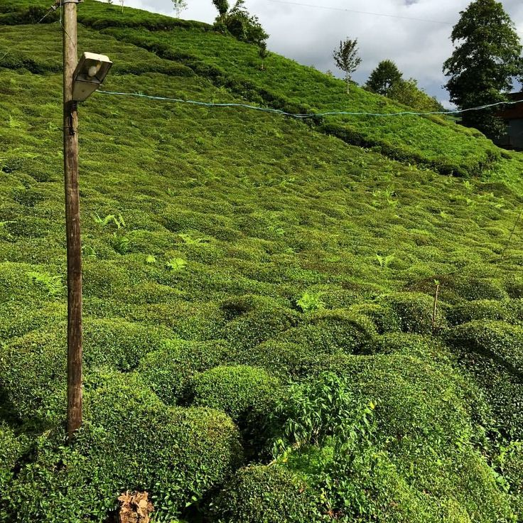
Above: Tea fields, Pazar District
One of Pazar’s defining characteristics has long been its outward-looking nature.
Generations have left in search of work — a tradition known as gurbetçilik — creating enduring ties between this small Black Sea district and the wider world.
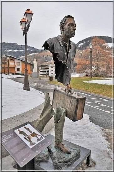
Yet, despite this constant movement, traces of traditional Laz culture remain woven into everyday life.
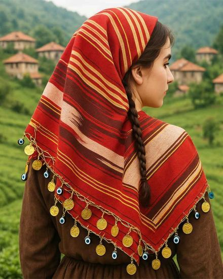
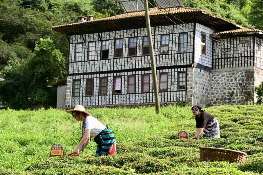
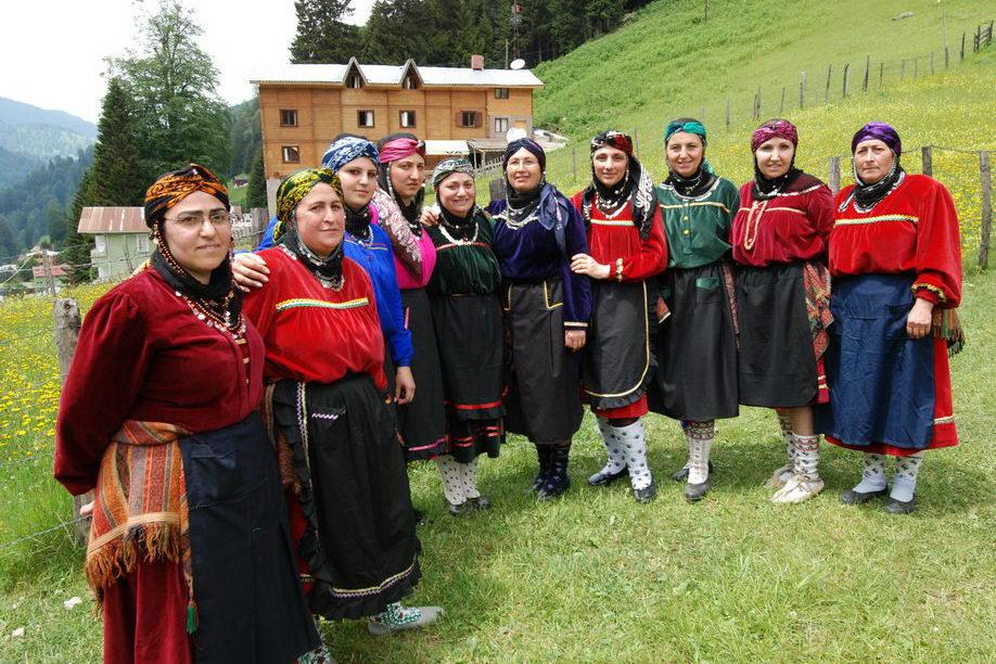
Women’s long, loose-fitting dresses, colourful keşan scarves and striped peştamal wraps reflect a style shaped as much by the region’s wet, windy climate as by custom.
Practical head coverings, once worn with veils and later with scarves, protected women from the ever-present Black Sea weather.
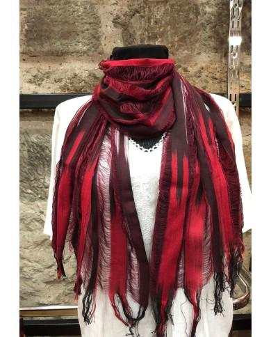
A keşan is a colourful, patterned square scarf traditionally worn by women throughout the eastern Black Sea region, especially around Rize, Pazar and Trabzon.
It is usually made of cotton and features bright geometric or floral motifs in reds, blues, greens, yellows and whites.
It can be tied over the hair, folded into a triangle, or draped around the shoulders.
Today it is both everyday wear for some older women and a symbol of regional identity during festivals and folk dances.
A peştamal is a long rectangular woven cloth with many uses.
Around Pazar and the Laz-speaking districts, women often wrapped it around the waist over a dress or apron while working.
It could also be worn over the shoulders or used as a practical cloth for carrying produce or protecting clothing.
Unlike the Turkish bath towel also called a peştamal, the Black Sea version is an item of traditional dress and workwear.
The women of Pazar brighten the misty hillsides with vividly patterned keşan scarves and striped peştamal waist wraps —garments that are as practical against the damp Black Sea climate as they were expressive of local identity.
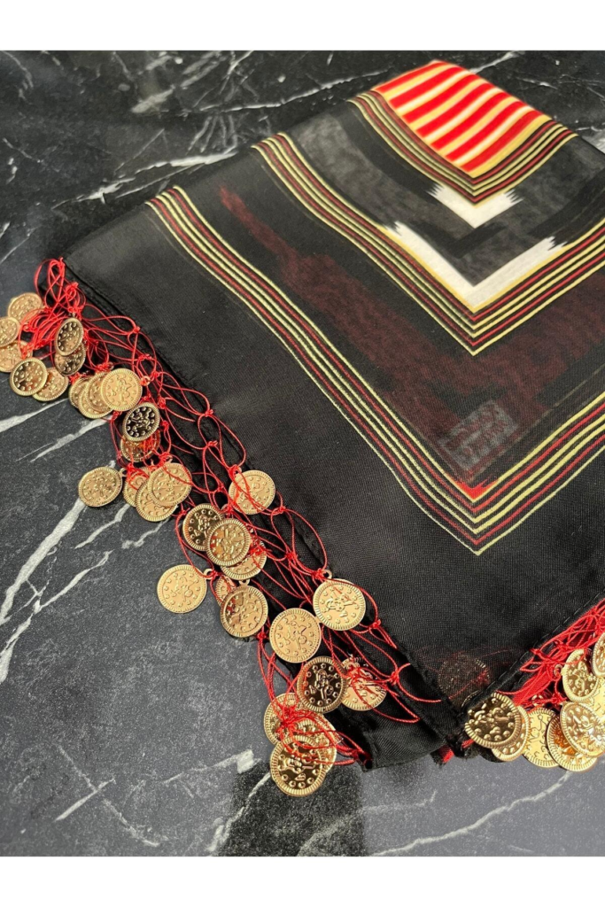
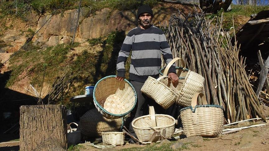
Weaving was once one of Pazar’s most important crafts.
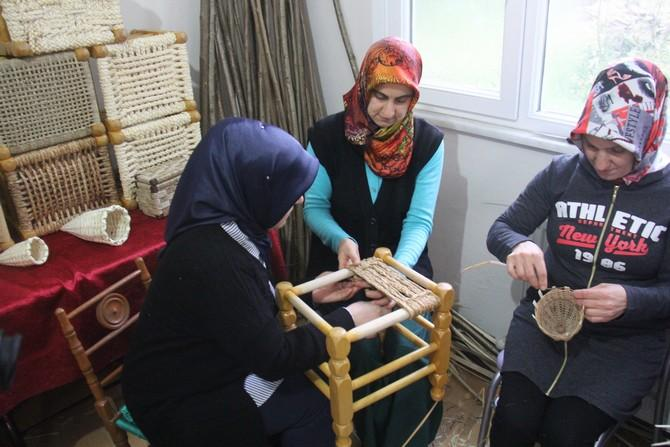
Hemp cloth was produced for clothing, while skilled artisans fashioned baskets, chairs and stools from hazelnut branches, corn husks and ivy.
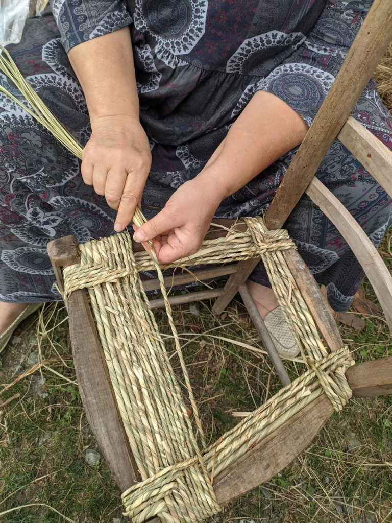
Although textile weaving has largely faded, basketry and chair-making continue in villages such as Yavuz and Tütüncüler, preserving a craft tradition that has outlasted many of the district’s older industries.
So, with opportunities of employment in tea cultivation, livestock, field agriculture, tobacco farming and orchard and garden farming, how does a man come to spend his days collecting coins outside a public lavatory?
I never asked.
Perhaps the tea harvest was too brief.
Perhaps age had stolen the strength his work once demanded.
Perhaps this modest municipal post offered something the hills no longer could:
A steady wage.
One moment changes the texture of the day.
Suddenly all the statistics — hectares, crops, livestock numbers, production figures — collapse into a single weary man sitting beside a foul-smelling public lavatory collecting coins from strangers.
The statistics suddenly dissolved into a single human face.
Whatever path had brought him to that doorway, it reminded me that economies are measured in tonnes and hectares…
But lives are lived one person at a time.
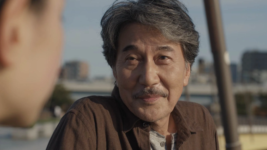
I am reminded of Perfect Days, the 2023 drama film directed by Wim Wenders from a script written by Wenders and Takuma Takasaki.
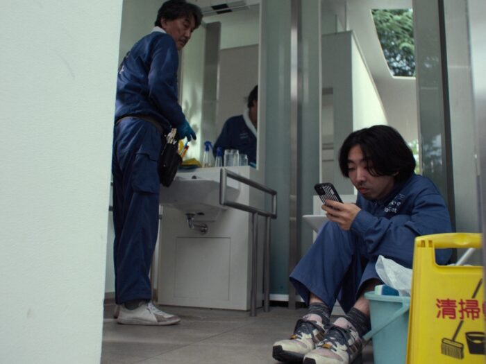
A co-production between Japan and Germany, the film follows the routine life of Hirayama (Kōji Yakusho), a public toilet cleaner in Tokyo.
Hirayama works as a public toilet cleaner for the Tokyo Toilet project in Tokyo’s upscale Shibuya district, across town from his modest home in a middle-class neighbourhood east of the Sumida River.
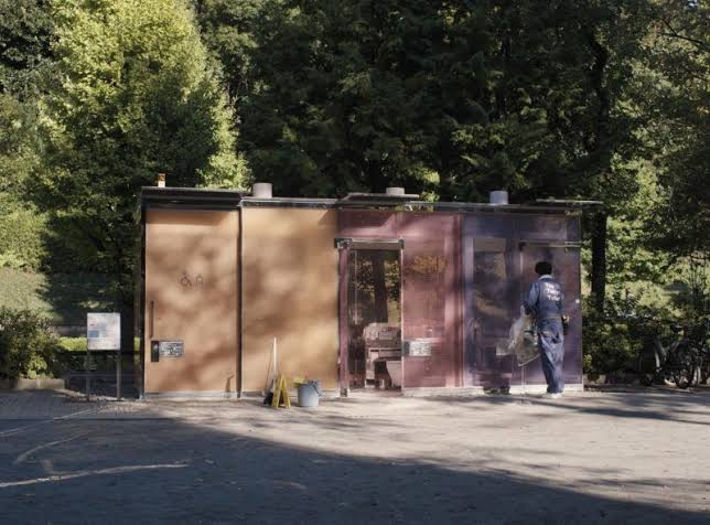
He repeats his structured, repetitive routine each day, starting at dawn.
His pride in his work is apparent by its thoroughness and precision.

He dedicates his free time to his passion for music cassettes, which he listens to in his van to and from work, and to his books (Faulkner, Kōda, Highsmith), which he reads every night before going to sleep.
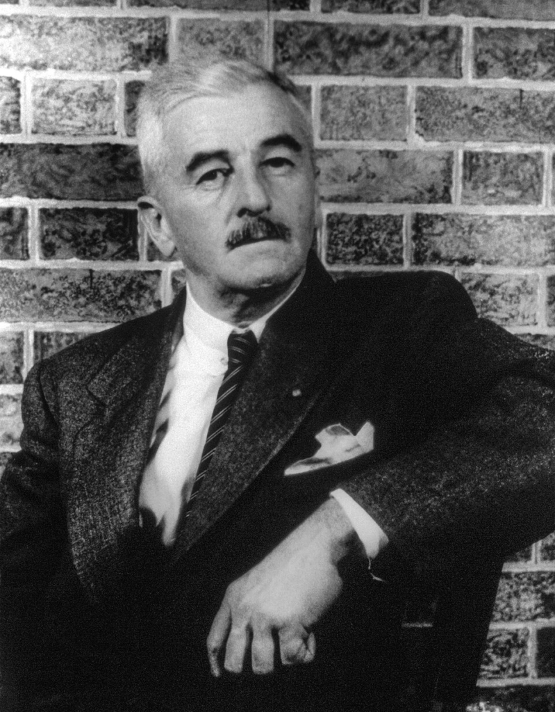
Above: US writer William Faulkner (1897 – 1962)
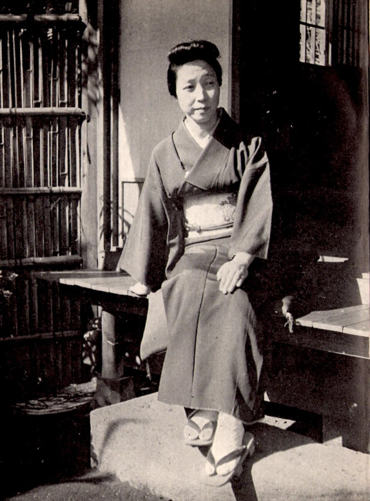
Above: Japanese writer Aya Kōda (Kōda Aya)(1904 – 1990)
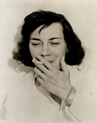
Above: US writer Patricia Highsmith (1921 – 1995)
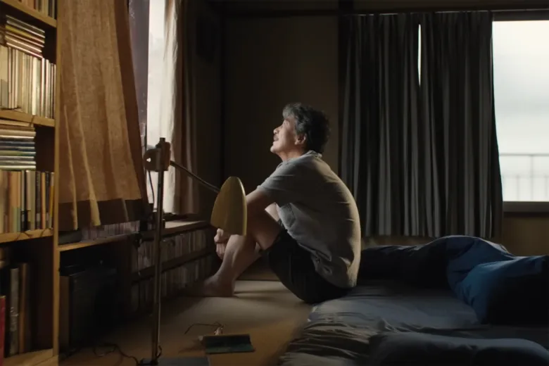
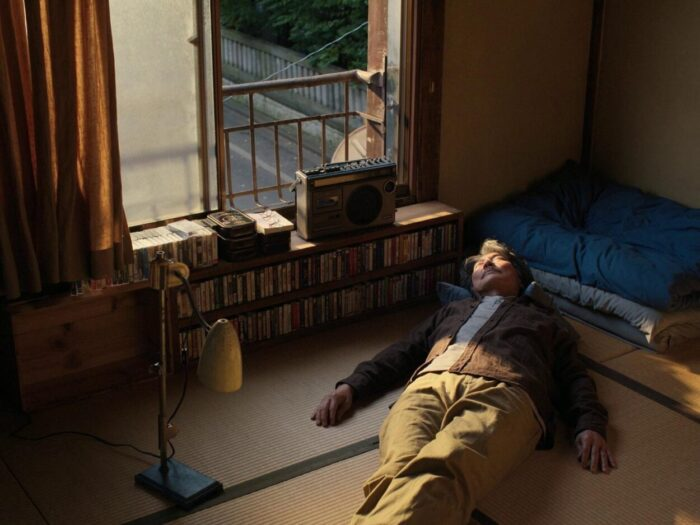
His dreams are shown in flickery impressionistic black-and-white sequences at the end of every day.

Hirayama is also fond of trees and spends time gardening and photographing trees.
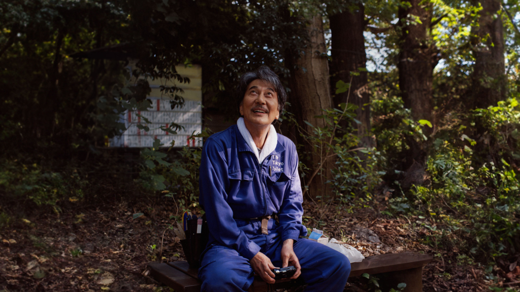
He eats a sandwich every day in the shade under trees in the grounds of a shrine, and takes film photos of their branches and leaves and the ‘Komorebi‘ (木漏れ日) – sunlight filtered by the leaves.

Hirayama’s love of trees is contrasted with the repeated appearance of the Tokyo Skytree during his drives and bike rides through the city.
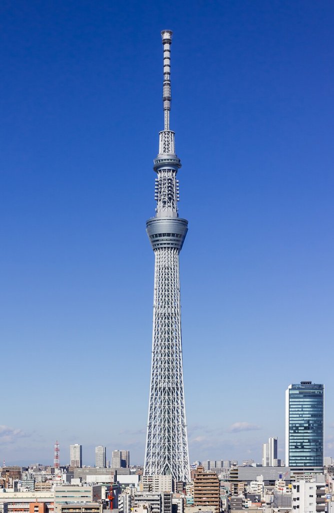
Above: Tokyo Skytree – It has been the tallest tower in Japan since opening in 2012 and reached its full height of 634 metres (2,080 feet) in early 2011, making it the tallest tower in the world, displacing the Canton Tower (Guangzhhou, China) and the third tallest structure in the world behind Merdeka 118 (678.9 metres or 2,227 feet)(Kuala Lumpar, Malaysia) and Burj Khalifa (829.8 m or 2,722 ft).(Dubai, UAE)
Hirayama’s young assistant, Takashi, is often late, loud and not as thorough.
One day, a young woman named Aya calls on Takashi at the toilet he is cleaning, so he hurries to finish.
He tries to leave with Aya, but his motorbike will not start, so he persuades Hirayama to let him use his van.
When Aya says Takashi can stay with her as she works at a girls bar, he complains that he is broke.
Unbeknownst to Hirayama, Takashi slips Hirayama’s Patti Smith tape into Aya’s purse.
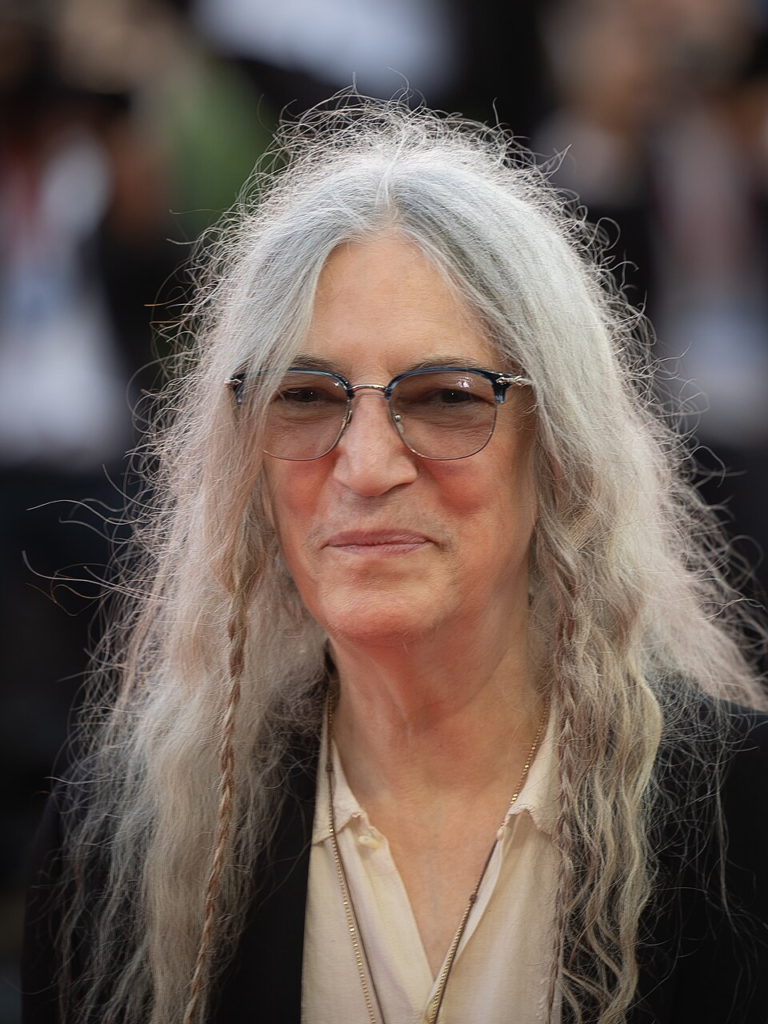
Above: US poet/performer Patti Smith
Takashi talks Hirayama into going into a shop to get some of his cassettes appraised.
When Takashi discovers they are valuable, he urges Hirayama to sell but Hirayama refuses, giving him some cash so he can take Aya out.
When Hirayama runs out of fuel, he is forced to sell a cassette for fuel money.
Hirayama commences a tic-tac-toe game with a stranger after finding a piece of paper left hidden in a stall.
The game continues over the course of the film.

He exchanges furtive glances with a woman eating lunch one bench over.
Aya catches up with Hirayama to return his cassette.
She asks to play it in his van one last time, and then gives him a thank-you kiss on the cheek, leaving him visibly startled.

On his free day, Hirayama does his laundry, takes the film with his tree photos to be developed, cleans his flat, buys a new book, and dines at a restaurant where the proprietor shares gossip with him.
Niko, Hirayama’s niece, shows up unannounced, having run away from his wealthy estranged sister Keiko’s home.
Hirayama lets Niko accompany him to work during the next two days.
They photograph the trees in the park and ride bikes together.
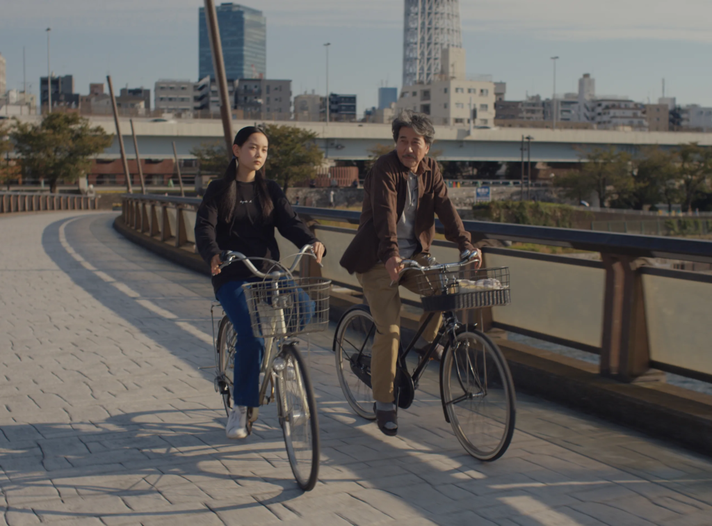
Eventually, Keiko comes to pick up Niko in a chauffeured car.
Keiko tells him that their father’s dementia has worsened and asks whether Hirayama will visit him in the nursing home where he lives.
She says that he does not recognise anything anymore and will not behave the way he did before.
Hirayama sorrowfully refuses but hugs his sister goodbye.
Before she leaves, she asks him whether he really cleans toilets for a living, and he says yes.
As they drive away, Hirayama begins to cry inconsolably.

The next day, Takashi quits without giving notice, leaving Hirayama to cover his shift.
Later, as Hirayama goes to his usual restaurant, he sees the female proprietor embracing a man.
Hirayama hurries off, buying cigarettes and three bottled highballs to consume at a nearby riverbank.
The man Hirayama saw at the restaurant approaches and asks him for a cigarette.
The man tells him the restaurant proprietor is his ex-wife whom he had not seen in seven years, and that she opened her restaurant the year after divorcing him.
He says he visited her to make peace before he dies of cancer, telling Hirayama to look after her.
Hirayama lightens the mood by offering him a drink and inviting him to play shadow tag.
They eventually part ways.

The following morning, Hirayama begins another workweek.
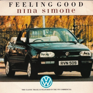
As he drives his van and listens to Nina Simone sing “Feeling Good“, a range of powerful emotions wash over his face.)
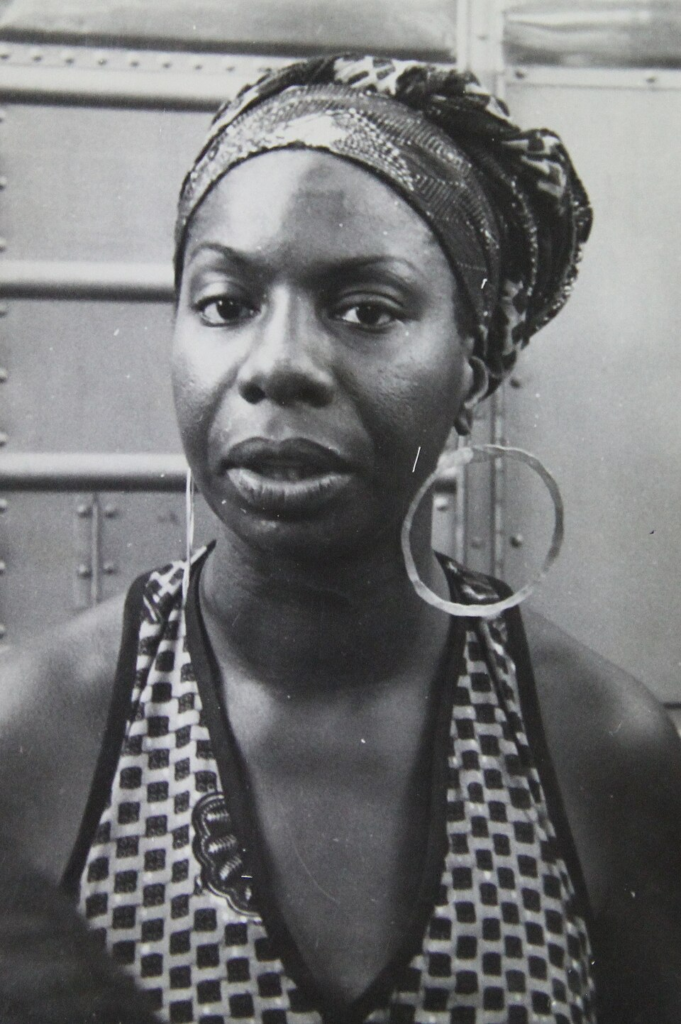
Above: US performer/activist Nina Simone (1933 – 2003)
The Pazar WC man does not seem to be living perfect days.
He sits – staring out at nothing.
He sits – uncaring whether the WC is up to your standards.
Pay the TL 15, do what you must, leave.
This I do.
It is telling that my mind turned immediately to Perfect Days.
Because that film asks precisely the question I am wrestling with:
What constitutes dignity?
Is meaning located in status, wealth, prestige — or in attention, ritual, care, endurance?

Hirayama’s life appears humble, even invisible, yet Wenders frames it with immense tenderness.
The Tokyo toilets become almost sacred through the seriousness with which he cleans them.
His routines create a kind of secular monasticism.
The film refuses to mock him or pity him.
But the Pazar WC attendant does not appear to inhabit that same quiet grace.
At least not outwardly.
His description carries none of Hirayama’s serenity — only exhaustion, smell, noise, resignation.
Perhaps one reason the scene affected me so strongly is because I myself am in a precarious in-between state at the moment.
Crossing borders.
Searching for work.
Carrying uncertainty.
The line between traveller and stranded man can feel alarmingly thin when one is tired enough.
And there is another irony here.
The entire region is full of labour:
- tea labour
- road labour
- migration labour
- forestry labour
- fishing labour
- toilet labour
Human beings maintaining systems so that other human beings may continue moving through the world comfortably.
The WC attendant becomes almost symbolic of invisible labour itself — the person everyone sees yet nobody really looks at.
Wenders’ film asks viewers to truly look at someone society trains itself not to see.
And I do that in Pazar.
Most passengers likely hand over TL 15 without a second thought.
I stop and imagine the man’s life.
There is compassion in that pause.

Meanwhile the bus continues eastward through mist, tea gardens, and old Laz country toward Georgia.
We travel on through Ardeşen.
It is located 45 km from the city center of Rize.
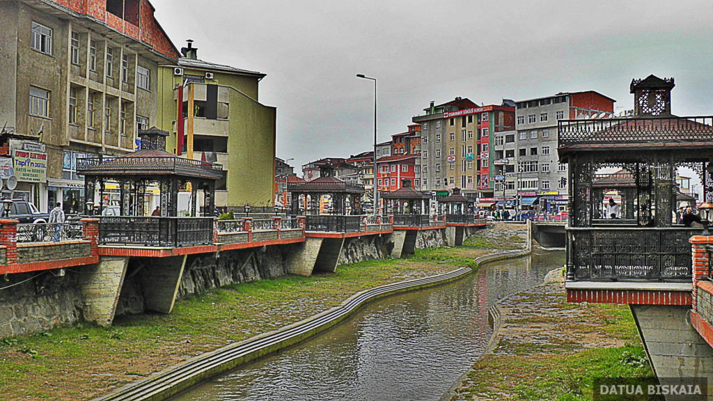
Above: Ardeşen, Rize Province, Türkiye
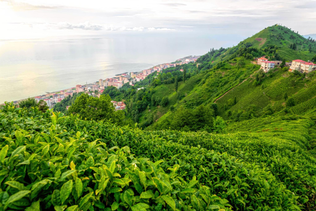
Ardeşen is a district shaped by steep mountains and limited farmland.
Nearly a quarter of its rugged landscape is forest, while only a small portion is suitable for agriculture.
Here, as throughout the eastern Black Sea coast, tea dominates.
Hazelnuts, kiwi, corn and small-scale livestock farming supplement household incomes, but for many families agriculture alone is not enough.
In Ardeşen, agriculture is a negotiation with the mountains.
Tea thrives on slopes where little else can grow, but the same terrain that gives the region its beauty limits the possibilities of those who call it home.
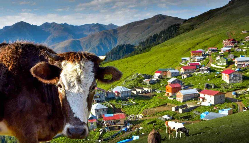
The mountains have also produced unexpected industries.
In 1993, ASİLSAN became Turkey’s first private arms manufacturer, bringing local weapons production into a legal framework.
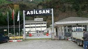
The factory produced the Atmaca and Fırtına pistols until it was destroyed by a landslide in 2010 — a striking reminder that in the Black Sea, nature is always a powerful neighbour.
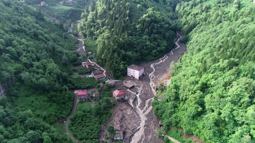
Above: Landslide aftermath
Today, Ardeşen’s future is increasingly tied to its landscape.
The Fırtına River attracts rafting enthusiasts, while the Tunca Valley Nature Park draws hikers to forests, glacial lakes and mountain trails.
The same terrain that limits agriculture has become the district’s greatest attraction.
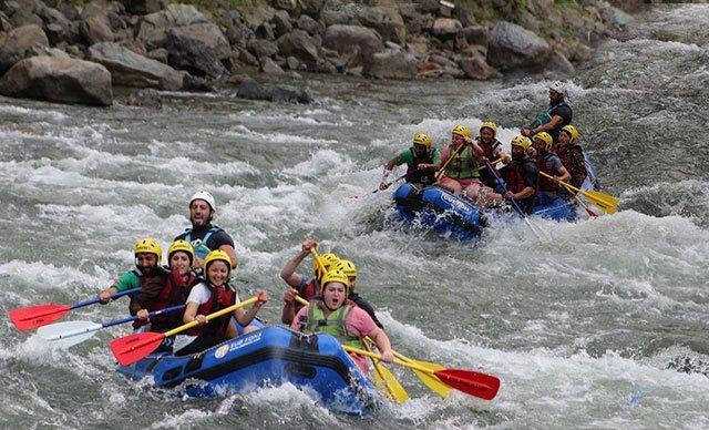
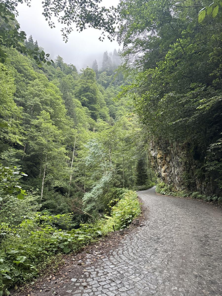
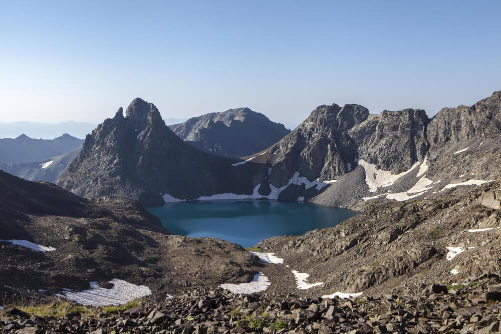
Yet behind the beauty lies an economic challenge.
Many young people leave in search of work, as traditional farming and small crafts no longer provide sufficient livelihoods.
Tea remains the backbone of the local economy, but the hills continue to send their children elsewhere.
For generations, the hills have provided identity and income.
Yet for many young people, the same slopes that shaped their childhood cannot provide the future they seek.
Even the name Ardeşen carries a memory of the forest.
In Laz, it is known as Vitze, meaning a piece of brushwood or a tree branch.
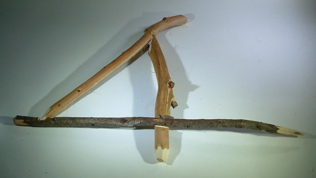
The word recalls an older world when children hunted blackbirds with viça — a simple forked wooden trap made from the branches of the forest itself.
There is a sense that the eastern Black Sea coast exists in a perpetual negotiation with geography itself.
Everywhere the same pattern emerges:
Steep mountains, narrow coastal strips, forests, tea, migration, survival.
Human settlement there feels almost improvised against the overwhelming force of terrain and rain.
What fascinated me most is the strange coexistence of beauty and precarity.
On one side:
— glacial lakes
— rafting rivers
— alpine plateaus
— dense forests
— beekeeping
— kiwi orchards
— misty valleys
And on the other:
— landslides swallowing factories
— youth unemployment
— out-migration
— subsistence agriculture
— dwindling traditional crafts
— labour replacing rootedness
The buried ASİLSAN factory is especially striking.
A firearms factory — embodiment of industrial modernity, precision engineering, machinery — destroyed not by economics or war but by the mountain itself collapsing.
The landscape reminds us who truly governs that coast.
And then the Laz linguistic traces again — Vitze, viça, forked bird-catching sticks fashioned from branches and cow-tail hair.
Details give the region texture that raw economic statistics never could.
One suddenly sees winter fields, boys hunting blackbirds, old techniques transmitted orally across generations.
Language preserves worlds long after material culture fades.
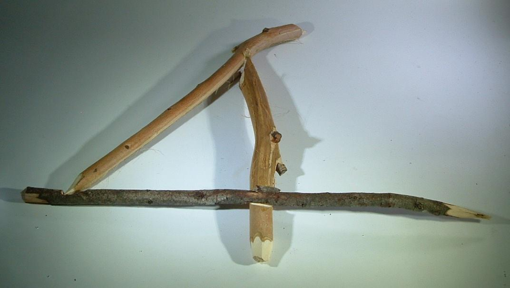
Above: A viça
There is also something poignant in how frequently we return to disappearing livelihoods:
- linen weaving
- cigar tobacco
- horse breeding
- basketry
- small-scale crafts
All are being replaced gradually by tea monoculture, wage labour, migration, bureaucracy, or simply decline.
The Black Sea coast feels simultaneously ancient and unsettled — a place where old identities endure linguistically and culturally even while economic reality relentlessly pushes people outward.
Through all this, I keep moving eastward half-awake on a bus, carrying uncertainty into another country.
I hope these observations resonate strongly.
I am not describing the region as a detached tourist.
I am reading it almost diagnostically, searching for clues about how people endure unstable lives in difficult terrain.
Every abandoned craft, every migrant worker, every modest livelihood – may they become personally legible at this moment in the journey.
The rhythm is wonderfully cinematic.
Each town emerges briefly through the bus window with its own micro-history and emotional atmosphere before receding behind into rain and tea gardens.
- Ardeşen: weapons factory buried by a landslide.
- Fındıklı: migration and hazelnuts.
- Pazar: the lonely WC attendant.
- Rize: tea and dawn departures.
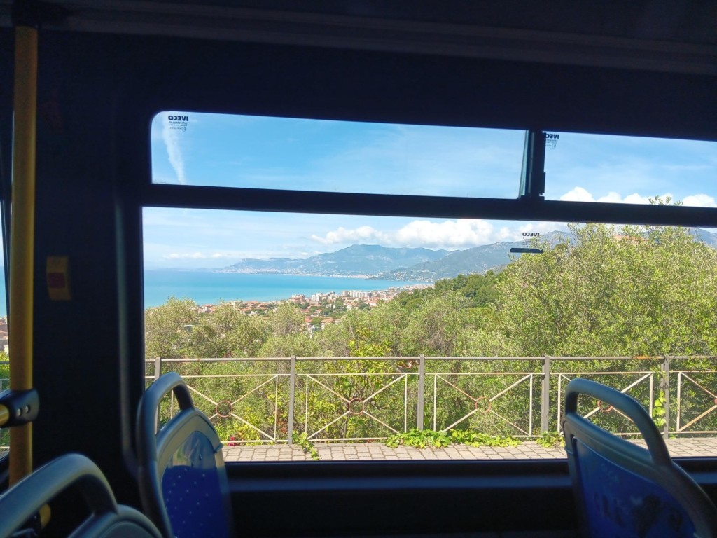
And always the Black Sea beside the bus.
The bus crosses from Rize Province into Artvin Province.
Our first stop is Güngören, a small coastal village in the Arhavi district.
Today, it appears as another quiet Black Sea settlement, but beneath its modern Turkish name lies an older identity.
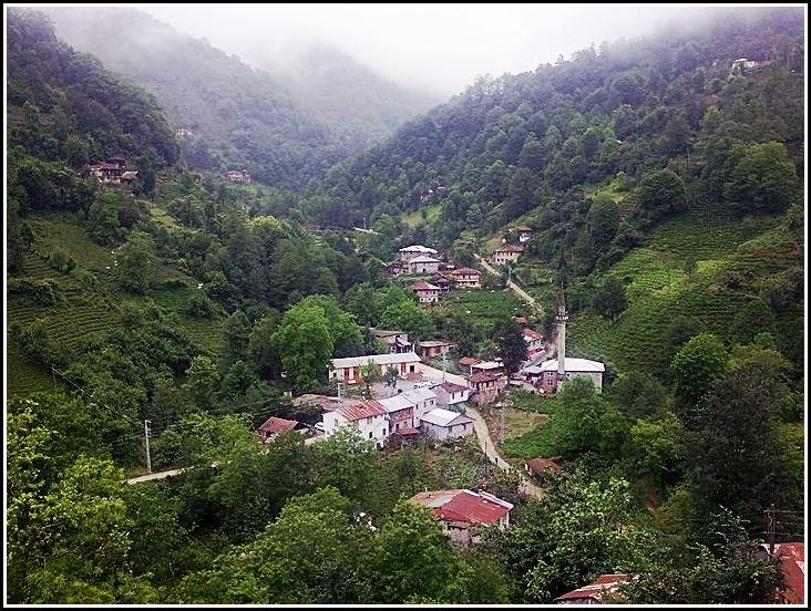
Above: Güngören, Atvin Province, Türkiye
In Turkish records, the area was historically known as Kapisre.
In Laz, the name survives as Kapistona (კაპისთონა).
Each year, Kapistona briefly returns — not as an administrative name on a map, but as a living memory.
Through Laz songs, traditional foods, language and stories, the village reconnects with the identity carried by its older name.
In 1965, Güngören had a population of 404, of whom only 199 were literate — a reminder of how dramatically life along the Black Sea has changed within a single generation.
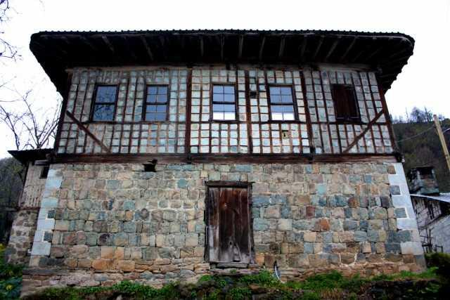
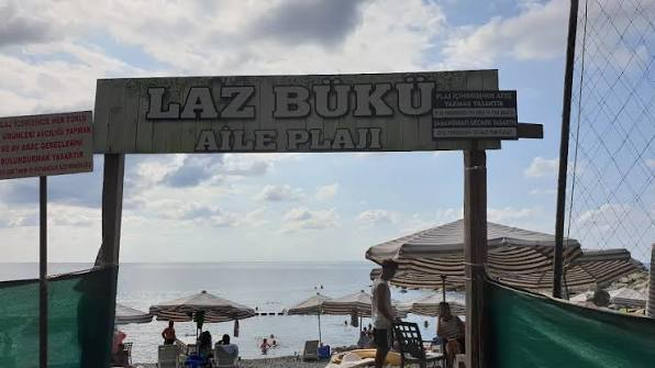
Today, the village looks toward the sea.
Its small public beach, known locally as Lazbükü, offers a quiet meeting place between mountains, language and memory.
The bus enters Arhavi (Laz: Arǩabi / არქაბი), a coastal district of Artvin Province where the mountains seem to descend directly into the Black Sea.
With only a narrow coastal strip and steep valleys rising behind it, Arhavi has always been a place shaped by geography.
The district covers about 407 square kilometres, but much of that area is rugged mountain terrain.
The town itself sits almost at sea level, beside the Kapisre Stream, the largest waterway in the district.
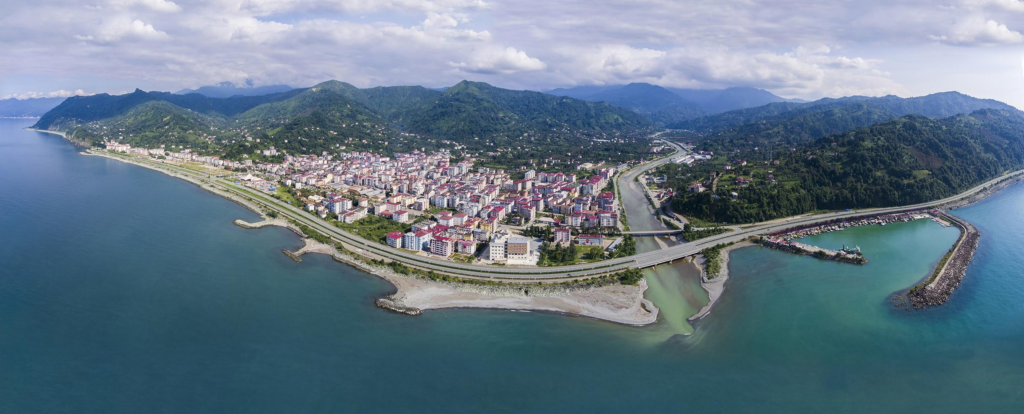
Above: Arhavi
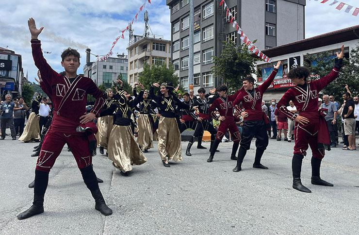
Today, Arhavi is perhaps best known for its annual Culture and Arts Festival, first held in 1973.
The Festival celebrates the region’s distinctive identity through music, sport, traditional competitions and local foods — from anchovy bread and Laz böreği to tea-picking and wood-cutting contests.
For several days each year, Arhavi becomes a stage where local traditions meet the wider world.
Yet the history beneath this modern celebration is far older.
The origin of the name Arhavi remains uncertain.
Some historians connect it with Arxavís, a river mentioned by the Roman writer Arrian in his Periplus Ponti Euxini (“Voyage Around the Black Sea“).
Over centuries, the name evolved through forms such as Arxave and Arhave before becoming Arhavi.
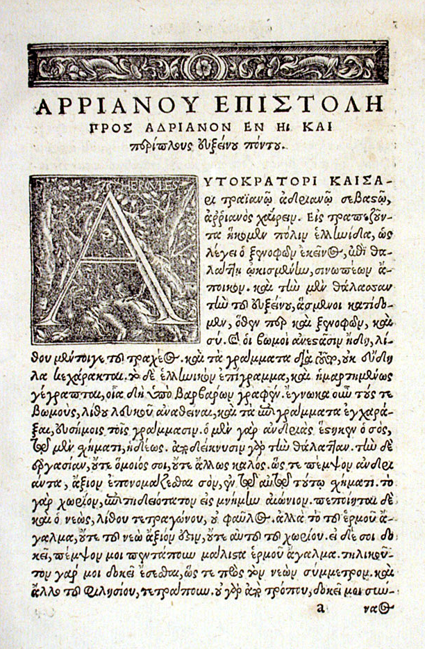
Above: The Periplus of the Euxine Sea (Koine Greek: Περίπλους τοῦ Εὐξείνου Πόντου, Períplous toû Euxeínou Póntou, Latin: Periplus Ponti Euxini) is a periplus or guidebook detailing the destinations visitors would encounter when traveling about the shore of the Black Sea (known to the Greeks as the Euxine, or Hospitable, Sea). It was written by Arrian of Nicomedia in 131.
Human settlement here reaches back thousands of years.
The area was part of the ancient Colchian world and later became part of the Kingdom of Lazica.
In the 6th century, it stood on the frontier of the Roman-Persian conflicts.
After Lazica’s decline, the region passed through Byzantine and Trebizond rule before being incorporated into the Ottoman Empire in 1486.
Arhavi’s early Ottoman records reveal a society in transition.
In 1486, the village that served as the centre of Lazistan was entirely Christian, with a population of around 181 people.
By the early 16th century, Muslims had become part of the community, although Christians remained the majority.
By 1704, Ottoman records referred to the settlement as Arhave, the centre of a district containing 81 villages.
The people cultivated millet, corn, hemp and grapes, grew fruits and vegetables, and produced wine.
The landscape provided, but never generously.
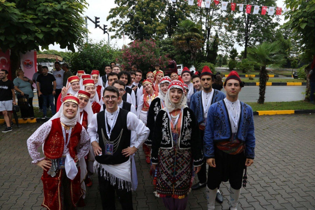
As the 19th century traveller Şakir Şevket (1847 – 1878) observed, agriculture produced modest yields, yet the people were skilled enough to bring valuable goods to market.
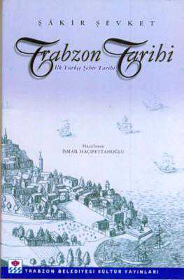
He also recorded another local reputation:
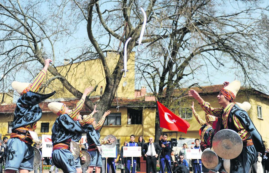
The people of Arhavi and Hopa were famous for their skill with swords — a reminder of a region where mountain communities often developed strong traditions of self-reliance and defence.
On 23 February 1915, Russian forces occupied Hopa, traversing the distance between Hopa and Arhavi in 20 days, and captured the eastern part of Arhavi on 15 March 1915.
On 5 February 1916, the Kapisre Stream was crossed by Russian troops, and Arhavi was completely occupied.
The collapse of Tsarist Russia and the ensuing internal turmoil forced the Russians to withdraw.
Thus, after a two-year occupation, Arhavi was liberated from enemy occupation on 12 March 1918.
This date is celebrated as Liberation Day in Arhavi.
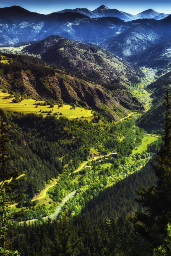
Before the Kapisre Stream was redirected and rehabilitated, it divided Arhavi into two distinct centres of life.
One grew around Kale Mahallesi, the other around Musazade Mahallesi.
Locals even had separate names for these areas:
Melen Noğa and Molen Noğa.
For residents of Musazade, the opposite bank was known as Lağata— a lively area associated especially with sailors’ coffee houses and the movement of people connected to the sea.
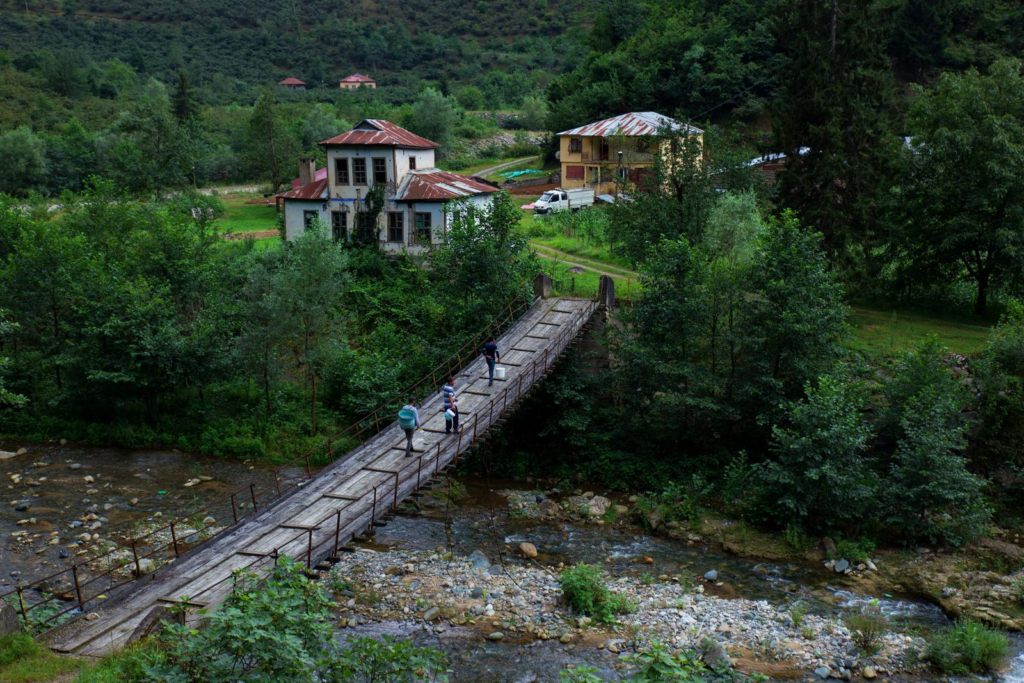
For generations, the stream was crossed not by roads but by wooden bridges and boats.
Only after the construction of a suspension bridge in 1950 did the two sides become more permanently connected.
The landscape has changed since then.
The old military barracks from the Ottoman period, later used as a primary school, has disappeared into the modern townscape, now replaced by the municipal wedding hall.
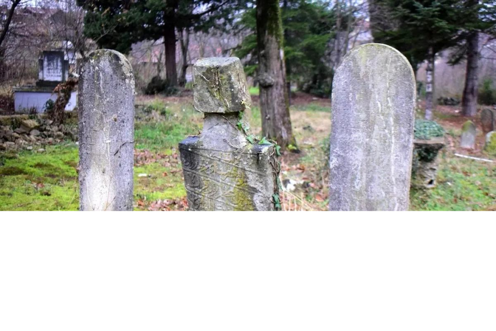
Behind the present-day Ertuğrul Kurdoğlu Primary School lies the old cemetery of Kale neighbourhood, where gravestones dating back two or three centuries still preserve the memory of earlier generations.
Before roads connected the villages to the town centre, the Black Sea itself was one of Arhavi’s main highways.
Boats carried goods along the coast, especially toward Trabzon, while others travelled farther west to Giresun and Samsun for trade.
Today, Arhavi’s identity remains inseparable from its geography.
The district lies between the Eastern Black Sea Mountains and valleys carved deeply by the Kapisre Stream and its tributaries.
The town centre occupies the district’s only significant plain.
Beyond it, the land rises rapidly into steep forested slopes and mountain valleys.
The rivers that cut through these mountains have always shaped human movement.
Their valleys became natural corridors connecting villages with the coast.
South of Arhavi, the mountains rise dramatically toward elevations approaching 3,000 metres.
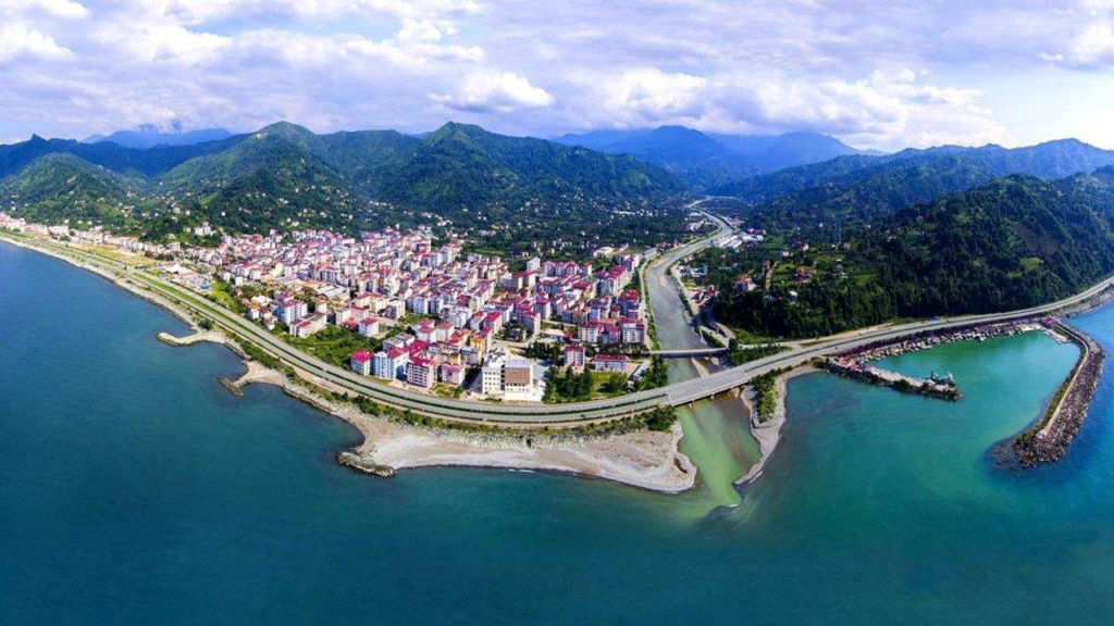
Above: Arhavi
Between the coast and the high plateaus lies one of the region’s richest ecological zones:
The Colchic forest — a dense green world of broadleaf trees, vines and undergrowth created by the Black Sea’s heavy rainfall.
Here grow alder, beech, chestnut, hornbeam, elm, plane and linden trees.
Lower slopes are rich with chestnut, laurel and boxwood, while higher elevations are dominated by beech forests and mountain vegetation.
These forests are not simply scenery.
They are part of the region’s history, economy and identity.
The same relationship with geography appears in Arhavi’s traditional houses.
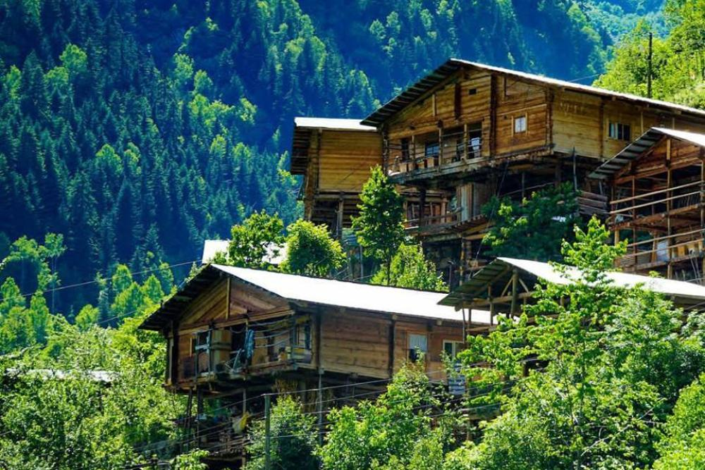
Built for a world of steep slopes and constant humidity, they are usually two or three storeys high, with stone-filled wooden walls designed for the wet Black Sea climate.
Their greatest achievement is not decoration but adaptation.
Traditional Arhavi houses breathe with their environment, allowing them to endure the region’s extraordinary humidity without developing the damp interiors one might expect.
In Arhavi, architecture, agriculture and transportation all tell the same story:
People have never conquered this landscape.
They have learned how to live with it.
Like the landscape itself, Laz cuisine reflects adaptation.
Its foundations are simple:
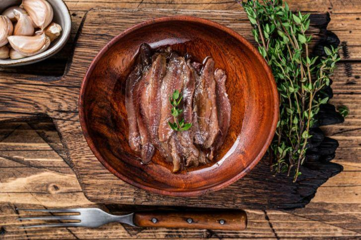
Kale, anchovies and dairy products.
From a limited range of ingredients, generations of Laz cooks created a surprising variety of flavours.
The food of the region developed around what the mountains and the Black Sea provided — vegetables from the gardens, fish from the coast and dairy products from local livestock.
Wherever Laz communities have travelled, two ingredients have travelled with them:
Kale and anchovies.

Kale appears throughout the year in many forms and remains a constant presence on the table.
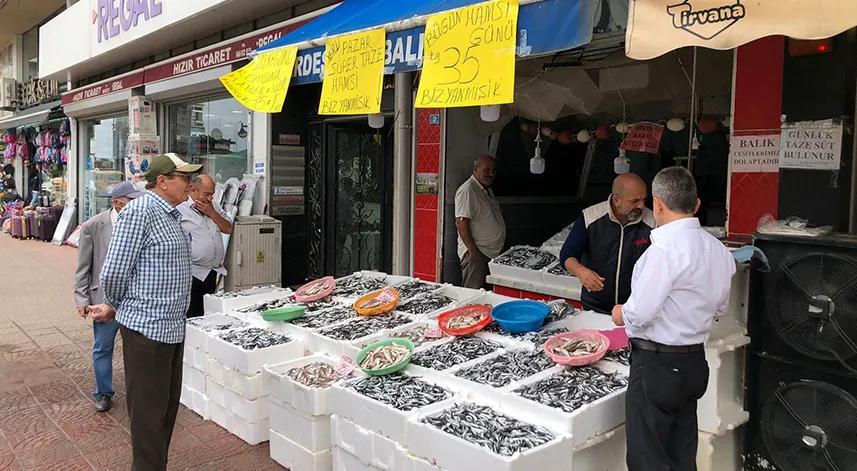
Anchovies belong especially to winter, when the fish are considered at their best.
Local tradition holds that anchovies only reach their full flavour after being touched by the cold waters of melting mountain snow.
In earlier generations, families preserved anchovies for the months ahead.
When the fish were plentiful and inexpensive, large quantities were cleaned, salted and stored in earthenware jars.
Fresh anchovies remain the most famous fish of the region, although trout from the mountain streams also has an important place.
In summer, villagers traditionally caught trout with rods and nets, sometimes even diverting streams to reach them.
Food, like farming, follows the geography of Arhavi.
Tea, hazelnuts and kiwi now dominate agricultural production, but the older relationship between mountain, forest and sea remains visible in the local cuisine.
Arhavi is not a district of grand monuments.
Its attractions are woven into the landscape itself.
Above the coast stands Ciha Castle, a reminder of the centuries when this narrow Black Sea corridor was watched and defended. Its position reflects the strategic importance of a coastline where mountains, sea routes and empires have always met.
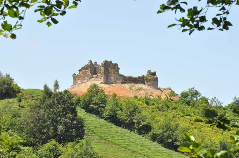
Above: Chia Castle, Artvin Province, Türkiye
The district’s bridges tell another story.
The Double Arch Bridge, the Kavak Bridge and the Derecik Bridge are more than crossings over streams.
They are traces of how communities once moved through a landscape shaped by rivers and steep valleys.
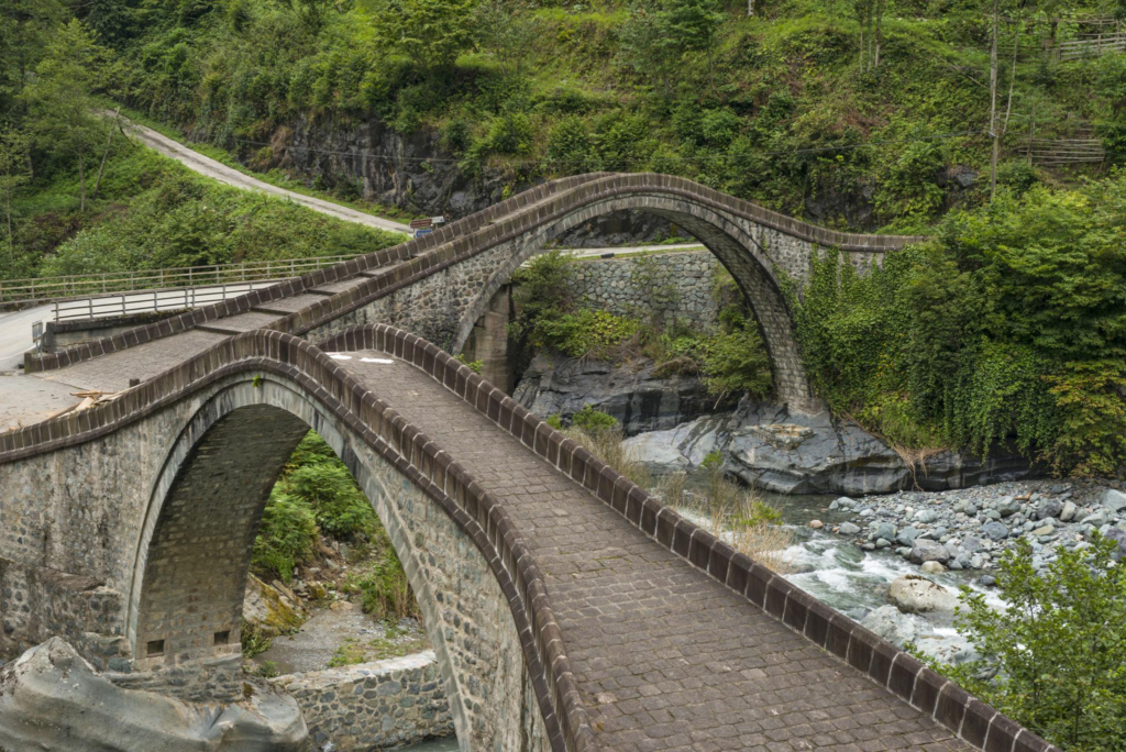
Above: Double Arch Bridge
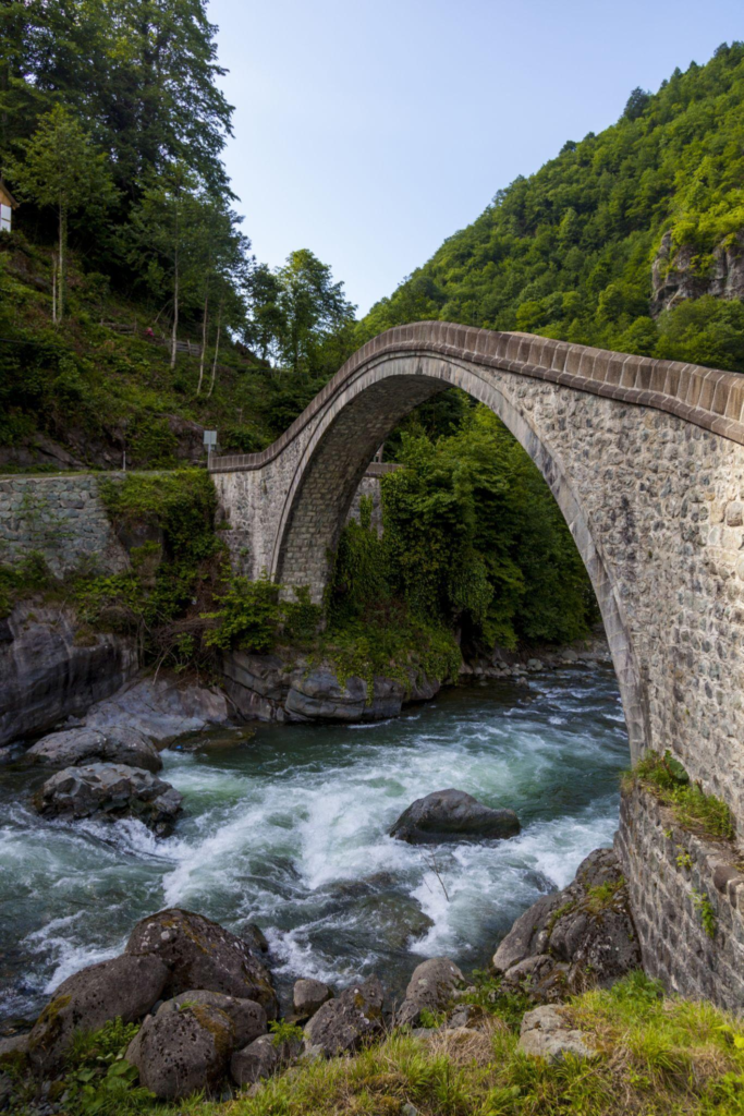
Above: Kavak Bridge
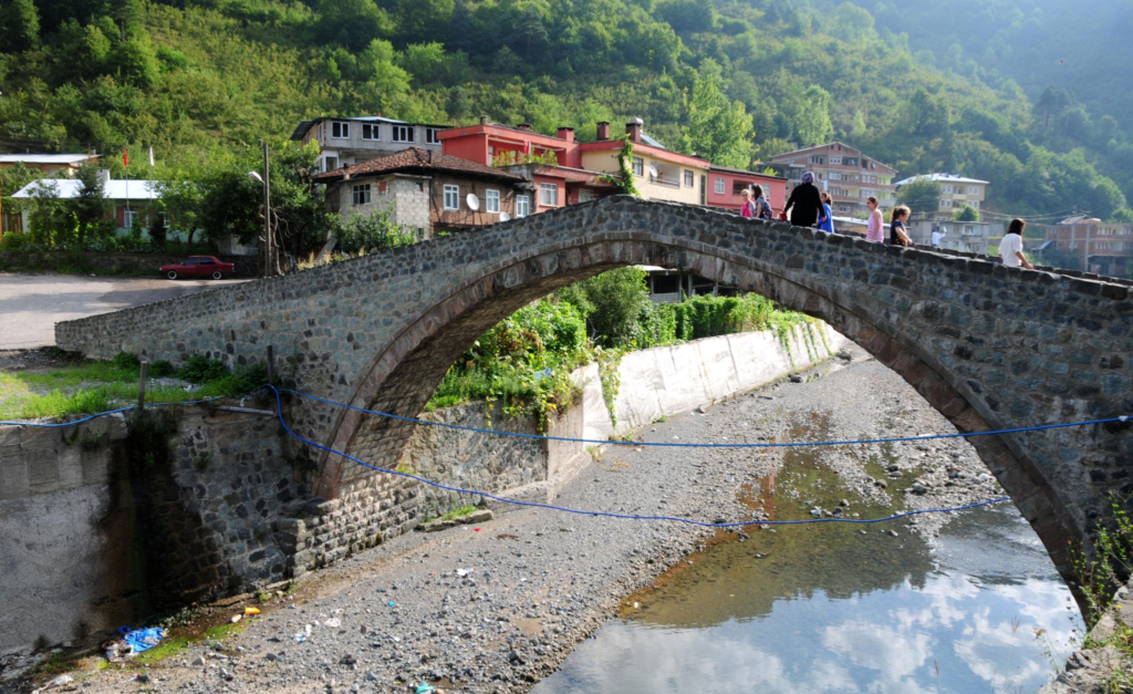
Above: Derecik Bridge
Among the natural landmarks, Mençuna Waterfall is perhaps the most dramatic.
Hidden within the forested mountains, it represents the same wild landscape that has shaped Arhavi’s agriculture, architecture and way of life.
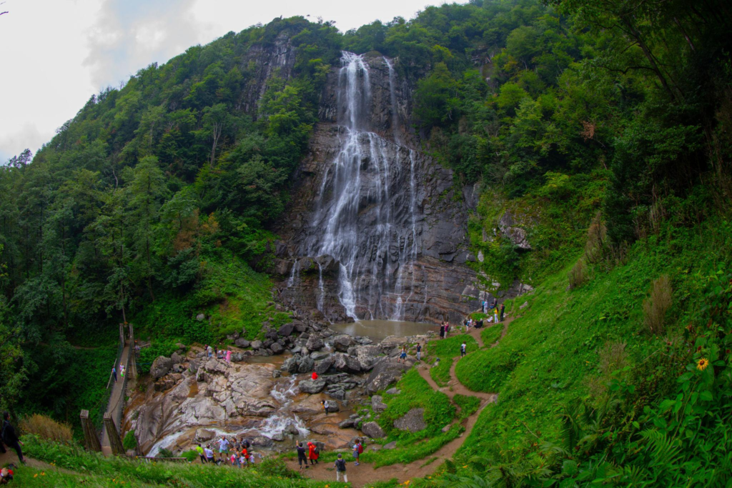
Above: Mençhuna Waterfall
Other places reveal the district’s cultural memory:
Stone Ship Rock, the Arhavi Central Mosque, Ulukent Mosque and Dikyamaç Mosque –
Each offers glimpses into the stories, beliefs and traditions that have accumulated in this corner of the Black Sea.
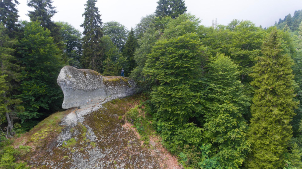
Above: Stone Ship Rock
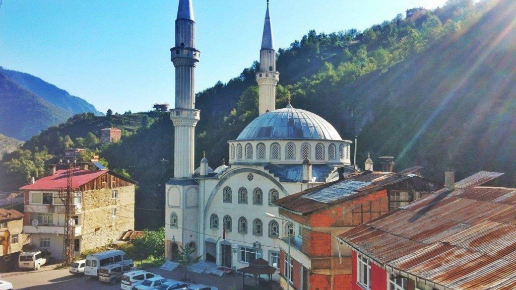
Above: Arhavi Central Mosque
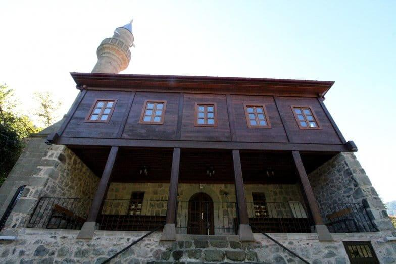
Above: Ulukent Mosque
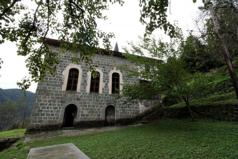
Above: Dikyamaç Mosque
In Arhavi, the visitor does not simply move from one attraction to another.
The landscape itself is the attraction.
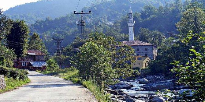
The bus briefly stops here.
Arhavi feels greener and more mountainous than Pazar.
The valleys appear deeper, the forests thicker, and mountain rivers rush down toward the Black Sea, creating ideal conditions for rafting and hiking.
Many visitors consider Arhavi one of the most beautiful districts on Türkiye’s eastern Black Sea coast.
Yet its appeal lies not only in scenery, but in the way the town seems to exist in conversation with its landscape.
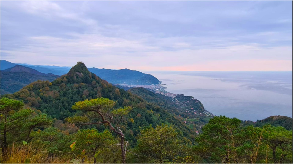
Above: Arhavi, Artvin Province, Türkiye
Towards Hopa, the character of the coast changes.
The traveller begins to see convoys of parked trucks lining both sides of the highway.
Many appear to be waiting — although for what, it is difficult to know.
Some vehicles sit empty, their drivers nowhere in sight.
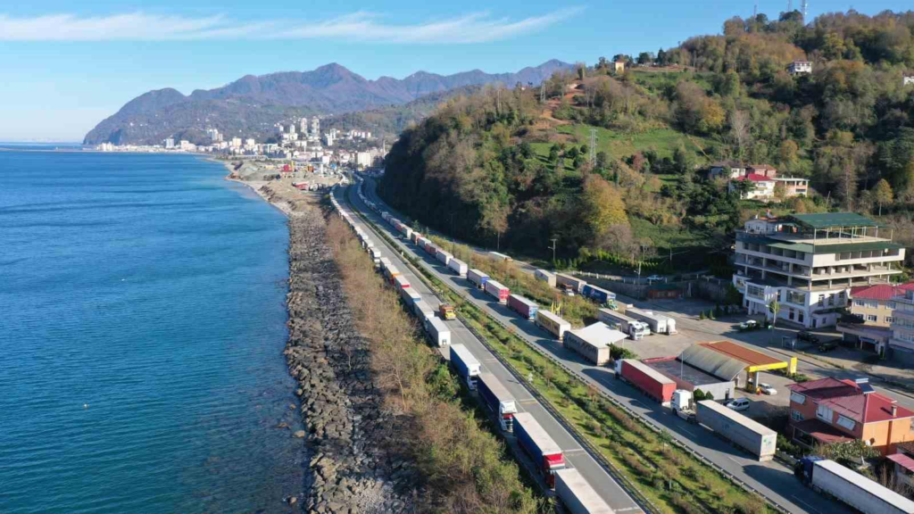
Above: The road to Hopa
Compared with the quieter settlements to the west, Hopa feels restless and industrial.
This is not surprising.
Located only 20 kilometres from the Sarp Border Crossing into Georgia, Hopa has long been a place of movement.
Today it functions simultaneously as a fishing port, a cargo harbour, a transport hub and a commercial centre for the surrounding tea-growing region.
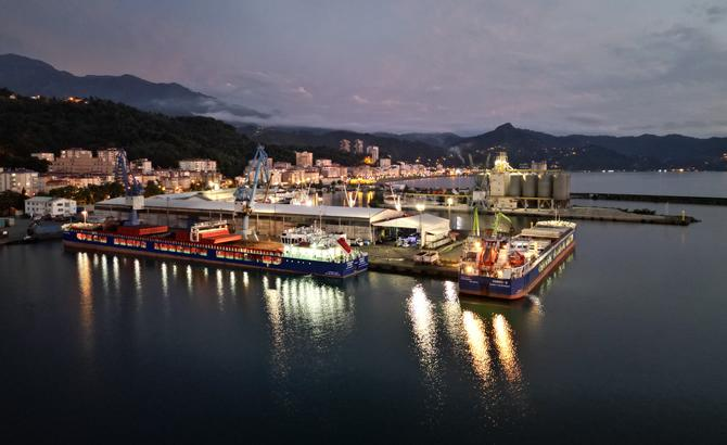
Above: Hopa Harbour
But Hopa’s history of borders goes back much further.
In antiquity, the area belonged to the world of Colchis and later became part of the shifting frontier between Byzantium, Lazica, Georgia, the Seljuk Turks and the Ottoman Empire.
The Ottomans incorporated Hopa into the Lazistan Sanjak in the 16th century, and for centuries the town existed within a region where languages, cultures and political powers overlapped.
The 19th and 20th centuries brought further upheaval.
Following the Ottoman-Russian War of 1877–1878, borders moved through this region, dividing communities and leaving some families with land and livestock on the other side of the frontier.
During the First World War, Hopa again became a battlefield between Ottoman and Russian forces.
After a brief period within independent Georgia, it became part of Turkey in 1921.
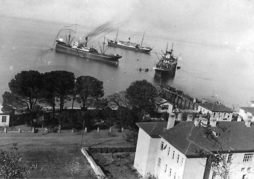
Above: Hopa
Even its older religious landscape reflects this layered past.
Historical sources and local memories record churches once standing in the area, although many traces have now disappeared.
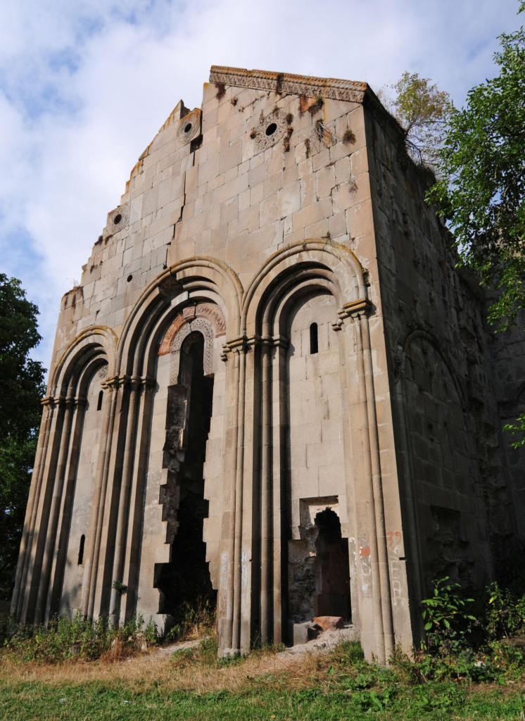
Today, Hopa’s economy rests on tea, agriculture, fishing and trade.
Yet like many Black Sea districts, it has also experienced outward migration.
Standing beside the highway, watching trucks wait for a border that is only 20 kilometres away, one senses the contradiction of Hopa:
It is a town built around movement, yet many of its people have left.
It is a gateway to another country, yet also a place searching for its own future.
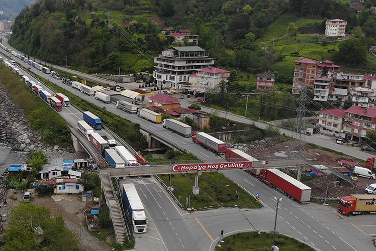
A few kilometres before the Georgian border, the bus enters Kemalpaşa —
A settlement where geography and history seem impossible to separate.
Until recently a village, Kemalpaşa has carried several names.
Its oldest known name was Makriali, written in Georgian as მაკრიალი.
The name is often linked to the Greek Makrigialos, meaning “long shore“, although some scholars suggest the direction of influence may have been reversed, with the Greek form developing from an older Georgian or Megrelian name.
The Laz name, Noğedi (ნოღედი), means “market” —
Perhaps reflecting its role as a gathering place in a region where settlements were traditionally scattered along the coast and mountains.
These names tell a familiar Black Sea story:
Languages overlap, borders change, but places remain.
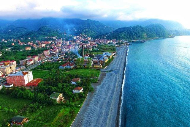
Above: Kemelpaşa, Artvin Province, Türkiye
In the late 19th century, when the Russian Empire controlled the region after the Ottoman-Russian War of 1877–1878, Makriali was recorded as a settlement of Laz and Armenian inhabitants.
After the First World War, the area briefly became part of independent Georgia before being incorporated into Turkey in 1921.
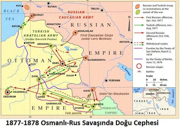
Above: Historical map of the Ottoman–Russian borderlands
The most important historical monument of Kemalpaşa is Makriyali Church, a single-nave stone church once decorated with frescoes.
Although only traces remain today, the building preserves the memory of a much older cultural landscape.
A tall structure beside the church, standing close to the shore, is believed to have served as a lighthouse.
The church carries an extraordinary historical connection:
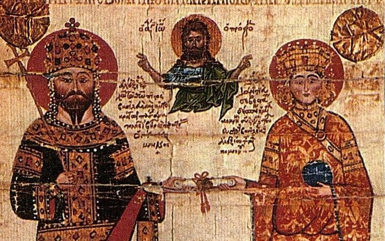
In June 1367, Georgian King Bagrat V and Princess Anna of the Empire of Trebizond were married there.
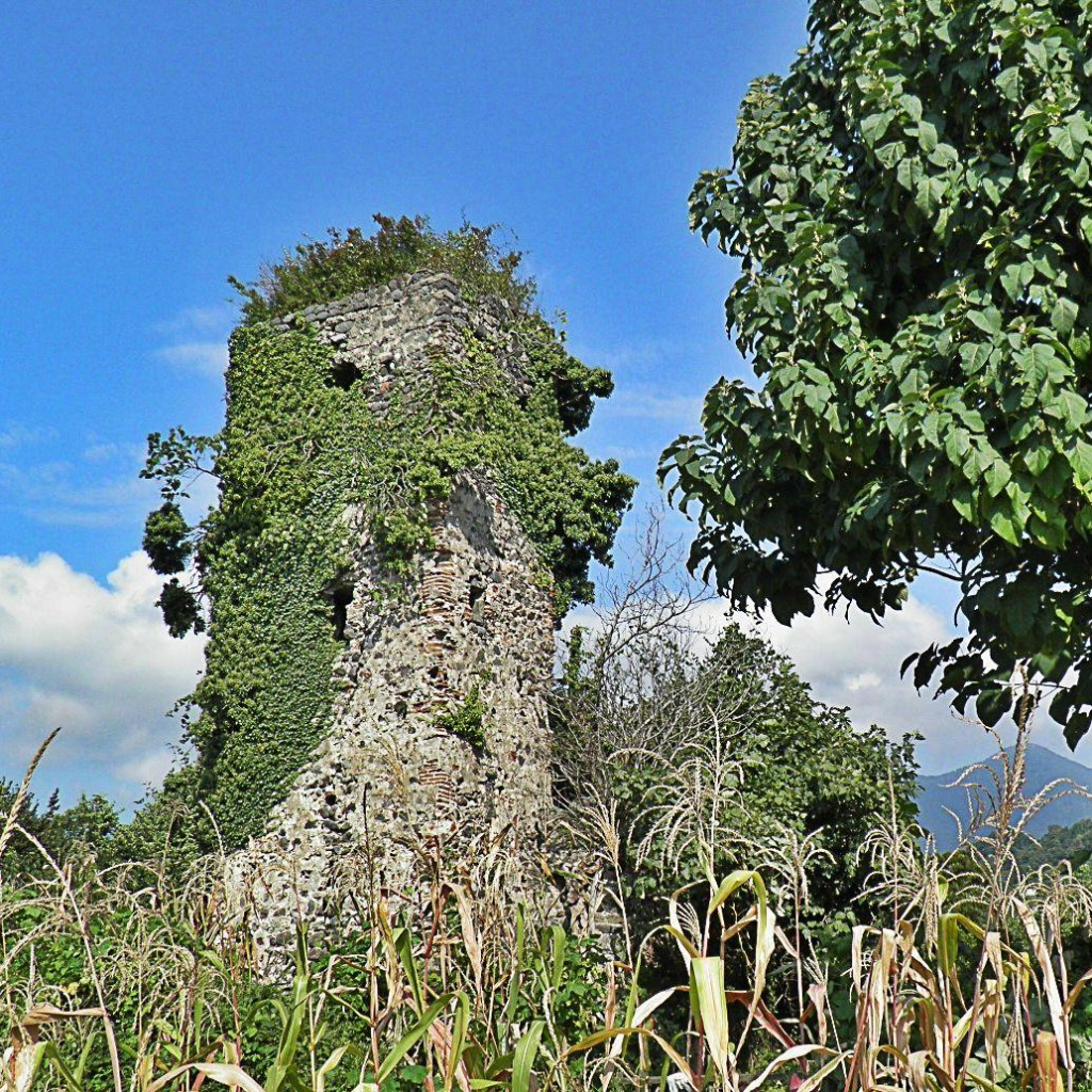
Above: Makriyali Church
Today, Kemalpaşa has a quieter character than neighbouring Hopa.
Its economy rests on tea, citrus, kiwi cultivation, livestock farming and increasingly on cross-border trade.
With the Sarp Border Crossing nearby, Georgian visitors now come to shop, while many local families continue to maintain connections across a frontier that has shifted repeatedly over the centuries.
Kemalpaşa is a small place, but its names tell a much larger story:
A coast where languages meet, borders move, and memories remain.
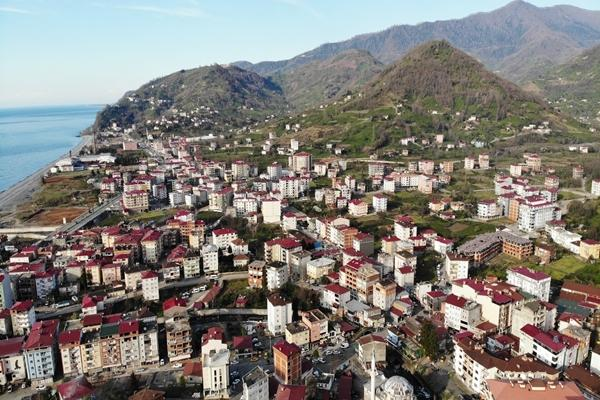
Above: Kemalpaşa, Artvin Province, Türkiye
The bus stops briefly here.
My heart begins to beat faster.
The next stop is the border.
What has made this journey so fascinating is that the change has never been sudden.
There is no clear line where one world ends and another begins. Instead, the landscape slowly changes its voice.
Around Rize and Pazar, Turkish dominates, although Laz remains present beneath the surface.
Further east, through Arhavi and Hopa, Laz identity becomes increasingly visible — in place names, traditions and memories.
Near Kemalpaşa and Sarp, another layer emerges.
Georgian influences appear in family names, cuisine, language and the constant movement of people across the frontier.
The border is close, but the story behind it is ancient.
Today I am not simply travelling from one country to another.
I am following a coastal corridor that has carried traders, armies, pilgrims and migrants around the Black Sea for thousands of years.
The bus journey may seem ordinary.
But the road beneath it is anything but.
It has been carrying people east and west across this coastline for centuries — long before there were modern borders to cross.